

- Usage in publication:
-
- Cassa group
- Modifications:
-
- Original reference
- Dominant lithology:
-
- Sandstone
- Shale
- AAPG geologic province:
-
- Chadron arch
- Denver basin
Summary:
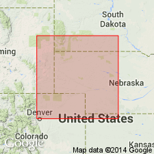
Pg. 2 (fig. 2), 5, 19, 45. Cassa group. Comprises upper 180 feet of Division I of Hartville "formation" (Condra and Reed, 1935). Thickness ranges from 175 to 328 feet. Underlies Phosphoria group; overlies Broom Creek group (new). Consists of Owl Canyon formation (new) below, Lyons sandstone above. Age is Permian.
Type locality: Buckshot Canyon (also called Ragan Canyon), in T. 29 N., R. 67 W., 3 mi northeast of Cassa, Platte Co., eastern WY. [Extends into northeastern CO and southwestern SD.]
Source: US geologic names lexicon (USGS Bull. 1200, p. 661).
For more information, please contact Nancy Stamm, Geologic Names Committee Secretary.
Asterisk (*) indicates published by U.S. Geological Survey authors.
"No current usage" (†) implies that a name has been abandoned or has fallen into disuse. Former usage and, if known, replacement name given in parentheses ( ).
Slash (/) indicates name conflicts with nomenclatural guidelines (CSN, 1933; ACSN, 1961, 1970; NACSN, 1983, 2005, 2021). May be explained within brackets ([ ]).