

- Usage in publication:
-
- Cardigan gneiss*
- Modifications:
-
- Named
- Dominant lithology:
-
- Gneiss
- Schist
- AAPG geologic province:
-
- Southwestern Basin-and-Range region
Summary:
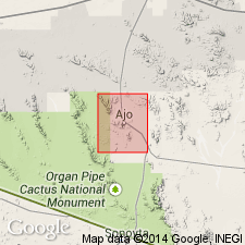
Name given to a contorted gneiss considered to be the oldest rock in the quad. Is exposed over 8 sq mi in T12S, Rs6 and 7W, Pima Co, AZ in the Southwestern Basin-and-Range region. Is named for the Cardigan prospect. No type locality designated. Forms somber brown-gray rolling hills. Is probably the least resistant to erosion of all the bedrock units in the area. Is in contact with Mesozoic and Tertiary igneous and sedimentary rocks. Intruded by Cornelia quartz monzonite (new). Consists of gray massive or crudely gneissic to schistose rock. Minerals include white feldspar, quartz, and chlorite derived from biotite. Has a few albite-chlorite-sericite-quartz schists and widespread gray porphyritic quartz diorite that forms injected bands and contorted folds in the darker gneisses. Some pegmatitic facies with pink microcline, white oligoclase, quartz in crystals, and a little muscovite, sericite, and chlorite. Geologic map; chemical analyses. Considered to be a deformed intrusive rock injected and contorted by feldspathic intrusions, and later brecciated along with the younger Chico Shunie quartz monzonite (new). Assigned tentatively to the pre-Cambrian.
Source: GNU records (USGS DDS-6; Denver GNULEX).
- Usage in publication:
-
- Cardigan Gneiss*
- Modifications:
-
- Age modified
- Overview
- AAPG geologic province:
-
- Southwestern Basin-and-Range region
Summary:
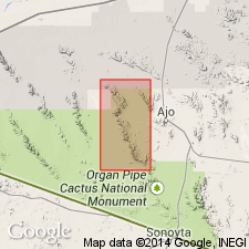
Is exposed near east boundary of map near Pack Rat Hills, Pima Co, AZ in the Southwestern Basin-and-Range region. Is the oldest unit exposed in the quad. Includes medium-grained irregularly banded gneiss, fine-grained gneiss, minor augen gneiss, albite-chlorite and sericite-quartz schists, and quartz-diorite gneiss. Has undergone two stages of pervasive deformation: 1) regional deformation of dioritic intrusives creating foliation and general gneissic appearance; and 2) injection of feldspathic material accompanied by ptygmatic folding. Was intruded by Chico Shunie Quartz Monzonite. Age modified from Precambrian? to Proterozoic on basis of correlation with Pinal Schist which has a 1.7 b.y. date.
Source: GNU records (USGS DDS-6; Denver GNULEX).
For more information, please contact Nancy Stamm, Geologic Names Committee Secretary.
Asterisk (*) indicates published by U.S. Geological Survey authors.
"No current usage" (†) implies that a name has been abandoned or has fallen into disuse. Former usage and, if known, replacement name given in parentheses ( ).
Slash (/) indicates name conflicts with nomenclatural guidelines (CSN, 1933; ACSN, 1961, 1970; NACSN, 1983, 2005, 2021). May be explained within brackets ([ ]).