

- Usage in publication:
-
- Capens formation*
- Modifications:
-
- Original reference
- Dominant lithology:
-
- Slate
- Conglomerate
- AAPG geologic province:
-
- New England province
Summary:
Pg. 156 (fig. 16), 177, pl. 34. Capens formation. Consists of fine-grained and well-indurated red and green slates interbedded with conglomerate consisting of quartz sand, fine-grained silt, and felsite, quartz, limestone, and slate pebbles. Thickness 200 to 400 feet on east side of Deer Island. Disconformably underlies Whiskey quartzite (new). Appears to be conformable on undifferentiated strata of Silurian and Devonian age, a transition zone a few feet thick between them. Age is Silurian or Early Devonian, based on stratigraphic position. Report includes geologic map and correlation chart.
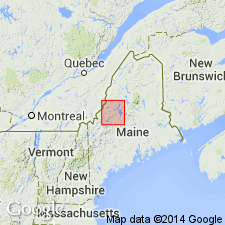
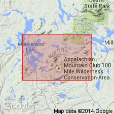
Type section: between Capens [no longer exists] and Lambert Island in northeastern part of Deer Island on the north limb of an anticline. Exposed on Sugar Island, Deer Island, and adjacent mainland in Moosehead Lake area (Moosehead Lake 15-min quadrangle). Named for Capens in Moosehead Lake 15-min quadrangle, western Piscataquis Co., western ME. [Capens possibly once near Lat. 45 deg. 35 min. 30 sec. N., Long. 69 deg. 38 min. 49 sec. W., Moosehead 7.5-min quadrangle.]
[For general location of Capens see the United States Genealogy Network, Inc. (USGenNet) 1895 Atlas Project; available online: http://www.livgenmi.com/1895/ME/County/piscataquis.htm (scanned images of Rand McNally Corp., 1895, "The New 11 x 14 Atlas of the World" provided by Pam Rietsch of CFC Productions).]
[Misprint: GNU records (USGS DDS-6; Reston GNULEX) state type section is on northwest part of Deer Island; should be northeast.]
Source: Publication; US geologic names lexicon (USGS Bull. 1350, p. 119); GNU records (USGS DDS-6; Reston GNULEX).
- Usage in publication:
-
- Capens Formation*
- Modifications:
-
- Age modified
- AAPG geologic province:
-
- New England province
Summary:
Age changed from Silurian to Devonian to just Silurian based on work by Boucot and Heath (1969).
Source: GNU records (USGS DDS-6; Reston GNULEX).
For more information, please contact Nancy Stamm, Geologic Names Committee Secretary.
Asterisk (*) indicates published by U.S. Geological Survey authors.
"No current usage" (†) implies that a name has been abandoned or has fallen into disuse. Former usage and, if known, replacement name given in parentheses ( ).
Slash (/) indicates name conflicts with nomenclatural guidelines (CSN, 1933; ACSN, 1961, 1970; NACSN, 1983, 2005, 2021). May be explained within brackets ([ ]).