


- Usage in publication:
-
- Caddo Creek formation
- Modifications:
-
- Original reference
- Dominant lithology:
-
- Shale
- Sandstone
- Limestone
- AAPG geologic province:
-
- Bend arch
- Fort Worth syncline
Summary:
Pg. 24, 31, 35; [see also Univ. Texas Bull., no. 2132]. Caddo Creek formation, top formation of Canyon group. [Replaces Eastland formation.] Disconformably underlies Bluff Creek shale member (Colorado River Valley) or Finis shale member of Graham formation (Brazos River Valley); overlies Brad formation, top member of which is Ranger limestone. Thickness 100 to 150 feet to north and 30 to 50 feet to south. Divided into Home Creek limestone member (above) and Hog Creek shale member (below). [Age is Pennsylvanian.]
Named from Caddo Creek, a tributary of Brazos River in Stephens Co., Brazos River region, TX.
Source: US geologic names lexicon (USGS Bull. 896, p. 312-313).
- Usage in publication:
-
- Caddo Creek formation
- Modifications:
-
- Revised
- AAPG geologic province:
-
- Bend arch
- Fort Worth syncline
Summary:
Pg. 104. Caddo Creek formation [of Canyon group]. Redefined by including in it Jacksboro limestone and Finis shale, which were originally included in overlying Graham formation. He stated that Home Creek limestone includes Jacksboro limestone.
Source: US geologic names lexicon (USGS Bull. 896, p. 312-313).
- Usage in publication:
-
- Caddo Creek formation
- Modifications:
-
- Revised
Summary:
Pg. 197+. Caddo Creek formation [of Canyon group]. Includes only Home Creek limestone and Hog Creek shale of Colorado River region. [This definition has been adopted by the USGS for its publications, and is the one followed by F.B. Plummer and J. Hornberger, Jr., 1936 (Univ. Texas Bull. 3531). They included in lower part of overlying Graham formation the Bunger limestone, Gonzales Creek shale, Eastland sandstone, and Finis shale of Brazos River region.]
Source: US geologic names lexicon (USGS Bull. 896, p. 312-313).

- Usage in publication:
-
- Caddo Creek formation
- Modifications:
-
- Areal extent
- AAPG geologic province:
-
- Bend arch
Summary:
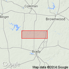
Pg. 108, 115. Caddo Creek formation [of Canyon group]. Consists of Hog Creek shale member, whose type locality is in northern Brown County, Texas, which has been correlated with limestone also called "Home Creek" occurring at same horizon in Brazos River basin in Palo Pinto County, Texas. Although these members are distinguishable in northern Brown County and in area along river, it is not practicable to separate them in much of intermediate area, for the reason that the Home Creek is broken into a number of relatively thin limestone beds interbedded with shale with no obvious dividing line between them. Thickness 69 feet. Overlies Brad formation (redefined); underlies Graham formation of Cisco group (restricted). [Age is Late Pennsylvanian.]
Source: US geologic names lexicon (USGS Bull. 1200, p. 571-572).

- Usage in publication:
-
- Caddo Creek group
- Modifications:
-
- Revised
- AAPG geologic province:
-
- Bend arch
Summary:
Pg. 66 (fig. 1), 88. Caddo Creek group. Rank raised to group. Includes Hog Creek shale below and Home Creek limestone. Underlies Graham group; overlies Brad group. [Age is Late Pennsylvanian.]
Source: US geologic names lexicon (USGS Bull. 1200, p. 571-572).
- Usage in publication:
-
- Caddo Creek group
- Modifications:
-
- Revised
- AAPG geologic province:
-
- Bend arch
Roth, Robert, 1956, [Fig. 2, columnar section]: North Texas Geological Society Field Trip Guidebook, May 25-26, 1956, [20 p.].
Summary:
Fig. 2. Caddo Creek group. Generalized columnar section shows group including Hog Creek shales and sandstone, Home Creek limestone, and lower part of Gonzales shale. [Age is Late Pennsylvanian.]
Source: US geologic names lexicon (USGS Bull. 1200, p. 571-572).
- Usage in publication:
-
- Caddo Creek formation*
- Modifications:
-
- Revised
- AAPG geologic province:
-
- Bend arch
Summary:
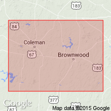
Pg. 51. Shown on columnar section of Brown and Coleman Counties, Texas, as Caddo Creek formation [in Canyon group]. Includes Colony Creek shale member below and Home Creek limestone member above. Thickness about 50 feet. Underlies Graham formation; overlies Brad formation. [Age is Late Pennsylvanian.]
Source: US geologic names lexicon (USGS Bull. 1200, p. 571-572).
- Usage in publication:
-
- Caddo Creek formation*
- Modifications:
-
- Revised
- AAPG geologic province:
-
- Bend arch
Summary:
Pg. 67. Caddo Creek formation of Canyon group. As originally defined, formation included Drake's Hog Creek shale below and Home Creek limestone member above. Because of miscorrelations in past, name Hog Creek shale should be replaced. As redefined here, formation includes (ascending) Home Creek limestone member and Colony Creek shale member. Thickness about 55 feet along Colorado River; about 75 feet in central Brown County, Texas. [Age is Late Pennsylvanian.]
Source: Publication; US geologic names lexicon (USGS Bull. 1200, p. 571-572).
For more information, please contact Nancy Stamm, Geologic Names Committee Secretary.
Asterisk (*) indicates published by U.S. Geological Survey authors.
"No current usage" (†) implies that a name has been abandoned or has fallen into disuse. Former usage and, if known, replacement name given in parentheses ( ).
Slash (/) indicates name conflicts with nomenclatural guidelines (CSN, 1933; ACSN, 1961, 1970; NACSN, 1983, 2005, 2021). May be explained within brackets ([ ]).