

- Usage in publication:
-
- Burnt Island Conglomerate*
- Modifications:
-
- Named
- Biostratigraphic dating
- Overview
- Dominant lithology:
-
- Conglomerate
- AAPG geologic province:
-
- Alaska Southeastern region
Summary:
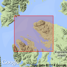
[Named for Burnt Island]. Type locality: reefs between Burnt and Grave Islands W of Kake. Reference sections: N shore of Hamilton Bay 2,000' NW of Little Hamilton Island and NE shore of islet 0.6 mi WSW of triangulation station Isle in northern Keku Islets. Correlated lithologically and stratigraphically to basal breccia member of Hyd Fm (Loney, 1964). Two facies: chert and limestone where unconformably overlies Pybus Fm; blue-green argillite, graywacke, and chert where unconformably overlies Cannery Fm. At type 100 ft thick; thickness varies from few tens of ft on NW Hamilton Island to 150 ft on N side of Hamilton Bay. At type rudely bedded, poorly sorted pebble conglomerate of clasts from the Cannery; matrix gray calcite. Interbed of limestones that increase upsection. Upper contact is highest light-brown weathering limestone. Overlain by Hamilton Island Limestone or Hound Island Volcanics (lowest formation of Hyd Group). Early Karnian fossils: COROCERAS cf. C. SWESSI and HALOBIA cf. H. RUGOSA; age is Late Triassic.
Source: GNU records (USGS DDS-6; Menlo GNULEX).
- Usage in publication:
-
- Burnt Island Conglomerate*
- Modifications:
-
- Areal extent
- Biostratigraphic dating
- AAPG geologic province:
-
- Alaska Southeastern region
Summary:
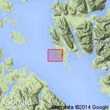
Burnt Island Conglomerate extended southeastward to the Screen Islands [W of Prince of Wales Island]. Is well bedded, poorly sorted bimodal chert, volcanic-rock and limestone-cobble conglomerate with intercalated sandstone and limestone. Contains Late Triassic fossils (ammonites, HALOBIA, and EPIGONDOLELLA PRIMITIA) and some older fossils (brachiopods, linoproductids) from chert cobbles. Rapid deposition in small basin adjacent to tectonically active volcanic islands; quieter intervals represented by limestone interbeds with pelagic fossils.
Source: GNU records (USGS DDS-6; Menlo GNULEX).
For more information, please contact Nancy Stamm, Geologic Names Committee Secretary.
Asterisk (*) indicates published by U.S. Geological Survey authors.
"No current usage" (†) implies that a name has been abandoned or has fallen into disuse. Former usage and, if known, replacement name given in parentheses ( ).
Slash (/) indicates name conflicts with nomenclatural guidelines (CSN, 1933; ACSN, 1961, 1970; NACSN, 1983, 2005, 2021). May be explained within brackets ([ ]).