

- Usage in publication:
-
- Burlington beds
- Encrinital group of Burlington
- Modifications:
-
- Original reference
- Dominant lithology:
-
- Limestone
- AAPG geologic province:
-
- Iowa shelf
Summary:
btw. p. 90 and 140. Encrinital group of Burlington (also called Burlington beds). In descending order: white crystalline and semi-oolitic limestones; brown and flesh-colored encrinital limestones; brown earthy crinoidal limestones with crystalline specks; band of cellular buff magnesium limestone; oolitic limestone; dark-gray argillaceous limestones. Overlies argillo-calcareous group. Separated from overlying Keokuck cherty limestones by brown Encrinital limestones alternating with bands of chert, as near Hannibal [Missouri]. [According to later reports the cherty beds of passage are Keokuck cherty limestones of Owen.]
Source: US geologic names lexicon (USGS Bull. 896, p. 298-299).
- Usage in publication:
-
- Burlington limestone
- Modifications:
-
- Revised
- Dominant lithology:
-
- Limestone
- AAPG geologic province:
-
- Illinois basin
- Iowa shelf
Summary:
Pg. 53-57. Encrinital limestone of Burlington, or, as we shall hereafter term it, the Burlington limestone. Very fossiliferous limestone overlying oolitic limestone and argillaceous sandstone belonging to Chemung group of New York and underlying cherty beds of passage (Keokuk cherty limestones of Owen, 60 to 100 feet thick) to the higher Keokuk or lower Archimedes limestone. Includes Owens' Encrinital group of Hannibal, Missouri, which is identical with Encrinital limestone of Burlington. Characterized by great numbers of crinoids.
Source: US geologic names lexicon (USGS Bull. 896, p. 298-299).
- Usage in publication:
-
- Burlington limestone
- Modifications:
-
- Revised
- AAPG geologic province:
-
- Iowa shelf
Worthen, A.H., 1882, Economical geology of Illinois: Illinois Geological Survey, v. 1, 541 p.
Summary:
Pg. 79, 85 [or 86?]. Burlington limestone at Burlington, Iowa [type locality], consists of (1) an upper member of light-gray or nearly white limestone with some brown layers and abundant chert; and (2) a lower member of brown magnesium locally arenaceous, with abundant chert.
Source: US geologic names lexicon (USGS Bull. 896, p. 298-299).
- Usage in publication:
-
- Burlington limestone
- Modifications:
-
- Revised
- AAPG geologic province:
-
- Iowa shelf
Summary:
Upper Burlington limestone is distinguished from Lower Burlington limestone by being more thin bedded and containing greater abundance of chert. The upper 30 feet (the flinty beds of Upper Burlington) are here named Montrose chert.
Source: US geologic names lexicon (USGS Bull. 896, p. 298-299).
- Usage in publication:
-
- Burlington limestone
- Modifications:
-
- Areal extent
Weller, Stuart, 1926, Faunal zones in the standard Mississippian section: Journal of Geology, v. 34, no. 4, p. 320-335.
Summary:
Considered the Fern Glen "a manifestation of the very lowest Burlington." The Fern Glen is at present treated by the USGS as basal formation of Osage group of Missouri and Illinois.
Source: US geologic names lexicon (USGS Bull. 896, p. 298-299).

- Usage in publication:
-
- Burlington limestone
- Modifications:
-
- Overview
Summary:
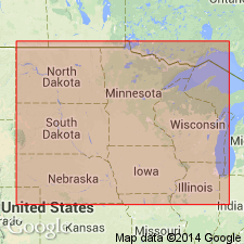
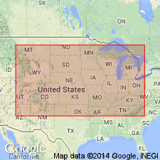
Burlington limestone of Osage group. See also under Keokuk limestone. Age is Mississippian. Recognized in Iowa, Illinois, eastern Missouri, and western Kentucky.
Named from exposures at Burlington, Des Moines Co., southeastern IA.
Source: US geologic names lexicon (USGS Bull. 896, p. 298-299).
- Usage in publication:
-
- Burlington limestone
- Modifications:
-
- Overview
- AAPG geologic province:
-
- Illinois basin
Summary:
Pg. 131, 132-133. Burlington limestone. Included in Osage group, Valmeyer series.
Source: US geologic names lexicon (USGS Bull. 1200, p. 542).

- Usage in publication:
-
- Burlington limestone*
- Modifications:
-
- Areal extent
- AAPG geologic province:
-
- Anadarko basin
Summary:
Extended into the subsurface of Baca County, Colorado, in the Anadarko basin, east of the Las Animas arch. Overlies Gilmore City limestone and underlies Keokuk "Osagian" limestone. Age is Early Mississippian [Osagean]. Report includes correlation chart.
Source: Modified from GNU records (USGS DDS-6; Denver GNULEX).
- Usage in publication:
-
- Burlington limestone
- Modifications:
-
- Overview
Summary:
Chart 5. Burlington limestone. In Mississippian standard section, Burlington limestone is included in Osagean series. Occurs above the Fern Glen formation and below Keokuk limestone.
Source: US geologic names lexicon (USGS Bull. 1200, p. 542).
- Usage in publication:
-
- Burlington limestone
- Modifications:
-
- Biostratigraphic dating
- Areal extent
Kaiser, E.P., 1950, Stratigraphy of Lower Mississippian rocks in southwestern Missouri: American Association of Petroleum Geologists Bulletin, v. 34, no. 11, p. 2133-2175.
Summary:
Pg. 2163-2168. Discussion of stratigraphy of Lower Mississippian rocks in southwestern Missouri. Burlington limestone ranges in thickness from a trace to 145 feet; thickest in Springfield area. Thins southward from Springfield and disappears from section between Mount Vernon, Lawrence County, and the Tri-State mining district. Divided into six faunal zones that are correlated with equivalent zones in northeastern Missouri. Rests unconformably on Reeds Spring formation in southern part of area. Reeds Spring and St. Joe formations pinch out a short distance north of Springfield, Greene County, and north of here the formation rests unconformably on Northview or Sedalia formations. Keokuk limestone rests with apparent conformity on Burlington limestone in southwestern part of area. Elsewhere the Burlington is either surface formation or is covered by thin veneer of Pennsylvanian sediments. Age is Early Mississippian (Osagean). Report includes stratigraphic sections, fossil lists.
Source: US geologic names lexicon (USGS Bull. 1200, p. 542).
- Usage in publication:
-
- Burlington limestone
- Modifications:
-
- Contact revised
Clark, E.L., and Beveridge, T.R., 1952, A revision of the Early Mississippian nomenclature in western Missouri: Missouri Division of Geological Survey and Water Resources Report of Investigations, no. 13, 93 p., See also Kansas Geol. Soc. Gdbk., 16th Regional Field Conf., 1952, p. 71-79
Summary:
Pg. 71-80. Presentation of revision of Early Mississippian nomenclature in western Missouri. Kaiser (1950) proposed that name Pierson be dropped, assigning the more dolomitic lower beds to the Sedalia and the upper beds to the St. Joe. Kaiser considered the entire St. Joe to be Osagean and the Sedalia to be Kinderhookian. Thus he placed a series line in the middle of the Pierson of Weller. In present report, the Pierson is accepted as defined by Weller and base of Osagean is placed at Pierson-Northview contact. The Pierson is extended northward to include the silty dolomitic limestone unit which lies between the Northview and the Burlington in west-central Missouri. This unit was included in upper Sedalia of west-central Missouri by Moore (1928, Missouri Bur. Geol. and Mines, 2d ser., v. 21) and Kaiser (1950). Hence, Burlington directly overlies Pierson.
Source: US geologic names lexicon (USGS Bull. 1200, p. 542).
- Usage in publication:
-
- Burlington formation
- Modifications:
-
- Areal extent
- AAPG geologic province:
-
- Lincoln anticline
Summary:
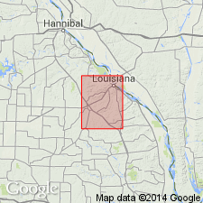
Pg. 9 (fig. 2), 42-47. Burlington formation described in Bowling Green quadrangle where it is 53 to 61 feet thick. Consists of thin- to massive-bedded lenses. In most of quadrangle, covered by glacial drift, loess, and its own chert residuum. Lies upon undulatory surface of Hannibal formation in that part of quadrangle north of southern boundary of T. 53 N., south of this area overlies Chouteau formation with gradational contact. Age is Early Mississippian (Osagean). Report includes geologic map.
Source: US geologic names lexicon (USGS Bull. 1200, p. 542).

- Usage in publication:
-
- Burlington Limestone
- Modifications:
-
- Biostratigraphic dating
- AAPG geologic province:
-
- Illinois basin
Summary:
In IL, Burlington Limestone extends from Henderson CO. in the northwest across a roughly triangular area southward to Jackson Co. and eastward to Iroquois Co. Good outcrops are found in Mississippi River bluffs from Quincy in Adams Co., to near Alton in Madison Co. Terminates sharply to the east where overlapped by Borden Siltstone. Lithology changes from limestone in the north to cherty in the south. In the south, Burlington and Keokuk can be distinguished only by their fossils and are generally referred to as Burlington-Keokuk Limestone. Conformably overlies Fern Glen and Meppen Formations, and unconformably overlies older beds where those two formations are absent. Common fossils restricted to Burlington include CRYPTOBLASTUS MELO, GLOBOBLASTUS NORWOODI, DICTYOCLOSTUS BURLINGTONENSIS, RHIPIDOMELLA BURLINGTONENSIS, STENOCISMA BISINUATA, SPIRIFER GRIMESEI, S. FORBESI, and SPIRIFERELLA PLENA (Weller and Sutton, 1940). Many crinoids have been described. Lower part of Burlington is in conodont BACTROGNATHUS-POLYGNATHUS COMMUNIS Zone; upper part is in conodont BACTROGNATHUS-TAPHROGNATHUS Zone (Collinson and others, 1971).
Source: GNU records (USGS DDS-6; Reston GNULEX).

- Usage in publication:
-
- Burlington Limestone*
- Modifications:
-
- Overview
- AAPG geologic province:
-
- Illinois basin
- Ozark uplift
Summary:
Mapped undivided with Keokuk Limestone in IL and MO, or undivided with Keokuk Limestone and Fern Glen Formation in MO. In St. Louis area, lower 18 to 30 ft contains 50 percent chert and was called "lower Burlington Limestone" by Kissling (1961) and Thompson (1975).
Source: GNU records (USGS DDS-6; Reston GNULEX).
For more information, please contact Nancy Stamm, Geologic Names Committee Secretary.
Asterisk (*) indicates published by U.S. Geological Survey authors.
"No current usage" (†) implies that a name has been abandoned or has fallen into disuse. Former usage and, if known, replacement name given in parentheses ( ).
Slash (/) indicates name conflicts with nomenclatural guidelines (CSN, 1933; ACSN, 1961, 1970; NACSN, 1983, 2005, 2021). May be explained within brackets ([ ]).