The National Geologic Map Database is migrating to a new infrastructure. We apologize for any service disruptions during this process.
|
|---|


- Usage in publication:
-
- Burgen sandstone*
- Modifications:
-
- Original reference
- AAPG geologic province:
-
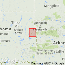
- Chautauqua platform
Summary:
Burgen sandstone. Massive, moderately fine-grained, light-brown sandstone, 5 to 100 feet thick. Underlies Tyner formation.
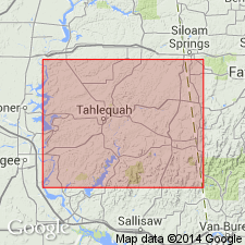
Named from Burgen Hollow, northeast of Tahlequah, northeastern OK.
Source: US geologic names lexicon (USGS Bull. 896, p. 295-296).
- Usage in publication:
-
- Burgen sandstone*
- Modifications:
-
- Overview
- AAPG geologic province:
-
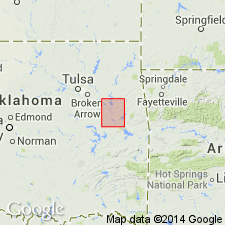
- Chautauqua platform
Summary:
No fossils have been found in Burgen sandstone. Its age is inferred from its stratigraphic position. A study of St. Peter or "Saccharoidal" sandstone in northern Arkansas and Missouri, with which the Burgen is correlated by Dr. E.O. Ulrich, caused him to class it as Early Ordovician.
Source: US geologic names lexicon (USGS Bull. 896, p. 295-296).
- Usage in publication:
-
- Burgen sandstone
- Modifications:
-
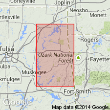
- Areal extent
- AAPG geologic province:
-
- Chautauqua platform
Summary:
Pg. 30-31. Showed St. Peter or Burgen sandstone of northeastern Oklahoma as = to upper part of St. Peter sandstone of Minnesota.
Source: US geologic names lexicon (USGS Bull. 896, p. 295-296).

- Usage in publication:
-
- Burgen sandstone*
- Modifications:
-
- Overview
- AAPG geologic province:
-
- Chautauqua platform
Summary:
The USGS from 1915 to 1930 used St. Peter sandstone instead of Burgen sandstone, Key sandstone, Saccharoidal sandstone, Crystal City sandstone, Pacific sandstone, Cap au Gres sandstone, etc. The Oklahoma Geol. Survey, however, has rather consistently adhered to the Oklahoma name Burgen sandstone. On 1926 Oklahoma geologic map, by H.D. Miser, this sandstone was called St. Peter. C.N. Gould, 1925 (Oklahoma Geol. Survey Bull., no. 35, p. 55), in the text to accompany that map used St. Peter ("Burgen") sandstone, but stated that his preference was for the Oklahoma name Burgen sandstone.
Source: US geologic names lexicon (USGS Bull. 896, p. 295-296).
- Usage in publication:
-
- Burgen sandstone
- Modifications:
-
- Areal extent
- AAPG geologic province:
-
- Chautauqua platform
Summary:
Pg. 12. In view of indefiniteness of correlation of Burgen sandstone the name Burgen should be applied to eastern Oklahoma beds rather than St. Peter. Ulrich's suggestion that the Burgen is basal sandstone of Bromide formation of Simpson group is not entirely out of line with subsurface evidence, but if writer's suggestion that lower Tyner is lower Simpson in age proves to be correct, the Burgen must be older than Ulrich suggests it to be. Possibly it is basal sandstone of Oil Creek formation of Simpson group.
Source: US geologic names lexicon (USGS Bull. 896, p. 295-296).
- Usage in publication:
-
- Burgen sandstone
- Modifications:
-
- Areal extent
- AAPG geologic province:
-
- Chautauqua platform
Summary:
Pg. 11-12. I have long insisted Burgen sandstone does not fall into the place to which it is usually assigned by Oklahoma geologists; that is about middle of the Simpson. It is either older than base of Simpson and of age of some part of Buffalo River series, or it is much younger; probably Black River. Fossil evidence is lamentably indecisive and goes little further than to prove Ordovician age of the Burgen. I am, somewhat reluctantly, I confess, forced to conviction that the Burgen is a much younger deposit than St. Peter sandstone and probably that it is represented in Arbuckle region by the sandstone that is locally developed, especially on northeast flank of that uplift, at base of the Bromide and above the Criner. The sand probably was blown in from eroding surfaces of Buffalo River sandstones on west side of Ozark uplift, which we have every reason to believe was emerged at that time.
Source: US geologic names lexicon (USGS Bull. 896, p. 295-296).
- Usage in publication:
-
- Burgen sandstone
- Modifications:
-
- Overview
- AAPG geologic province:
-
- Chautauqua platform
Summary:
In view of doubt that exists as to Burgen sandstone being the same as St. Peter sandstone, the USGS now [ca. 1938] employs the local name Burgen sandstone for the sandstone underlying Tyner formation in eastern Oklahoma.
Source: US geologic names lexicon (USGS Bull. 896, p. 295-296).
- Usage in publication:
-
- Burgen sandstone
- Modifications:
-
- Areal extent
- Revised
- AAPG geologic province:
-
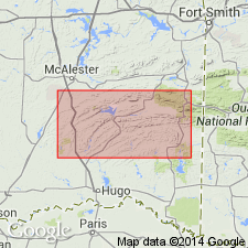
- Ozark uplift
Summary:
Pg. 14 (fig. 2), 16 (fig. 3), 20-22, pls. 2, 3, 4. Burgen sandstone. Described on southwestern flank of Ozark uplift. Predominantly sandstone with minor amounts of shale and thin dolomitic limestone; thin beds of green fissile shale and sandy dolomite present in upper parts. Thickness 72 feet near Quails where entire thickness is exposed; 26 feet along Spring Creek in sec. 12, T. 19 N., R. 20 E.; outside mapped area thickness of 100 feet reported, Unconformably overlies Cotter dolomite; conformably succeeded by Tyner shale in southern exposures; truncated by pre-Chattanooga erosion north of T. 19 N., where it is succeeded by Sylamore sandstone member of Chattanooga. Age assignment and correlation not certain; precise dating is dependent upon correct correlation of overlying Tyner; if Tyner is equivalent of Bromide, then Burgen is probably equivalent to lower Bromide sand (Tulip Creek). Chart shows Champlainian series.
Source: US geologic names lexicon (USGS Bull. 1200, p. 537).
For more information, please contact Nancy Stamm, Geologic Names Committee Secretary.
Asterisk (*) indicates published by U.S. Geological Survey authors.
"No current usage" (†) implies that a name has been abandoned or has fallen into disuse. Former usage and, if known, replacement name given in parentheses ( ).
Slash (/) indicates name conflicts with nomenclatural guidelines (CSN, 1933; ACSN, 1961, 1970; NACSN, 1983, 2005, 2021). May be explained within brackets ([ ]).