

- Usage in publication:
-
- Bullion Canyon volcanics*
- Modifications:
-
- First used
- Dominant lithology:
-
- Tuff
- Latite
- Breccia
- AAPG geologic province:
-
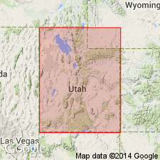
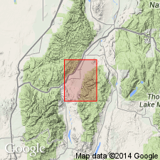
- Wasatch uplift
Summary:
Intent to name and derivation of place name not stated. No type locality designated. Are widely distributed in Tushar Mountains, in the Sevier Plateau, and in lower mountains such as Antelope Range, and in blocks east of Marysvale, UT on the Wasatch uplift. Divisible into a lower part of latitic and andesitic tuffs and breccias with a thin basal conglomerate up to 2,500 ft thick, the Delano Peak latite member (new), a cliff former over 800 ft thick, and the upper part composed of dark-gray to black flows and breccias probably in excess of 2,500 ft thick. Is older than some unnamed quartz monzonites and associated intrusives. Shown as earlier Tertiary on geologic map.
Source: GNU records (USGS DDS-6; Denver GNULEX).
- Usage in publication:
-
- Bullion Canyon volcanics*
- Modifications:
-
- Revised
- Age modified
- AAPG geologic province:
-
- Wasatch uplift
Summary:
All granular intrusives are restricted to Bullion Canyon volcanics. Underlies in quad large areas of Antelope Range and Sevier Plateau, Sevier Co, UT on the Wasatch uplift. Base not exposed; thickness estimated to be more than 1,000 ft. Lower part has thick pyroclastics; upper part has gray to purple tuff, breccia, conglomerate and a few thin dark calcic flows. Monrovian Park latite member in middle part named. Age changed from Tertiary. May be as old as late Oligocene and may be as young as early Miocene. Assigned to the Miocene? on map explanation. Detailed lithologic description.
Source: GNU records (USGS DDS-6; Denver GNULEX).
- Usage in publication:
-
- Bullion Canyon Volcanics
- Modifications:
-
- Revised
- AAPG geologic province:
-
- Great Basin province
Summary:
Divided into Sulphur Peak Member (new) which is an andesite flow and an overlying sequence of andesite flows and ash-flows. Represents the earliest volcanism in the Marysvale area. Field recognition aided by high degree of alteration. Magnetic samples show lower unit as reversed and top is intermediate. Quartz monzonite intrusion restricted to the Bullion Canyon and older rocks. Overlain by Wales Canyon Member (new) of Dry Hollow Formation. Separation of Bullion Canyon and Dry Hollow no more than 3 m.y. Geologic map. Is a unit known in report area in Millard Co, UT, Great Basin province, that is assigned an Oligocene age.
Source: GNU records (USGS DDS-6; Denver GNULEX).
- Usage in publication:
-
- Bullion Canyon Volcanics*
- Modifications:
-
- Revised
- Age modified
- AAPG geologic province:
-
- Wasatch uplift
Summary:
Divided into a lower part (volcanic tuffs and breccias) and the Three Creeks Tuff Member (new) of Oligocene age, the Miocene Delano Peak Tuff Member (redefined), and an upper part. Age changed from Oligocene and Miocene? to Oligocene and Miocene. Replaces use of Dry Hollow Formation (abandoned) in many areas.
Source: GNU records (USGS DDS-6; Denver GNULEX).
- Usage in publication:
-
- Bullion Canyon Volcanics*
- Modifications:
-
- Areal extent
- Revised
- AAPG geologic province:
-
- Great Basin province
Summary:
Three Creeks Tuff Member of Bullion Canyon Volcanics replaces use of †Wallaces Peak Tuff Member (abandoned) of Needles Range Formation in the Wah Wah Mountains, southwestern UT, Great Basin province.
Source: GNU records (USGS DDS-6; Denver GNULEX).
For more information, please contact Nancy Stamm, Geologic Names Committee Secretary.
Asterisk (*) indicates published by U.S. Geological Survey authors.
"No current usage" (†) implies that a name has been abandoned or has fallen into disuse. Former usage and, if known, replacement name given in parentheses ( ).
Slash (/) indicates name conflicts with nomenclatural guidelines (CSN, 1933; ACSN, 1961, 1970; NACSN, 1983, 2005, 2021). May be explained within brackets ([ ]).