

- Usage in publication:
-
- Buford granite porphyry
- Modifications:
-
- Overview
- AAPG geologic province:
-
- Midcontinent region
Summary:
Buford granite porphyry (new) of Musco group (new). Briefly summarized in report by W.C. Hayes, Precambrian rock units in Missouri, p. 83 (table 1), this volume. New names are credited to Tolman and Robertson (in prep.) [1969, Missouri Div. Geol. Survey Water Res. Rpt. Inv., no. 44 (Contrib. to Precambrian Geol., no. 1)]. Age is Precambrian.
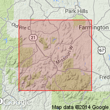
Occurs in St. Francois Mountain area. Buford Mountain is in Iron Co., southeastern MO.
Source: Modified from US geologic names lexicon (USGS Bull. 1350, p. 100).
- Usage in publication:
-
- Buford granite porphyry
- Modifications:
-
- Principal reference
- Dominant lithology:
-
- Porphyry
- Granite
- AAPG geologic province:
-
- Midcontinent region
Summary:
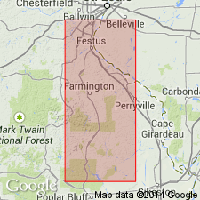
Pg. 37. Buford granite porphyry of Musco group. A sill-like body of dense, very fine-grained, mottled brown and green granite porphyry with abundant small light-brown orthoclase phenocrysts. Closely resembles Stono granite of Musco group except it is finer grained. Exposed on Buford Mountain and in Wing Lake area, St. Francois Mountains, Iron County, southeastern Missouri; an area over 6 sq mi. Thickness less than 300 feet at west end of Buford Mountain, but is thought to be much thicker in Wing Lake area. Represents an intrusion directly related to initial stage of intrusive activity in St. Francois Mountains batholith. Age is Precambrian.
Named from exposures on Buford Mountain, in sec. 27, T. 35 N., R. 3 E., Iron Co., MO. (Type locality not designated.)
See C.E. Robertson, 1995, Precambrian rocks, IN T.L. Thompson, Stratigraphic succession in Missouri (revised-1995), Missouri Division of Geology and Land Survey, 2nd series, v. 40 Revised, p. 5-14.
[GNU remark (Feb. 16, 1990, USGS DDS-6; Denver GNULEX): Stratigraphic relationships of units of Musco not discussed in text; geologic map (plate 1) missing from library copy of report.]
Source: Strat. succession in Missouri (Thompson, 1995, p. 13); GNU records (USGS DDS-6; Denver GNULEX).
- Usage in publication:
-
- Buford Granite Porphyry
- Modifications:
-
- Revised
- AAPG geologic province:
-
- Midcontinent region
Summary:
Buford Granite Porphyry, youngest of four Precambrian Y hypabyssal rock units assigned to the /St. Francois Mountains Intrusive Suite (revised). [Previously assigned to Musco Group by Tolman and Robertson (1969); status of Musco not discussed.] Present in St. Francois Mountains, southeast Missouri (Midcontinent region). Younger than Munger Granite Porphyry (revised) of St. Francois Mountains. Nomenclature listed in table 1.
[Conflicts with nomenclature guidelines (ACSN, 1970; NACSN, 1983, 2005, 2021): name St. Francois Mountains applied concurrently to two different units in same area.]
Source: Modified from GNU records (USGS DDS-6; Denver GNULEX).
For more information, please contact Nancy Stamm, Geologic Names Committee Secretary.
Asterisk (*) indicates published by U.S. Geological Survey authors.
"No current usage" (†) implies that a name has been abandoned or has fallen into disuse. Former usage and, if known, replacement name given in parentheses ( ).
Slash (/) indicates name conflicts with nomenclatural guidelines (CSN, 1933; ACSN, 1961, 1970; NACSN, 1983, 2005, 2021). May be explained within brackets ([ ]).