

- Usage in publication:
-
- Brunswick shales
- Modifications:
-
- Original reference
- Dominant lithology:
-
- Shale
- Sandstone
- AAPG geologic province:
-
- Piedmont-Blue Ridge province
- Newark basin
Summary:
Pg. 47-55; Jour. Geol., v. 5, p. 547-549. Brunswick shales. Soft shales with a few sandstone layers. Chiefly red, but a few purple, green, yellow, and black layers occur in lower 1,000 feet and at higher horizons. Massive quartzite conglomerate beds occur along northwest border of formation, a part of which are correlatives of Brunswick shales. Thickness 12,000 feet. Grade into underlying Lockatong series [formation]. Top formation of Newark system [group]. [Age is Late Triassic.]
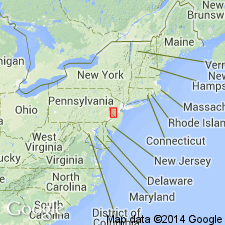
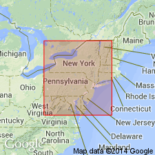
Well exposed in valley of Raritan, particularly near New Brunswick, [Middlesex Co.], NJ.
Source: US geologic names lexicon (USGS Bull. 896, p. 279); supplemental information from GNU records (USGS DDS-6; Reston GNULEX).
- Usage in publication:
-
- Brunswick shale*
- Modifications:
-
- Overview
Summary:
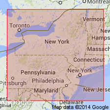
The classification of the Newark Group established in NJ is here adopted by the USGS in PA. It comprises the Stockton Formation, Lockatong Formation, and Brunswick Shale, which are approximately equivalent to the Norristown, Gwynedd, and Lansdale Shales, respectively, which have not been found acceptable because of their indefinite application.
Source: GNU records (USGS DDS-6; Reston GNULEX).
- Usage in publication:
-
- Brunswick formation
- Modifications:
-
- Revised
- AAPG geologic province:
-
- Newark basin
- Piedmont-Blue Ridge province
Summary:
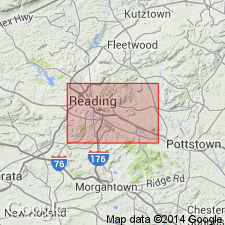
Dark shale belts in the lower part of the Brunswick Formation in Bucks and Montgomery Cos., PA, are traced and named members C, D, E, Graters (F, G, H), and Sanatoga.
Source: GNU records (USGS DDS-6; Reston GNULEX).

- Usage in publication:
-
- Brunswick formation
- Modifications:
-
- Areal extent
- AAPG geologic province:
-
- Newark basin
- Piedmont-Blue Ridge province
Summary:
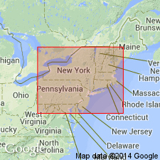
Gray shale members C through M of the Brunswick Formation are recognized in northern Bucks Co., PA, and members C through H are recognized on the NJ side of the Delaware River.
Source: GNU records (USGS DDS-6; Reston GNULEX).
- Usage in publication:
-
- Brunswick lithofacies
- Modifications:
-
- Revised
- AAPG geologic province:
-
- Newark basin
- Piedmont-Blue Ridge province
Summary:
The terms Stockton, Lockatong, and Brunswick lithofacies are used here because these units are intertonguing lithologic facies rather than distinct time stratigraphic units. The Perkasie Shale of Lyman (1895) is here revised as a member of the Brunswick.
Source: GNU records (USGS DDS-6; Reston GNULEX).
- Usage in publication:
-
- Brunswick lithosome
- Modifications:
-
- Revised
- AAPG geologic province:
-
- Newark basin
- Piedmont-Blue Ridge province
Summary:
The Lockatong and Brunswick are designated lithosomes, intertonguing, mutually exclusive lithostratigraphic bodies that can be repeated in a vertical succession of strata. Isolated outcrop units are thought to join downdip with their respective main bodies or were once part of the main bodies. Coarse clastics in the narrow neck area of the Gettysburg basin, typical of neither the Gettysburg Formation to the west nor the Brunswick Formation in the Newark basin to the east, are named the Hammer Creek Formation. It is defined by arbitrary cutoffs at the ends of the narrow neck. The eastern cutoff, a line west of the Schuylkill River, is so placed that it restricts the Brunswick to the originally defined fine red sandstone, siltstone, and shale and locally exposed uppermost conglomerate bodies at the northern margin of the outcrop belt, which occur principally east of the Schuylkill River.
Source: GNU records (USGS DDS-6; Reston GNULEX).
- Usage in publication:
-
- Brunswick Formation†
- Modifications:
-
- Abandoned
- AAPG geologic province:
-
- Newark basin
- Piedmont-Blue Ridge province
Summary:
The Brunswick Formation of Kummel (1897) consists of a heterogeneous mix of major units of differing lithology interbedded with basalt units of the Watchung Basalt of Darton (1889). The basalt units and the interbedded and overlying sedimentary units of the Brunswick are lithologically distinct from the lower Brunswick. The Brunswick and the Watchung are here abandoned and their components subdivided to form seven new formations, the Passaic Formation, Orange Mountain Basalt, Feltville Formation, Preakness Basalt, Towaco Formation, Hook Mountain Basalt, and Boonton Formation, all of the Newark Supergroup.
Source: GNU records (USGS DDS-6; Reston GNULEX).
- Usage in publication:
-
- Brunswick Formation
- Modifications:
-
- Revised
- AAPG geologic province:
-
- Newark basin
- Piedmont-Blue Ridge province
Summary:
In the Birdsboro quad., the Brunswick Formation is divided into a lower member, the Jacksonwald Basalt Member, and an upper member. Fossil pollen and spores place the Triassic-Jurassic boundary more than 50 ft (15 m), but less than 130 ft (40 m) below the basalt. The lower and upper members are reddish-brown mudstone and shale. Thickness of the Jacksonwald is 500 ft (152 m).
Source: GNU records (USGS DDS-6; Reston GNULEX).
- Usage in publication:
-
- Brunswick Formation+
- Modifications:
-
- Biostratigraphic dating
- AAPG geologic province:
-
- Newark basin
- Piedmont-Blue Ridge province
Summary:
The ages of the units replacing the Brunswick Formation, abandoned by Olsen (1980), based on pollen, spore, and reptile assemblages, are Late Triassic and Early Jurassic (late Carnian to Pliensbachian).
Source: GNU records (USGS DDS-6; Reston GNULEX).
- Usage in publication:
-
- Brunswick Group*
- Modifications:
-
- Revised
- Reinstated
- AAPG geologic province:
-
- Newark basin
- Piedmont-Blue Ridge province
Summary:
The rank of the Brunswick is raised to Brunswick Group of the Newark Supergroup in NJ, NY, and PA. It includes the Passaic Formation of Olsen (1980), in NJ and NY, the Orange Mountain Basalt in NJ and NY, the Feltville Formation in NJ, the Preakness Basalt in NJ and NY, and the Towaco Formation, Hook Mountain Basalt, and Boonton Formation in NJ. In PA, the Brunswick Group is divided into the lower part, equivalent to the Passaic, the Jacksonwald Basalt, equivalent to the Orange Mountain, and the upper part, equivalent to the Feltville.
Source: GNU records (USGS DDS-6; Reston GNULEX).
For more information, please contact Nancy Stamm, Geologic Names Committee Secretary.
Asterisk (*) indicates published by U.S. Geological Survey authors.
"No current usage" (†) implies that a name has been abandoned or has fallen into disuse. Former usage and, if known, replacement name given in parentheses ( ).
Slash (/) indicates name conflicts with nomenclatural guidelines (CSN, 1933; ACSN, 1961, 1970; NACSN, 1983, 2005, 2021). May be explained within brackets ([ ]).