

- Usage in publication:
-
- Broadway alluvium*
- Modifications:
-
- Named
- Dominant lithology:
-
- Sand
- AAPG geologic province:
-
- Denver basin
Summary:
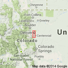
Named for Broadway Avenue on Broadway terrace which lies 25 ft above the South Platte River, Denver, Denver Co, CO in the Denver basin. Type locality is a gravel pit in SEl/4 sec 30, T2S, R67W. Consists of 12 to 15 ft of reddish-brown, fine- to coarse-grained sand and some pebbles. Is younger than Louviers alluvium (new); is older than pre-Piney Creek alluvium. Is underlain by alluvium of two ages. Is overlain by a sheet of later alluvium. Thought to be of late Wisconsin, Pleistocene age.
Source: GNU records (USGS DDS-6; Denver GNULEX).

- Usage in publication:
-
- Broadway alluvium*
- Modifications:
-
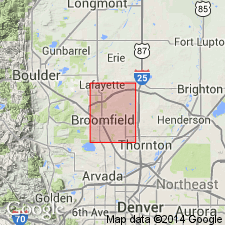
- Mapped 1:24k (Littleton quad, Arapahoe, Douglas, and Jefferson Cos, CO)
- Dominant lithology:
-
- Sand
- AAPG geologic province:
-
- Denver basin
Summary:
Is upper Wisconsin (Pleistocene) formation mapped in west Arapahoe and northwest Douglas Cos, CO (Denver basin). Older than "pre-Piney Creek alluvium" map unit (lower Recent [Holocene]); younger than "younger loess" map unit (lower Wisconsin). Consists of about 25 ft of pebbly sand in a well-formed terrace along South Platte River and Plum Creek; is almost entirely confined to east side of streams. Terrace is about 25 ft above stream level but is poorly preserved due to stream changes and erosion in Recent time. Alluvium is composed of grayish-brown or moderate yellowish-brown well-stratified humic pebbly sand near sides of valleys, but grades into reddish-brown well-washed coarse pebbly sand near center of valley. Pebbles are composed mainly of granite, quartz, ironstone, feldspar, welded tuff. Finer alluvium is well stratified, but coarser alluvium is crudely stratified.
Source: GNU records (USGS DDS-6; Denver GNULEX).
- Usage in publication:
-
- Broadway alluvium*
- Modifications:
-
- Mapped 1:24k (Kassler quad, Douglas and Jefferson Cos, CO)
- Dominant lithology:
-
- Sand
- Pebbles
- AAPG geologic province:
-
- Denver basin
Summary:
Is Pleistocene formation mapped in northwestern Douglas Co, CO (Denver basin). On map explanation Broadway is shown to be younger than younger loess unit and older than pre-Piney Creek alluvium. Broadway is described (p. 38) as a uniform coarse-grained sand near center of Plum Creek channel (in northeasternmost corner of quad), but grades into silty humic coarse-grained sand near east edge of channel. Uniform sand is reddish brown and clean and contains subangular to subrounded pebbles, most of which are less than 1 in. in diameter. Humic silty sand is grayish brown. Measured section. Thickness is estimated to be about 25 ft. Age considered to be late Wisconsin (Pleistocene) because: (1) upper part of gravel capping Broadway terrace contains late Pleistocene fossils and is considered late Wisconsin, (2) Broadway alluvium was first alluvium deposited after early Wisconsin Louviers alluvium, and (3) it is older than pre-Piney Creek alluvium.
Source: GNU records (USGS DDS-6; Denver GNULEX).
- Usage in publication:
-
- Broadway Alluvium*
- Modifications:
-
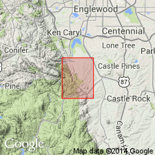
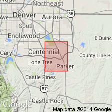
- Mapped 1:24k (Parker quad, Arapahoe and Douglas Cos, CO)
- Dominant lithology:
-
- Sand
- Clay
- AAPG geologic province:
-
- Denver basin
Summary:
Is Pleistocene formation mapped in southwestern Arapahoe and northern Douglas Cos, CO (Denver basin). Conformably overlies lower part (younger part) of Louviers Alluvium (Pleistocene); younger than eolian sand unit (Pleistocene and Holocene); lower part correlates with upper part of loess unit (Pleistocene). Unit described as dark-yellowish-brown to light-brown fine to coarse pebbly sand composed of quartz and feldspar grains, with interbedded lenses of clay. Occurs as terrace surfaces 10-30 ft above principal streams. Up to 30 ft thick.
Source: GNU records (USGS DDS-6; Denver GNULEX).

- Usage in publication:
-
- Broadway Alluvium*
- Modifications:
-
- Mapped 1:24k (Morrison quad, Jefferson Co, CO)
- Dominant lithology:
-
- Alluvium
- AAPG geologic province:
-
- Denver basin
Summary:
Is Pleistocene (Pinedale Glaciation) alluvium mapped in Jefferson Co, CO (Denver basin). Map unit described as yellowish-orange to light-brown, sandy to clayey alluvium along small intermittent streams or cobbly alluvium along major streams. Largest exposure in Green Mountain Village area, east-central part of quad; a few smaller exposures occur along hogback. Contains fossil mollusks. On Correlation of Map Units is shown to unconformably overlie Louviers Alluvium (Pleistocene--Bull Lake Glaciation) and to unconformably underlie eolian sand unit (lower Holocene and upper part of Pinedale Glaciation). Correlates in part with upper Holocene to Pleistocene landslide and colluvium units. Thickness probably about 25 ft. Brown soil of early Holocene age (Altithermal) in upper part. Terrace is 25-40 ft above modern streams.
Source: GNU records (USGS DDS-6; Denver GNULEX).
- Usage in publication:
-
- Broadway Alluvium*
- Modifications:
-
- Mapped 1:24k (Highlands Ranch quad, Arapahoe and Douglas Cos, CO)
- Dominant lithology:
-
- Silt
- Sand
- Gravel
- AAPG geologic province:
-
- Denver basin
Summary:
Is Pleistocene formation mapped in southwestern Arapahoe and northern Douglas Cos, CO (Denver basin). Is younger than Slocum Alluvium (Pleistocene); conformably underlies Piney Creek Alluvium (Holocene); shown on Correlation of Map Units to be equivalent to lower part of colluvium, eolian sand, and loess units (Pleistocene and Holocene). Unit described as tan to light-brown, generally well-stratified silt, sand, and gravel; contains abundant plant debris. Forms low terraces about 10-25 ft above modern streams; most prominently exposed along Big Dry Creek in central part of quad. [Thickness not given.]
Source: GNU records (USGS DDS-6; Denver GNULEX).
- Usage in publication:
-
- Broadway Alluvium*
- Modifications:
-
- Mapped 1:24k (Lafayette quad, Adams Boulder, and Jefferson Cos, CO)
- Dominant lithology:
-
- Sand
- Silt
- Gravel
- AAPG geologic province:
-
- Denver basin
Summary:
Is Pleistocene (Pinedale age) formation mapped in southeastern Boulder, northeastern Jefferson, and northwestern Adams Cos, CO (Denver basin). Unconformably overlies Louviers Alluvium (Pleistocene, Pinedale-Bull Lake interglaciation and Bull Lake glaciation); unconformably underlies Piney Creek Alluvium (Holocene). Unit described as light-gray-brown to light-brown moderately well sorted fine sand and silt; minor clayey gravel lenses near base. Alluvium is cross-bedded and generally finer grained upward in deposit. Forms terraces 3-4 m above modern flood plain of Big Dry Creek. Upper part has weakly developed zonal soil with poorly developed Cca (calcium carbonate-enriched) horizon. Soil profile shown. Thickness 5-6 m along Big Dry Creek; more than 6 m along Coal Creek at north edge of quad. Radiocarbon date of charcoal from near base of unit is greater than 38,440 yrs B.P.
Source: GNU records (USGS DDS-6; Denver GNULEX).
- Usage in publication:
-
- Broadway Alluvium*
- Modifications:
-
- Mapped 1:24k (Fort Logan quad, Arapahoe, Denver, and Jefferson Cos, CO)
- Dominant lithology:
-
- Sand
- Gravel
- AAPG geologic province:
-
- Denver basin
Summary:
Is Pleistocene formation mapped in western Denver and eastern Jefferson Cos, CO (Denver basin). On Correlation of Map Units, Broadway is shown to unconformably overlie Louviers Alluvium (Pleistocene) and to unconformably underlie eolian sand unit (Pleistocene and Holocene). Correlates in part with loess and colluvium units (both units are Pleistocene and Holocene). Unit described as pink to light-brown, generally well-stratified sand and gravel, in well-formed terraces along South Platte River and Lakewood and McIntyre Gulches. Alluvium on west side of South Platte River and its tributaries generally is fine sand and silt. Upper surfaces of terrace deposits are about 25-30 ft above modern major steams. Mapped in northern half and southeastern part of quad. Engineering properties discussed. Up to 30 ft thick.
Source: GNU records (USGS DDS-6; Denver GNULEX).
- Usage in publication:
-
- Broadway Alluvium*
- Modifications:
-
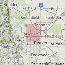
- Mapped 1:24k (Arvada quad, Adams, Denver, and Jefferson Cos, CO)
- Dominant lithology:
-
- Sand
- Gravel
- Silt
- AAPG geologic province:
-
- Denver basin
Summary:
Is Pleistocene formation mapped in northeastern Jefferson Co, CO (Denver basin). On Correlation of Map Units, Broadway is shown to unconformably overlie Louviers Alluvium (Pleistocene) and to unconformably underlie eolian sand unit (Pleistocene and Holocene); correlates in part with Pleistocene and Holocene colluvium and loess units. Broadway is described as pink to light-brown, generally well stratified sand and gravel in well-defined terraces. Upper 2-3 ft commonly a clayey to pebbly silt. Occurs in small area on western edge of quad south of Leyden Creek. Engineering properties discussed. Is up to 15 ft thick.
Source: GNU records (USGS DDS-6; Denver GNULEX).
- Usage in publication:
-
- Broadway Alluvium*
- Modifications:
-
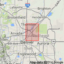
- Mapped 1:24k (Commerce City quad, Adams and Denver Cos, CO)
- Dominant lithology:
-
- Gravel
- Sand
- Silt
- AAPG geologic province:
-
- Denver basin
Summary:
Is Pleistocene formation mapped in northern Denver and western Adams Cos, CO (Denver basin). Unconformably overlies Louviers Alluvium (Pleistocene); unconformably underlies eolian sand unit (Pleistocene and Holocene). Correlates in part with loess and colluvium units (both Pleistocene and Holocene). Unit described as pink to light-brown, generally well stratified sand and gravel. Upper 2-3 ft commonly is a clayey to pebbly silt. Occurs in well-defined terraces on east side of South Platte River valley. Engineering properties discussed. Is up to 15 ft thick.
Source: GNU records (USGS DDS-6; Denver GNULEX).
- Usage in publication:
-
- Broadway Alluvium*
- Modifications:
-
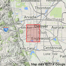
- Mapped 1:24k (Englewood quad, Adams, Arapahoe, and Denver Cos, CO)
- Dominant lithology:
-
- Sand
- Silt
- AAPG geologic province:
-
- Denver basin
Summary:
Is Pleistocene formation mapped in southwestern Arapahoe and eastern Denver Cos, CO (Denver basin). Unconformably overlies Louviers Alluvium (Pleistocene); unconformably underlies Piney Creek Alluvium (upper Holocene) and undifferentiated alluvium unit (upper Holocene). Correlates in part with lowermost part of eolian sand unit (upper Pleistocene to upper Holocene) and part of colluvium unit (Pleistocene to Holocene). Unit described as light-brown, noncalcareous, clean to slightly silty pebbly sand interbedded with sandy silt to silty sand along South Platte River and silty pebbly sand interbedded with sandy silt along Cherry Creek. Slightly finer grained in upper meter. Forms terraces about 12-14 m above South Platte River, 6 m above Cherry Creek, and 5 m above Little Dry Creek. Partially to completely buried by eolian sand in places. Table of physical properties. Thickness is 6-9 m along South Platte River in Denver's central business district and probably less than 9 m along Cherry Creek and Little Dry Creek.
Source: GNU records (USGS DDS-6; Denver GNULEX).
For more information, please contact Nancy Stamm, Geologic Names Committee Secretary.
Asterisk (*) indicates published by U.S. Geological Survey authors.
"No current usage" (†) implies that a name has been abandoned or has fallen into disuse. Former usage and, if known, replacement name given in parentheses ( ).
Slash (/) indicates name conflicts with nomenclatural guidelines (CSN, 1933; ACSN, 1961, 1970; NACSN, 1983, 2005, 2021). May be explained within brackets ([ ]).