

- Usage in publication:
-
- Bozeman lake beds*
- Modifications:
-
- Mapped
- AAPG geologic province:
-
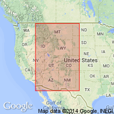
- Montana folded belt
Summary:
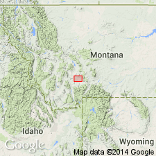
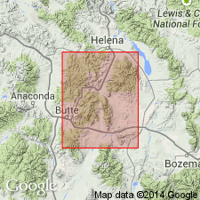
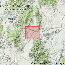
Pl. 1. Mapped, but did not describe, Bozeman lake beds (Neocene), over a large area in vicinity of Threeforks [Three Forks], Montana.
Source: US geologic names lexicon (USGS Bull. 896, p. 245-246).
- Usage in publication:
-
- Bozeman lake beds*
- Modifications:
-
- Principal reference
- Dominant lithology:
-
- Conglomerate
- Sandstone
- Clay
- AAPG geologic province:
-
- Montana folded belt
Summary:
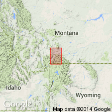
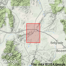
Bozeman lake beds. The conglomerates, sandstones, and clays deposited in waters of a lake that once occupied Gallatin Valley, receive their name from town of Bozeman. Loosely cemented. Consist of variety of materials from adjacent mountain slopes, with marls and layers of volcanic dust. Thickness exposed in this quadrangle 1,200+/- feet, but much greater in other parts of Gallatin Valley. Rest unconformably on Archean schists and all sedimentary strata up to and including Livingston formation (of Cretaceous and Eocene age).
Source: US geologic names lexicon (USGS Bull. 896, p. 245-246).
- Usage in publication:
-
- Bozeman lake beds*
- Modifications:
-
- Principal reference
- Dominant lithology:
-
- Sand
- Conglomerate
- Limestone
- Clay
- AAPG geologic province:
-
- Montana folded belt
Summary:
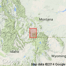
Bozeman lake beds. Sand, conglomerate, limestone, clay, and volcanic dust, deposited in extinct Gallatin Lake. Named for good exposures in vicinity of Bozeman. Total thickness may be 2,000 to 2,500 feet.
Source: US geologic names lexicon (USGS Bull. 896, p. 245-246).
- Usage in publication:
-
- Bozeman formation
- Modifications:
-
- Revised
- AAPG geologic province:
-
- Montana folded belt
Summary:
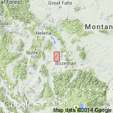
Pg. 270-290. Bozeman formation. The whole series of Tertiary valley sediments [in region about Three Forks] has been grouped under heading Bozeman formation for convenience in mapping. Dr. Peale's name "Bozeman lake beds" seems no longer applicable, since they have been shown to be due to subaerial and fluviatile deposition rather than to lakes. Bozeman formation here is chiefly Miocene, but in some parts of region strata of Oligocene (White River) age have been identified.
Source: US geologic names lexicon (USGS Bull. 896, p. 245-246).
- Usage in publication:
-
- Bozeman lake beds
- Modifications:
-
- Revised
- Age modified
- AAPG geologic province:
-
- Montana folded belt
Summary:
Pg. 15. Bozeman lake beds. Loose term for entire middle and late Cenozoic section northwest of Yellowstone Park in Gallatin and Broadwater Counties, Montana, including beds ranging in age from early Chadronian to Pleistocene and devoid of lacustrine deposits (except the LEUCISCUS TURNERI lake beds).
Source: US geologic names lexicon (USGS Bull. 1200, p. 448).
- Usage in publication:
-
- Bozeman formation
- Modifications:
-
- Areal extent
- AAPG geologic province:
-
- Montana folded belt
Summary:
Bozeman formation. Name applied to beds in Whitehall area, Jefferson County, Montana. Rests on pre-Cambrian (LaHood formation) to Paleocene (Livingston formation) rocks; underlies Tertiary-Quaternary gravels. Carries early Oligocene and late Miocene vertebrate fossils. Lower Oligocene part distinguished from upper Oligocene and Miocene part by higher percentage and greater variety of basic minerals, and fresher and cleaner shards.
Source: Modified from GNU records (USGS DDS-6; Denver GNULEX).
- Usage in publication:
-
- Bozeman group*
- Modifications:
-
- Revised
- AAPG geologic province:
-
- Montana folded belt
Summary:
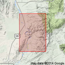
Raised in stratigraphic rank from Bozeman lake beds to Bozeman group. Divided into Sphinx conglomerate at base, newly assigned to Bozeman, and the three newly named Milligan Creek, Climbing Arrow, and Dunbar Creek formations, and some unnamed upper Tertiary gravels (table 1) that fit Peale's (1893) concept of the Bozeman as well as forming a useful genetic concept. Group is exposed over 35 sq mi in quad and is thinly mantled by Quaternary deposits over another 40 sq mi. Deposited in a Tertiary basin and includes rocks of fluvial, eolian, and lacustrine origin. Ranges in age from Eocene to Pliocene. Geologic map covers Gallatin, Jefferson and Broadwater Cos, MT, Montana folded belt province.
Source: GNU records (USGS DDS-6; Denver GNULEX).
- Usage in publication:
-
- Bozeman Group*
- Modifications:
-
- Revised
- AAPG geologic province:
-
- Montana folded belt
Summary:
Sixmile Creek Formation named as uppermost formation of Bozeman Group in Big Belt Mountains area, Broadwater and Gallatin Cos, MT, Montana folded belt province. Here, Bozeman consists of (ascending): Climbing Arrow, Dunbar Creek, and Sixmile Creek Formations. Cross sections. Oligocene to Pliocene age.
Source: GNU records (USGS DDS-6; Denver GNULEX).
- Usage in publication:
-
- Bozeman Group
- Modifications:
-
- Revised
- Areal extent
- AAPG geologic province:
-
- Montana folded belt
Summary:
Extended into Jefferson basin area, southern Jefferson and northern Madison Cos, MT, Montana folded belt province. Divides Bozeman Group into two formations: Renova Formation (new) at base, and Sixmile Creek Formation (new) at top. Renova unconformably underlies Sixmile Creek. Unconformably overlies pre-basin (pre-Tertiary) rocks; unconformably underlies Quaternary deposits. Geologic map, cross sections, correlation chart, fossil lists. Early Oligocene (Chadronian) to middle Pliocene (Hemphillian) age based on vertebrate fossils.
Source: GNU records (USGS DDS-6; Denver GNULEX).
- Usage in publication:
-
- Bozeman Group
- Modifications:
-
- Age modified
- AAPG geologic province:
-
- Montana folded belt
Summary:
Age range based on mammalian fossils is late Uintan (late Eocene) to about middle Hemphillian (late Miocene). (Oldest beds that can be included in Bozeman are the Dell beds of late Uintan age [see addendum, p. 36].) Additional studies may reveal older Eocene rocks; may also be as young as Pliocene because in each basin studied, unit extends above dated fossils and top of section is an erosional and angular unconformity.
Source: Modified from GNU records (USGS DDS-6; Denver GNULEX).
- Usage in publication:
-
- Bozeman Group*
- Modifications:
-
- Revised
- AAPG geologic province:
-
- Montana folded belt
Summary:
Is revised in the Montana folded belt province to exclude Sphinx Conglomerate (restricted) as a unit of the group because Sphinx is demonstrated to be a product of the Laramide Orogeny (Cretaceous) and Bozeman as defined by Robinson (1963) is post-Laramide.
Source: GNU records (USGS DDS-6; Denver GNULEX).
- Usage in publication:
-
- Bozeman Group*
- Modifications:
-
- Not used
- AAPG geologic province:
-
- Montana folded belt
Summary:
Historical use of formal stratigraphic nomenclature applied to Bozeman Group in southwest MT. Charts. Bozeman and its formations --Sphinx Conglomerate (oldest), Milligan Creek, Climbing Arrow, Dunbar Creek, Sixmile Creek of the Toston-Clarkson Valley areas, and the Renova (oldest) and Sixmile Creek Formations of the Jefferson-Beaverhead Valley areas not used. These Tertiary rocks considered to be basin-fill deposits separable on basis of sequence stratigraphic concepts, rather than on lithostratigraphic principles. Lithologic distinctions within the group are not distinctive due to abrupt lateral facies changes. These rocks are separable into five sequences, numbered 1 to 5, no. 1 is the oldest; no. 5 is post-Bozeman alluvium. Each sequence is separated by an unconformity. Term unconformity applied in this paper to surfaces of non-deposition or erosion; these surfaces have soils developed on them. Sequence 1 consists of calc-alkalic flows, flow tuffs, tuff, matrix-supported conglomerate, some massive sandstone about 157 m thick, and is of Eocene age. Sequence 2 is mostly fluvial channel conglomerate, sandstone, mudstone, siltstone, and minor tuff, lapilli tuff about 400 m thick, and is of Eocene and Oligocene age. Sequence 3 is fluvial sheet sandstone, some mudstone, siltstone, sandstone, lenses of conglomerate of flood plain origin about 214 m thick and is of Oligocene and Miocene age. Sequence 4 is mudstone, siltstone, sandstone, lenses of conglomerate mostly of flood plain origin 1,000 m thick, and is of Miocene and Pliocene age. Sequence five unconformably overlies rocks that were assigned to the Bozeman. Map shows distribution of the five sequences. The unconformities can be traced into the subsurface seismically.
Source: GNU records (USGS DDS-6; Denver GNULEX).
- Usage in publication:
-
- Bozeman Group*
- Modifications:
-
- Areal extent
- AAPG geologic province:
-
- Montana folded belt
Summary:
Bozeman Group of Eocene to Pliocene age is mapped as an undivided unit with some unnamed Tertiary valley-fill deposits. Although Bozeman has been divided into the Sixmile Creek and Renova Formations mainly on the basis of mammalian fauna, these formation names are not used in the Dillon quad because they cannot be separated lithologically at most localities in this quad. Mapped on both sides of Jefferson and Ruby Rivers in the eastern part of the quad, in the south-central and southwest and west-central parts of the map area, Madison and Beaverhead Cos, MT in the Montana folded belt province. Map unit is more than 4000 m thick.
Source: GNU records (USGS DDS-6; Denver GNULEX).
For more information, please contact Nancy Stamm, Geologic Names Committee Secretary.
Asterisk (*) indicates published by U.S. Geological Survey authors.
"No current usage" (†) implies that a name has been abandoned or has fallen into disuse. Former usage and, if known, replacement name given in parentheses ( ).
Slash (/) indicates name conflicts with nomenclatural guidelines (CSN, 1933; ACSN, 1961, 1970; NACSN, 1983, 2005, 2021). May be explained within brackets ([ ]).