

- Usage in publication:
-
- Borrego Pass Lentil
- Modifications:
-
- Named
- Dominant lithology:
-
- Sandstone
- AAPG geologic province:
-
- San Juan basin
Summary:
Borrego Pass Lentil of Crevasse Canyon Formation. Ledge-forming, white to buff, fine-grained, quartzose sandstone. Trace fossils at top. Lower part cross trough-bedded; is conglomeratic at base of cross trough-bedded units. Thickness at type 64 feet; ranges 0 to 120 feet. Overlies Dilco Coal Member of Crevasse Canyon Formation and underlies and intertongues with Mulatto Tongue of Mancos Shale; both contacts sharp. Called "stray sandstone" by Sears and others, 1941 (USGS Prof. Paper 193-F, p. 113). [Recognized in Crownpoint-Mount Taylor region, McKinley and Valencia Counties, northwestern NM.] Age is considered Late Cretaceous (Niobrara).
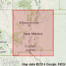
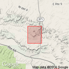
Type section: measured in cliff approx. 4.2 mi southwest of Borrego Pass and about 1 mi east of county road from Prewitt to Borrego Pass Trading Post, in sec. 21, T. 15 N., R. 11 W., [approx. Lat. 35 deg. 31 min. 06 sec. N., Long. 108 deg. 00 min. 15 sec. W.], Casamero Lake 7.5-min quadrangle, McKinley Co., northwestern NM.
Named from Borrego Pass, in SW/4 sec. 27, T. 16 N., R. 11 W., [Borrego Pass 7.5-min quadrangle], McKinley Co., northwestern NM.
Source: Publication; US geologic names lexicon (USGS Bull. 1520, p. 35).
- Usage in publication:
-
- Borrego Pass Lentil*
- Modifications:
-
- Areal extent
- AAPG geologic province:
-
- San Juan basin
Summary:
Ranges from 0-8 m thick in Hosta Butte quad. Forms a thick mappable unit in the Casamero Lake quad to east, but is thin, lenticular, discontinuous, and pinches out in the east part of Hosta Butte quad, McKinley Co, NM in the San Juan basin. Is a member of the Crevasse Canyon Formation that intertongues with and is stratigraphically above the Dilco Coal Member of the Crevasse Canyon. Unconformably underlies Mulatto Tongue of Mancos Shale. Of Late Cretaceous age.
Source: GNU records (USGS DDS-6; Denver GNULEX).
For more information, please contact Nancy Stamm, Geologic Names Committee Secretary.
Asterisk (*) indicates published by U.S. Geological Survey authors.
"No current usage" (†) implies that a name has been abandoned or has fallen into disuse. Former usage and, if known, replacement name given in parentheses ( ).
Slash (/) indicates name conflicts with nomenclatural guidelines (CSN, 1933; ACSN, 1961, 1970; NACSN, 1983, 2005, 2021). May be explained within brackets ([ ]).