

- Usage in publication:
-
- Border conglomerate
- Modifications:
-
- Named
- Dominant lithology:
-
- Conglomerate
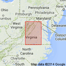
- AAPG geologic province:
-
- Culpeper basin
- Barboursville basin
- Piedmont-Blue Ridge province
Summary:
Conglomerates exposed along the east and west borders of the Triassic basins in VA from the Potomac River to the Carolina border are here named the Border conglomerate. They are of six classes depending on clast composition: 1. limestone conglomerate, also known as "Potomac marble" and "calico marble", derived from Cambrian limestone; 2. quartz conglomerate, derived from granites and quartz lenses in Piedmont crystalline rocks; 3. arkose conglomerate, derived from granites, granite gneisses, and quartz; 4. schist conglomerate, derived from Catoctin schist; 5. trap conglomerate, derived from diabase basalt; 6. quartz-arkose conglomerate, derived from Precambrian granites and gneisses. The conglomerates are easily traceable by their hilly topography, flat exposures, boulders, fertile soil, and frequent pebbles at the surface.
Source: GNU records (USGS DDS-6; Reston GNULEX).

- Usage in publication:
-
- Border Conglomerate†
- Modifications:
-
- Abandoned
- AAPG geologic province:
-
- Culpeper basin
- Barboursville basin
- Piedmont-Blue Ridge province
Summary:
The Border Conglomerate of Roberts (1928), spanning the entire time interval from late Carnian to possibly Pliensbachian and the entire Triassic-Jurassic section in the Culpeper basin, is here abandoned. The conglomerates are lenticular, isolated, and are separable into geographically and lithologically distinct members of several different formations. The two limestone conglomerates are now named the Leesburg Member of the Balls Bluff Siltstone and the Tuscarora Creek Member (new) of the Manassas Sandstone; the arkose conglomerate is subdivided and named the Millbrook Quarry Member (new) of the Waterfall Formation and the Goose Creek Member of the Catharpin Creek Formation; the schist conglomerate is subdivided and named the Reston Member of the Manassas Sandstone and the Haudricks Mountain Member (new) of the Tibbstown Formation; and the trap conglomerate is subdivided and named the Rapidan Member (new) of the Manassas Sandstone and the Mountain Run Member (new) of the Tibbstown Formation.
Source: GNU records (USGS DDS-6; Reston GNULEX).
For more information, please contact Nancy Stamm, Geologic Names Committee Secretary.
Asterisk (*) indicates published by U.S. Geological Survey authors.
"No current usage" (†) implies that a name has been abandoned or has fallen into disuse. Former usage and, if known, replacement name given in parentheses ( ).
Slash (/) indicates name conflicts with nomenclatural guidelines (CSN, 1933; ACSN, 1961, 1970; NACSN, 1983, 2005, 2021). May be explained within brackets ([ ]).