

- Usage in publication:
-
- Bluecastle sandstone bed*
- Modifications:
-
- Original reference
- Dominant lithology:
-
- Sandstone
- AAPG geologic province:
-
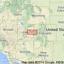
- Paradox basin
Summary:
[Bluecastle sandstone bed of Price River formation of Mesaverde group.] Cross-bedded sandstone, medium-to fine-grained, weathering buff to gray. Thickness 0 to 100+/- feet. Included in Nelson coal-bearing member of Price River formation, lying 200+/- feet above base of that member. Is younger than Thompson Canyon sandstone bed, and younger than Chesterfield coal zone and Sulphur Canyon sandstone bed to east. Age is Late Cretaceous.
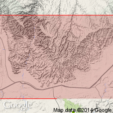
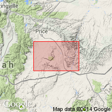
Named from exposures in Bluecastle Canyon, [Book Cliffs coal field, in T. 20 S., R. 15 and 16 E., Grand Co.], central eastern UT. Caps Bluecastle Butte.
Source: US geologic names lexicon (USGS Bull. 896, p. 218).
- Usage in publication:
-
- Bluecastle sandstone member*
- Modifications:
-
- Revised
- AAPG geologic province:
-
- Paradox basin
Summary:
Raised in stratigraphic rank to Bluecastle sandstone member of Neslen formation (rank raised) of Mesaverde group. Formerly a bed in Neslen Member. Change made for central Book Cliffs area, UT in the Paradox basin. Of late Campanian, Late Cretaceous age. Correlation chart.
Source: GNU records (USGS DDS-6; Denver GNULEX).
- Usage in publication:
-
- Bluecastle sandstone bed*
- Modifications:
-
- Revised
- AAPG geologic province:
-
- Paradox basin
Summary:
Assigned as a member at top of Price River formation in western Book Cliffs, west of Green River, Emery Co, UT in the Paradox basin. Assigned as a member, in upper part, of Neslen formation in central Book Cliffs, east of Green River, Grand Co, UT in the Paradox basin. Columnar sections.
Source: GNU records (USGS DDS-6; Denver GNULEX).

- Usage in publication:
-
- Bluecastle Tongue*
- Modifications:
-
- Revised
- AAPG geologic province:
-
- Paradox basin
Summary:
Removed from Price River Formation west of the Green River and from Neslen Formation east of Green River, and placed in the upper part of the Castlegate Sandstone [of Mesaverde Group], as the Bluecastle Tongue, northern Paradox basin. Overlies lower part of Castlegate. Intertongues with Buck Tongue of Mancos Shale, Sego Sandstone, and Neslen Formation. Underlies Price River Formation, or Tuscher and Farrer Formations. Is of Campanian, or Late Cretaceous age.
Source: GNU records (USGS DDS-6; Denver GNULEX).
- Usage in publication:
-
- Bluecastle Sandstone Member*
- Modifications:
-
- Revised
- AAPG geologic province:
-
- Paradox basin
Summary:
Assigned as member of Price River Formation. Mapped undivided with mudstone member of Price River west of Desolation Canyon, Emery Co, UT, Paradox basin. Price River divided into Bluecastle in upper part, and mudstone member in lower part. Late Cretaceous age.
Source: GNU records (USGS DDS-6; Denver GNULEX).
For more information, please contact Nancy Stamm, Geologic Names Committee Secretary.
Asterisk (*) indicates published by U.S. Geological Survey authors.
"No current usage" (†) implies that a name has been abandoned or has fallen into disuse. Former usage and, if known, replacement name given in parentheses ( ).
Slash (/) indicates name conflicts with nomenclatural guidelines (CSN, 1933; ACSN, 1961, 1970; NACSN, 1983, 2005, 2021). May be explained within brackets ([ ]).