

- Usage in publication:
-
- Blue Point member
- Modifications:
-
- Original reference
- Dominant lithology:
-
- Conglomerate
- Clay
- AAPG geologic province:
-
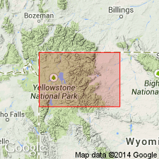
- Bighorn basin
Summary:
Pg. 17. Blue Point Member of Wiggins Formation. Name proposed for lower member of formation. Composed of two green andesitic cobble conglomerates separated by light-greenish-gray clay bed. Locally, upper part of clay bed is white trachytic ash. Either directly overlies or lies within 100 feet above top of Early Basalt flows (Hague, 1899, USGS Geol. Atlas Folio, no. 52) in Carter Mountain-Greybull River area. Underlies sequence of dominantly grayish to brownish fairly well-bedded andesitic volcanic material (conglomerates, sandstones, lapilli tuffs, tuff breccias, and an occasional flow). These beds underlie Crosby breccia (new). [Age is Oligocene.]
Named from exposures at "Blue Point" on Wood River, Park Co., northwestern WY.
Source: US geologic names lexicon (USGS Bull. 1350, p. 79-80).
- Usage in publication:
-
- Blue Point Member
- Modifications:
-
- Not used
Summary:
Abandonment recommended. Though assigned originally to Wiggins Formation, this member does not occur at type Blue Point in Wiggins, and original definition included rocks of two previously named formations --Tepee Trail and Wiggins. Isotopic dates of 47.9 +/-0.5 Ma and 48.5 +/-0.6 Ma formerly reported from Blue Point, are on rocks in lower part of Wiggins.
Source: GNU records (USGS DDS-6; Denver GNULEX).
- Usage in publication:
-
- Blue Point Member
- Modifications:
-
- Overview
- AAPG geologic province:
-
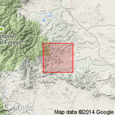
- Bighorn basin
Summary:
Blue Point Member of Wiggins Formation as defined by Wilson (1963), southeastern Absaroka Range in Park Co, WY in the Bighorn basin, includes a basal conglomerate, middle ash, and upper conglomerate. The ash is thick (50+ m) and has greater areal extent than either conglomerate; it forms the base of Wiggins Formation on Carter Mountain and top of Aycross Formation at Owl Creek. Blue Point not assigned to a formation. Name Blue Point marker applied to middle ash bed which has a date of 47.9 +/-0.5 m.y. Blue Point marker underlain by Aycross, Wapiti, or unnamed sequence and overlain by Tepee Trail south of Greybull River Valley and by Wiggins Formation to north. Eocene age. Fauna from Blue Point transitional Bridger B and C.
Source: GNU records (USGS DDS-6; Denver GNULEX).
For more information, please contact Nancy Stamm, Geologic Names Committee Secretary.
Asterisk (*) indicates published by U.S. Geological Survey authors.
"No current usage" (†) implies that a name has been abandoned or has fallen into disuse. Former usage and, if known, replacement name given in parentheses ( ).
Slash (/) indicates name conflicts with nomenclatural guidelines (CSN, 1933; ACSN, 1961, 1970; NACSN, 1983, 2005, 2021). May be explained within brackets ([ ]).