


- Usage in publication:
-
- Fort Payne chert*
- Modifications:
-
- Overview
- AAPG geologic province:
-
- Appalachian basin
Summary:
As thus defined the Fort Payne cherts included (according to E.A. Smith's 1894 report) the rocks which in 1894 he differentiated into "Tuscumbia limestone (=upper part of Fort Payne chert)" and "Lauderdale cherty limestone (=lower part of Fort Payne chert)." In subsequent reports the noncherty beds equivalent to Tuscumbia limestone were included in Bangor limestone of some areas, and the name Fort Payne was thus actually applied to beds of pre-Tuscumbia age. In 1910 (USGS Bull. 400 and Folio 175) C. Butts definitely restricted the name Fort Payne chert to rocks of pre-Warsaw (=pre-Tuscumbia) age, and since then detailed work has proved that in Kentucky, western Tennessee, and northern Alabama, the Ste. Genevieve, St. Louis, and Warsaw limestones can be separated as formations, so that the name Fort Payne chert is now applied to pre-Warsaw rocks underlain by Chattanooga shale. In western Tennessee the Fort Payne is unconformably underlain by New Providence formation or Ridgetop shale, both of post-Chattanooga age. According to E.O. Ulrich and C. Butts the Fort Payne contains fossils of Keokuk, lower Burlington, and Fern Glen age (comprising Osage group), and of late Kinderhook age. (See also C. Butts, 1926, Alabama Geol. Survey Spec. Rpt., no. 14.)
Named from development at Fort Payne, DeKalb Co., AL.
Source: US geologic names lexicon (USGS Bull. 896, p. 757).
- Usage in publication:
-
- Blue Gap Member*
- Modifications:
-
- Original reference
- Dominant lithology:
-
- Claystone
- Mudstone
- AAPG geologic province:
-
- Green River basin
Summary:
Pg. 4-5, sheet 1 (figs. 1-3, geol. map), sheet 2. Blue Gap Member, middle member of Fort Union Formation. Present in Washakie and Sand Wash basins, Carbon County, southernmost Wyoming, and Moffat County, northwesternmost Colorado. Previously called upper zone (or part) of Fort Union. Predominantly olive- to brownish-gray claystone and mudstone; some thin interbeds of fine-grained sandstone, siltstone; rare ironstone and carbonaceous shale. Plant rootlets and fragments are common. Thickness 290 feet at type section (lower part not exposed). Overlies China Butte Member (new) of Fort Union; where exposed, contact placed at base of massive claystones and siltstones. Unconformably underlies Overland Member (new) of Fort Union; contact recognized by sharp juxtaposition of coarse-grained to pebbly sandstones of the Overland resting on fine-grained strata of the Blue Gap. In subsurface of southeastern Sand Wash basin, near Craig, Colorado, underlies conglomerate and arkosic sandstones assigned to basal part of Wasatch Formation (M. Brownfield, USGS, oral commun., 1985). Age is early Paleocene (Torrejonian), based on stratigraphic position. Report includes geologic map, measured sections, correlation chart, cross sections.
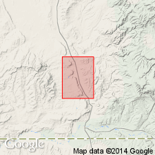
Type section: only upper part exposed beginning about 550 ft from south line and 1,850 ft from east line, and ending about 250 ft from south line and 2,600 ft from east line, in sec. 10, T. 13 N., R. 91 W., Dixon 7.5-min quadrangle, Carbon Co., southernmost WY. Named from Blue Gap Draw, in sec. 24, T. 15 N., R. 92 W., Blue Gap 7.5-minute quadrangle, Carbon Co., southernmost WY.
Type area: prominent exposures showing typical claystone lithology, visible from WY State Highway 789, on east bank of Muddy Creek, 1.5 mi southeast of southeast corner of Peach Orchard Flat 7.5-min quadrangle, in NE/4 sec. 15 and SE/4 sec. 10, T. 13 N., R. 91 W., Dixon 7.5-min quadrangle, Carbon Co., southernmost WY.
Entire member seen at approx. 1,500 ft from east line and 1,800 ft from north line of sec. 34, T. 17 N., R. 92 W., Doty Mountain 7.5-min quadrangle, Carbon Co., southernmost WY.
Source: Publication.
For more information, please contact Nancy Stamm, Geologic Names Committee Secretary.
Asterisk (*) indicates published by U.S. Geological Survey authors.
"No current usage" (†) implies that a name has been abandoned or has fallen into disuse. Former usage and, if known, replacement name given in parentheses ( ).
Slash (/) indicates name conflicts with nomenclatural guidelines (CSN, 1933; ACSN, 1961, 1970; NACSN, 1983, 2005, 2021). May be explained within brackets ([ ]).