

- Usage in publication:
-
- Bloomer Hill Formation*
- Modifications:
-
- Named
- Dominant lithology:
-
- Metavolcanics
- AAPG geologic province:
-
- Sierra Nevada province
Summary:
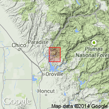
Named for Bloomer Hill Mountain. Type section: West-southwest section across Bloomer Hill sec.30 T21N R5E, continuing to southwest along prominent ridge, sec.25 and 26, T21N R4E and east of Bloomer Hill, secs.29 and 28, T21N R5E, Berry Creek 15' quad, Butte Co, CA. Consists of greenish-gray metavolcanic rocks including metadacite, metasodarhyolite, meta-andesite, metabasalt, metatuff, carbonate rock, phyllite, and quartzite (all shown separately on Berry Creek quad map). Is in fault contact with, or unconformably overlies(?), Paleozoic rocks, including Horseshoe Bend Formation. Age is Jurassic based on stratigraphic relations.
Source: GNU records (USGS DDS-6; Menlo GNULEX).
For more information, please contact Nancy Stamm, Geologic Names Committee Secretary.
Asterisk (*) indicates published by U.S. Geological Survey authors.
"No current usage" (†) implies that a name has been abandoned or has fallen into disuse. Former usage and, if known, replacement name given in parentheses ( ).
Slash (/) indicates name conflicts with nomenclatural guidelines (CSN, 1933; ACSN, 1961, 1970; NACSN, 1983, 2005, 2021). May be explained within brackets ([ ]).