

- Usage in publication:
-
- Blackrock limestone
- Modifications:
-
- Overview
- AAPG geologic province:
-
- Northern Rocky Mountain region
Summary:
Pg. 92-93. Blackrock limestone. Overlies Pocatello formation (new); unconformably underlies Brigham quartzite. Maximum thickness 535 feet. Age is Precambrian. Spelling Blackrock used rather than Black Rock as used by Anderson (1928) because former spelling now appears on USGS topographic map of Pocatello quadrangle, southeastern Idaho.
Source: US geologic names lexicon (USGS Bull. 1200, p. 374).
- Usage in publication:
-
- Blackrock Canyon Limestone*
- Modifications:
-
- Principal reference
- Revised
- AAPG geologic province:
-
- Northern Rocky Mountain region
Summary:
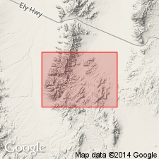
Pg. 585. Blackrock Canyon Limestone. †Black Rock Limestone of Anderson (1928) renamed †Blackrock Limestone by Ludlum (1942) to conform with spelling on Pocatello topographic map. †Blackrock preoccupied and is here renamed Blackrock Canyon. Present in Pocatello area, Bannock County, southeastern Idaho. Consists of fine-grained limestone interbedded with quartzite and minor variegated argillite. Thickness 160 m [approx. 525 feet]. Is thought to be equivalent to the limestone in the middle part of the Kelley Canyon Formation (new) of the Huntsville area, Weber County, Utah. Overlies Pocatello Formation (revised); underlies Papoose Creek Formation (new). Age is late Precambrian (Precambrian Z). Blackrock Canyon Limestone is adopted by the USGS.
Type section: about 7.5 mi (12 km) southeast of Pocatello, on east side of lower Blackrock Canyon, in sec. 14, T. 7 S., R. 35 E., Bannock Co., ID (Northern Rocky Mountain region).
Source: US geologic names lexicon (USGS Bull. 1520, p. 31); Changes in stratigraphic nomenclature, 1971 (USGS Bull. 1372-A, p. A4-A5); GNU records (USGS DDS-6; Denver GNULEX, Menlo GNULEX).
- Usage in publication:
-
- Blackrock Canyon Limestone*
- Modifications:
-
- Age modified
- AAPG geologic province:
-
- Great Basin province
Summary:
In report area, age of the Blackrock Canyon Limestone is Proterozoic Z.
Source: GNU records (USGS DDS-6; Menlo GNULEX).
For more information, please contact Nancy Stamm, Geologic Names Committee Secretary.
Asterisk (*) indicates published by U.S. Geological Survey authors.
"No current usage" (†) implies that a name has been abandoned or has fallen into disuse. Former usage and, if known, replacement name given in parentheses ( ).
Slash (/) indicates name conflicts with nomenclatural guidelines (CSN, 1933; ACSN, 1961, 1970; NACSN, 1983, 2005, 2021). May be explained within brackets ([ ]).