- Usage in publication:
-
- Bissell formation*
- Modifications:
-
- Original reference
- Dominant lithology:
-
- Sandstone
- Conglomerate
- Siltstone
- Shale
- Limestone
- Dolomite
- AAPG geologic province:
-
- Mojave basin
- San Joaquin basin
Summary:
Pg. 137 (fig. 1), 138 (fig. 2), 141-142; see also USGS Bull. 1089-C, pl. 10 (geol. map), 1963. Bissell formation of Tropico group (both new). Arkosic sandstone, granitic conglomerate, green-gray siltstone, clay shale, limestone, dolomite, chert, and siliceous shale. Thickness about 845 feet. Overlies Gem Hill formation (new) of Tropico group with apparent conformity; unconformably underlies fanglomerate of probable Pleistocene(?) age. Nonfossiliferous. May be in part a lacustrine facies of Fiss fanglomerate (new). Age is Miocene or Pliocene.
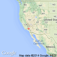
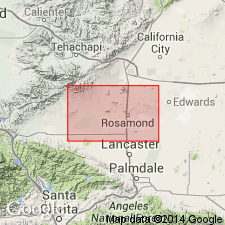
Type locality: an east-trending ridge, in N/2 sec. 11, T. 10 N., R. 11 W., [northeast of Bissell Station on the Atchison, Topeka, and Santa Fe RR, approx. Lat. 34 deg. 59 min. 00 sec. N., Long. 118 deg. 00 min. 51 sec. W., in northeastern corner of Bissell 7.5-min quadrangle, 1947 ed.], in Bissell Hills, Kern Co., southern CA. Named from Bissell Hills [series of hogback ridges north of RR].
[Since Dibblee's publication, the Atchison, Topeka, and Santa Fe RR has been re-routed to areas a few mi north of original route. Bissell Station now in sec. 1, T. 10 N., R. 11 W., northeastern corner of Bissell 7.5-min quadrangle, Kern Co., southern CA. Bissell Hills are the southeast-trending series of ridges extending from sec. 21, T. 10 N., R. 11 W., in eastern part of Bissell 7.5-min quadrangle, to west side of town of Edwards, in sec. 32, T. 10 N., R. 10 W., in western part of Edwards 7.5-min quadrangle, Kern Co., southern CA.]
[Additional locality information from USGS GNIS database, USGS historical topographic map collection TopoView, and Cartography Associates, David Rumsey Collection, https://www.davidrumsey.com (early maps showing Atchison, Topeka, and Santa Fe RR Co. stations); accessed April 26, 2018.]
Source: Publication; US geologic names lexicon (USGS Bull. 1200, p. 355); GNU records (USGS DDS-6; Menlo GNULEX).

- Usage in publication:
-
- Bissell formation*
- Modifications:
-
- Mapped 1:62.5k
- AAPG geologic province:
-
- Mojave basin
- San Joaquin basin
Summary:
Pg. 142, 191-198, pl. 10 (geol. map). Bissell formation of Tropico group. Consists of (in descending order) conglomerate and sandstone, claystone, and dolomite. Contains magnesite deposits. Thickness about 800 feet; 700+/- feet at type locality (in N/2 sec. 11, T. 10 N., R. 11 W., Rosamond 15-min quadrangle). Subdivided into (descending): sandstone member, about 470 feet thick; claystone member, about 150 feet thick; and carbonate and shale member, up to 300 feet thick; all separately mapped. Overlies Gem Hill formation. May be, at least in part, correlative with Miocene(?) Fiss fanglomerate, or younger. Interpreted as lacustrine and fluviatile. Age is considered late Miocene or early Pliocene, based on stratigraphic position.
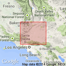
Exposed in hills [Bissell Hills] in extreme northeastern part of mapped area (pl. 10, geol. map).
Source: Publication; GNU records (USGS DDS-6; Menlo GNULEX).

- Usage in publication:
-
- Bissell Formation*
- Modifications:
-
- Age modified
- AAPG geologic province:
-
- Mojave basin
- San Joaquin basin
Summary:
Bissell Formation of Tropico Group. Lower part may be lacustrine facies of upper part of Gem Hill Formation of Tropico Group. Age is tentatively considered Miocene(?).
Source: Modified from GNU records (USGS DDS-6; Menlo GNULEX).
For more information, please contact Nancy Stamm, Geologic Names Committee Secretary.
Asterisk (*) indicates published by U.S. Geological Survey authors.
"No current usage" (†) implies that a name has been abandoned or has fallen into disuse. Former usage and, if known, replacement name given in parentheses ( ).
Slash (/) indicates name conflicts with nomenclatural guidelines (CSN, 1933; ACSN, 1961, 1970; NACSN, 1983, 2005, 2021). May be explained within brackets ([ ]).

