

- Usage in publication:
-
- Bethel schist
- Modifications:
-
- Original reference
- Dominant lithology:
-
- Schist
- AAPG geologic province:
-
- New England province
Summary:
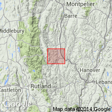
Pg. 82-83, on Bethel Township. Bethel schist. Hydro-mica schists, fine-grained greenish, schistose, highly metamorphosed sedimentary rocks, more or less intimately associated with chlorite, and characterized by numerous lenses, or eyes, and stringers of granular quartz. Underlies [igneous] chlorite schist (Lower Cambrian) which underlies, with apparent disconformity, the various members of Missisquoi group. Of Lower Cambrian age. [C.H. Richardson in 1927 assigned his Bethel schist to Upper Cambrian, and stated that it traverses entire western part of Bethel Township, from which it derived its name. See also Bethel group, of which he treated this schist as a part.]
Source: US geologic names lexicon (USGS Bull. 896, p. 175).
- Usage in publication:
-
- Bethel schist
- Modifications:
-
- Areal extent
- AAPG geologic province:
-
- New England province
Summary:
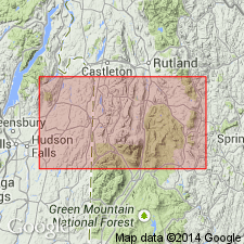
Pg. 208-246, on Reading, Cavendish, Baltimore, and Chester Townships. Bethel schist is present in Chester Township and to south, but is absent in Reading, Cavendish, and Baltimore. Believed to form base of Upper Cambrian in Vermont. [In table opp. p. 288 Bethel chlorite schist is used, and is assigned to base of Upper Cambrian.]
Source: US geologic names lexicon (USGS Bull. 896, p. 175).
For more information, please contact Nancy Stamm, Geologic Names Committee Secretary.
Asterisk (*) indicates published by U.S. Geological Survey authors.
"No current usage" (†) implies that a name has been abandoned or has fallen into disuse. Former usage and, if known, replacement name given in parentheses ( ).
Slash (/) indicates name conflicts with nomenclatural guidelines (CSN, 1933; ACSN, 1961, 1970; NACSN, 1983, 2005, 2021). May be explained within brackets ([ ]).