

- Usage in publication:
-
- Bethel sandstone*
- Modifications:
-
- Named
- Dominant lithology:
-
- Sandstone
- AAPG geologic province:
-
- Illinois basin
Summary:
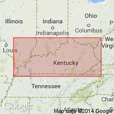
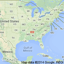
Name Bethel sandstone applied to the sandstone overlying, probably with a slight unconformity, the Ohara limestone member of the Ste. Genevieve limestone in western KY. Unit is thick-bedded, rather coarse-grained sandstone with some pebbles, but not conglomeratic. Thickness 10 to 40 ft. Is Cypress sandstone of Ulrich in USGS Prof. Paper 36. Underlies Ridenhower shale in some places and Gasper oolite in others. Is especially thick and well displayed in vicinity of Bethel School, 3.5 mi west of Marion in Crittenden Co., western KY. Age is Mississippian.
Source: GNU records (USGS DDS-6; Reston GNULEX).

- Usage in publication:
-
- Bethel sandstone
- Modifications:
-
- Areal extent
- AAPG geologic province:
-
- Illinois basin
Summary:
Bethel sandstone occurs in area of report where it underlies Paint Creek formation and overlies Renault formation.
Source: GNU records (USGS DDS-6; Reston GNULEX).
- Usage in publication:
-
- Bethel sandstone
- Modifications:
-
- Areal extent
- AAPG geologic province:
-
- Black Warrior basin
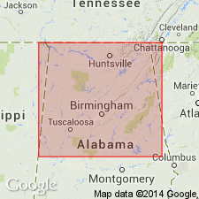
Summary:
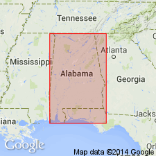
Name Bethel sandstone extended into northern AL for the sandstone overlying Ste. Genevieve limestone.
Source: GNU records (USGS DDS-6; Reston GNULEX).
- Usage in publication:
-
- Bethel sandstone
- Modifications:
-
- Revised
- Areal extent
- AAPG geologic province:
-
- Illinois basin
Summary:
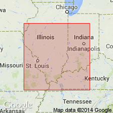
Bethel sandstone assigned to New Design group (new). In standard Mississippian section, underlies Paint Creek formation and overlies Renault formation. Sandstone is brownish moderately fine grained, in part massive and cross-bedded and in part more thinly and evenly bedded. Locally conglomeratic at base. Not more than 10 ft thick in Union Co., IL. In southwestern part of county and in southeastern Perry Co., MO, cannot be recognized sufficiently to separate Renault and Paint Creek formations. Thickness in southern Johnson Co., IL, is 12 ft. Thickens eastward to 50 ft in Ohio River bluff below Golconda. On both sides of river near Shetlerville unit is at least 100 ft thick. Thins southward in KY and is not recognized beyond Elkton, Todd Co.
Source: GNU records (USGS DDS-6; Reston GNULEX).
- Usage in publication:
-
- Bethel formation
- Modifications:
-
- Areal extent
- AAPG geologic province:
-
- Illinois basin
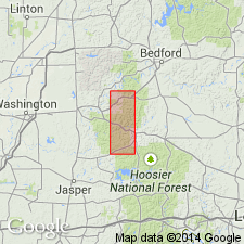
Summary:
In this southwestern IN, Bethel formation is used in place of Mooretown sandstone. Stratigraphic position is below Beaver Bend limestone and above Paoli limestone.
Source: GNU records (USGS DDS-6; Reston GNULEX).
- Usage in publication:
-
- Bethel sandstone*
- Modifications:
-
- Areal extent
- AAPG geologic province:
-
- Black Warrior basin
Summary:
In northwestern AL (Colbert Co. and central Lawrence Co.) and northeastern MS (Tishomingo Co.), beds described by Butts (1926) as Bethel sandstone are included in Tanyard Branch member of Pride Mountain formation (both new).
Source: GNU records (USGS DDS-6; Reston GNULEX).
- Usage in publication:
-
- Bethel sandstone
- Modifications:
-
- Revised
- AAPG geologic province:
-
- Illinois basin
Summary:
Lowermost formation in West Baden group (redefined). Thickness 16 to 35 ft. Underlies Beaver Bend limestone; overlies Paoli limestone of Blue River group (new).
Source: GNU records (USGS DDS-6; Reston GNULEX).
- Usage in publication:
-
- Bethel Sandstone
- Modifications:
-
- Areal extent
- AAPG geologic province:
-
- Black Warrior basin
Summary:
Abandonment in AL of the Ste. Genevieve Limestone, Bethel Sandstone, Gasper Formation, Cypress Sandstone, and Golconda Formation is herein recommended. Pride Mountain Formation appears to be the only mappable stratigraphic subdivision that can be used regionally for the alternating clay shale and sandstone units between the Tuscumbia Limestone and Hartselle Sandstone in northwestern AL.
Source: GNU records (USGS DDS-6; Reston GNULEX).
- Usage in publication:
-
- Bethel Member
- Modifications:
-
- Revised
- Areal extent
- AAPG geologic province:
-
- Ozark uplift
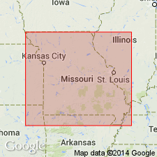
Summary:
Bethel extended into southeastern MO as middle member of Paint Creek Formation. Age is Mississippian (Chesterian).
Source: GNU records (USGS DDS-6; Reston GNULEX).
For more information, please contact Nancy Stamm, Geologic Names Committee Secretary.
Asterisk (*) indicates published by U.S. Geological Survey authors.
"No current usage" (†) implies that a name has been abandoned or has fallen into disuse. Former usage and, if known, replacement name given in parentheses ( ).
Slash (/) indicates name conflicts with nomenclatural guidelines (CSN, 1933; ACSN, 1961, 1970; NACSN, 1983, 2005, 2021). May be explained within brackets ([ ]).