The National Geologic Map Database is migrating to a new infrastructure. We apologize for any service disruptions during this process.
|
|---|


- Usage in publication:
-
- Berryessa formation
- Modifications:
-
- Original reference
- Dominant lithology:
-
- Siltstone
- Sandstone
- Shale
- AAPG geologic province:
-
- Northern Coast Range province
Summary:
Pg. 22 (fig. 4), 31, 33-35, pl. 1. Berryessa formation. Introduced to designate sandstone, siltstone, and shale between Lower Cretaceous Oakland conglomerate and Tertiary Monterey formation. In western limb of Tularcitos syncline, thickness about 1,000 feet at Berryessa Creek; 1,600 feet at Alum Rock Canyon; 2,000 feet near Hendricks Ranch; may be thicker south of there, but base has not been mapped accurately, and top is clearly faulted; no complete section exposed in eastern limb of syncline. About 1 mile south of Alum Rock Canyon, Monterey formation overlaps Berryessa completely. Formation consists of rocks called Chico by Lawson, 1914 (USGS Geol. Atlas Folio, no. 193) and included in Knoxville by Templeton, 1913 (GSA Bull., v. 24, p. 96). Intruded by Alum Rock rhyolite (new). Name Berryessa does not imply that its exact age and stratigraphic position are known, but rather is an attempt to avoid confusion associated with name Chico. [Berryessa includes siltstone and shale that weathers to olive-drab, thin-bedded micaceous sandstone. Age is Early Cretaceous based on fossils (some listed) although unit may include beds of Late Cretaceous age. Map legend of geologic map of San Jose-Mount Hamilton area shows unit as "Berryessa shale" of Cretaceous age.]
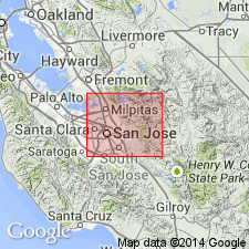
Type locality: on Berryessa Creek, San Jose-Mount Hamilton area, in central Coast Ranges, about 50 mi southeast of San Francisco; both top and base are exposed at type locality. Crops out on both sides of Tularcitos syncline; one band extends along Calaveras fault from vicinity of Calaveras Reservoir to Halls Valley a short distance east of San Felipe Valley; other band extends from Scott Creek across Alum Rock Canyon, then is faulted out for a distance of 3 miles and reappears west of Masters Hill and extends southeast to Panochita Hill, faulted segments reach edge of mapped area southeast of San Felipe Valley. [Named for Berryessa Creek, Calaveras Reservoir 7.5-min quadrangle, Santa Clara Co., CA.]
Source: US geologic names lexicon (USGS Bull. 1200, p. 315); supplemental information (in brackets) from GNU records (USGS DDS-6; Menlo GNULEX).
For more information, please contact Nancy Stamm, Geologic Names Committee Secretary.
Asterisk (*) indicates published by U.S. Geological Survey authors.
"No current usage" (†) implies that a name has been abandoned or has fallen into disuse. Former usage and, if known, replacement name given in parentheses ( ).
Slash (/) indicates name conflicts with nomenclatural guidelines (CSN, 1933; ACSN, 1961, 1970; NACSN, 1983, 2005, 2021). May be explained within brackets ([ ]).