The National Geologic Map Database is migrating to a new infrastructure. We apologize for any service disruptions during this process.
|
|---|


- Usage in publication:
-
- Fort Benton group*
- Modifications:
-
- Original reference
- Dominant lithology:
-
- Clay
- AAPG geologic province:
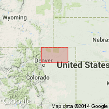
-
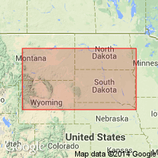
- Sweetgrass arch
Summary:
Pg. 419, 421. Fort Benton group (Formation No. 2 of Cretaceous). Dark-gray laminated clays, sometimes alternating near upper part with seams and layers of soft gray and light-colored limestone. Fossiliferous (invertebrates listed). Thickness 800 feet in vicinity of Fort Benton, on Upper Missouri River. Also occurs along Missouri River from 10 miles above James River to Big Sioux River; along eastern slope of Rocky Mountains; and at Black Hills. (Recognized as far north as Lat. 54 deg. N., on branch of Saskatchewan River, and as far south as Texas.) Overlies Dakota group and underlies Niobrara division. Dakota group, Fort Benton group, and Niobrara division together represent the "lower," or "gray chalk," and probably the "upper green sand" of British geologists (=Turonien and Cenomanien, of D'Orbigny). [This paper by Meek and Hayden described the rocks of Nebraska, which at that time included Wyoming, Montana, and the Dakotas.]
Named from Fort Benton, on Upper Missouri River, about 40 mi below Great Falls, [central Chouteau Co.], MT.
Source: US geologic names lexicon (USGS Bull. 896, p. 164); supplemental information from GNU records (USGS DDS-6; Denver GNULEX).
- Usage in publication:
-
- Fort Benton group*
- Modifications:
-
- Areal extent
- AAPG geologic province:
-
- Williston basin
- Powder River basin
- Chadron arch
Summary:
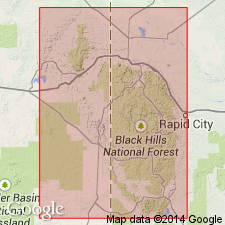
Fort Benton group. Mostly dark plastic clays containing alkaline salts and selenite. In its upper portion are frequently found thin-bedded calcareous sandstones carrying numerous but fragmentary fossils. Thickness 200 to 300 feet. Overlies Dakota group; underlies Niobrara group. In the Black Hills, Wyoming and South Dakota, forms outer slope to series of foothills bordering the encircling Red Valley. Age is Cretaceous. Describes local features.
Source: Modified from GNU records (USGS DDS-6; Denver GNULEX).
- Usage in publication:
-
- Benton group*
- Modifications:
-
- Revised
- AAPG geologic province:
-
- Williston basin
- Chadron arch
- Powder River basin
Summary:
Benton group. In the Black Hills area, Wyoming and South Dakota, includes (ascending) Graneros shale, Greenhorn limestone, and Carlile formation. Overlies Dakota formation; underlies Niobrara formation. Age is Late Cretaceous.
Source: Modified from GNU records (USGS DDS-6; Denver GNULEX).
- Usage in publication:
-
- Benton shale*
- Modifications:
-
- Areal extent
- AAPG geologic province:
-
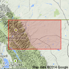
- Sweetgrass arch
Summary:
Benton shale. Recognized west of Saint Mary Lakes, Glacier County, Montana. Contains "Benton fauna" (ammonites, etc.). Underlies Kennedy gravels or formation (new). Age is Cretaceous.
Source: Modified from GNU records (USGS DDS-6; Denver GNULEX).
- Usage in publication:
-
- Benton shale*
- Modifications:
-
- Revised
- AAPG geologic province:
-
- Wind River basin
Summary:
Benton shale of Colorado group. In Salt Creek oil field, Natrona County, Wyoming, includes (ascending): unnamed shale, 270 feet; Mowry shale member, 300 feet; unnamed shale, 800 feet; Wall Creek sandstone lentil (new), 80 feet; and unnamed shale, 220 feet. Overlies Dakota(?) sandstone. Underlies Niobrara shale. Age is Late Cretaceous.
Source: Modified from GNU records (USGS DDS-6; Denver GNULEX).
- Usage in publication:
-
- Benton shale*
- Modifications:
-
- Revised
- AAPG geologic province:
-
- Powder River basin
- Wind River basin
Summary:
Benton shale. In Natrona and Converse Counties, Wyoming, comprises (ascending): thick dark soft shale; dark hard shale; Mowry shale member; shale; Wall Creek sandstone member; and dark shale. Thickness about 1,000 feet. Overlies Cloverly formation; underlies Niobrara formation. A sandstone about 320 feet below the Wall Creek contains the marine fossil plant HALYMENITES MAJOR Lesquereux. Age is Late Cretaceous.
Source: Modified from GNU records (USGS DDS-6; Denver GNULEX).
- Usage in publication:
-
- Benton shale
- Modifications:
-
- Revised
- AAPG geologic province:
-
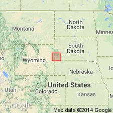
- Bighorn basin
Summary:
Benton shale of Colorado group. In Basin-Greybull area, Bighorn County, Wyoming, includes (ascending) Lower Benton shale, Peay sandstone, Upper Benton shale, and Torchlight sandstone members. Overlies Cloverly sandstone and underlies Basin shale. Age is Late Cretaceous. Report includes history of nomenclature.
Source: Modified from GNU records (USGS DDS-6; Denver GNULEX).
- Usage in publication:
-
- Benton group
- Modifications:
-
- Not used
Summary:
Rocks previously included in Benton group in Black Hills area, Wyoming and South Dakota, are transferred to Colorado group.
Source: Modified from GNU records (USGS DDS-6; Denver GNULEX).
- Usage in publication:
-
- Benton shale*
- Modifications:
-
- Revised
- AAPG geologic province:
-
- Denver basin
Summary:
Benton shale. Applied Codell sandstone member to uppermost part. Lies above Dakota group and below Niobrara formation. Equivalent to Graneros, Greenhorn, and Carlile formations of southern Colorado and eastern Wyoming. Age is Cretaceous. Report includes measured section.
Source: Modified from GNU records (USGS DDS-6; Denver GNULEX).
- Usage in publication:
-
- Benton shale
- Modifications:
-
- Not used
Summary:
In Salt Creek oil field, Natrona County, Wyoming, rocks formerly included in Benton shale by Wegemann (1918) are reassigned to (ascending) Thermopolis shale, Mowry shale, Frontier formation, and Carlile shale. Report includes nomenclature chart, columnar section.
Source: Modified from GNU records (USGS DDS-6; Denver GNULEX).

- Usage in publication:
-
- Benton shale*
- Modifications:
-
- Overview
Summary:
Benton shale. Is lower formation of Colorado group. For many years the "Fort" has been dropped from the name, and Benton shale has been used.
Named for Fort Benton, on Missouri River, about 40 miles below Great Falls, [central Chouteau Co.], Montana, but the stratigraphic limits of the formation are based largely on sections along Missouri River in northern Nebraska, where Benton shale rests on Dakota sandstone and is overlain by Niobrara limestone. The [lower] Cretaceous rocks of central Montana region, including Fort Benton, are now [ca. 1938] classified as Colorado shale (= undivided Niobrara and Benton) and Kootenai formation (Lower Cretaceous). In parts of Wyoming and Colorado the rocks formerly called Benton are now [ca. 1938] divided into (descending) Carlile shale, Greenhorn limestone, and Graneros shale. In central southern Wyoming and Bighorn Mountains they are divided into (descending) Carlile shale, Frontier formation, Mowry shale, and Thermopolis shale.
Benton shale (Upper Cretaceous) recognized in southeastern Montana, South Dakota, eastern Wyoming, Nebraska, southern Minnesota, eastern Colorado, Kansas, and northeastern New Mexico.
Source: US geologic names lexicon (USGS Bull. 896, p. 164).
- Usage in publication:
-
- Benton formation
- Modifications:
-
- Areal extent
- AAPG geologic province:
-
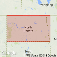
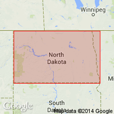
- Williston basin
Summary:
Benton formation. In subsurface of Williston basin, eastern North Dakota, consists of (ascending): a dark-gray, noncalcareous, slightly fossiliferous shale (Carlile? correlative); a light-gray, highly fossiliferous limestone or calcareous shale (Greenhorn? correlative); and a dark-gray, noncalcareous, slightly fossiliferous shale (Graneros? correlative). Thickness as much as 750 feet. Overlies Dakota sandstone; underlies Niobrara formation. Age is Cretaceous.
Source: Modified from GNU records (USGS DDS-6; Denver GNULEX).
- Usage in publication:
-
- Benton formation
- Modifications:
-
- Revised
- AAPG geologic province:
-
- Williston basin
Summary:
Benton formation of Colorado stage [group]. In the Williston basin, North Dakota, includes Greenhorn limestone and "Muddy sand" members. Overlies Dakota sandstone; underlies Niobrara formation. Age is Cretaceous.
Source: Modified from GNU records (USGS DDS-6; Denver GNULEX).
- Usage in publication:
-
- Benton formation*
- Modifications:
-
- Areal extent
- AAPG geologic province:
-
- Williston basin
Summary:
Benton formation. Recognized in subsurface of Williston basin, northwestern and central South Dakota. Conformably underlies Dakota sandstone and conformably overlies Niobrara formation. Correlates with (ascending) Graneros, Greenhorn, and Carlile formations of Ward County, north-central North Dakota. Age is Late Cretaceous (Cenomanian, Turonian, and early Coniacian).
Source: Modified from GNU records (USGS DDS-6; Denver GNULEX).

- Usage in publication:
-
- Benton shale
- Modifications:
-
- Not used
Summary:
Benton shale restricted from Williston basin, North Dakota.
Source: Modified from GNU records (USGS DDS-6; Denver GNULEX).
- Usage in publication:
-
- Benton shale*
- Modifications:
-
- Areal extent
- Dominant lithology:
-
- Shale
- Siltstone
- Limestone
- Bentonite
- AAPG geologic province:
-
- Denver basin
Summary:
Benton shale. Mainly shale interbedded with bentonite, siltstone, and limestone. Thickness about 500 feet. Conformably overlies Dakota group (Lower Cretaceous); unconformably underlies Niobrara formation (Upper Cretaceous). Cut by Golden fault south of Tucker Gulch. Fossiliferous, contains INOCERAMUS and KANABICERAS, and shark teeth.
Source: Modified from GNU records (USGS DDS-6; Denver GNULEX).
- Usage in publication:
-
- Benton Formation*
- Modifications:
-
- Areal extent
- AAPG geologic province:
-
- North Park basin
Summary:
Benton Formation. Gray to dark-gray, fissile to subfissile, silty shale and claystone. Uppermost 10 feet includes dark-brown limestone underlain by well-indurated fine-grained sandstone; lower part contains beds of fine-grained sandstone intercalated with dark-gray shale. Thickness about 450 feet. Overlies Dakota Sandstone (Lower Cretaceous); underlies Niobrara Formation (Upper Cretaceous). Unit is potentially unstable and highly susceptible to slump and landsliding. Age is Cretaceous.
Source: Modified from GNU records (USGS DDS-6; Denver GNULEX).
- Usage in publication:
-
- Benton Shale*
- Modifications:
-
- Biostratigraphic dating
- AAPG geologic province:
-
- North Park basin
Summary:
Benton Shale. Age (in part) is early late Cenomanian (Late Cretaceous), based on ammonites NEOCARDIOCERAS UPTONENSE, N. LAEVIGATUM, and N. MINUTUM (USGS Mesozoic localities D7388, D7389, D7390, D7395, D7402, and D7403) collected 64.3 m to 38.4 m below base of Juana Lopez Member, in Grand County, north-central Colorado.
Source: Modified from GNU records (USGS DDS-6; Denver GNULEX).
For more information, please contact Nancy Stamm, Geologic Names Committee Secretary.
Asterisk (*) indicates published by U.S. Geological Survey authors.
"No current usage" (†) implies that a name has been abandoned or has fallen into disuse. Former usage and, if known, replacement name given in parentheses ( ).
Slash (/) indicates name conflicts with nomenclatural guidelines (CSN, 1933; ACSN, 1961, 1970; NACSN, 1983, 2005, 2021). May be explained within brackets ([ ]).