The National Geologic Map Database is migrating to a new infrastructure. We apologize for any service disruptions during this process.
|
|---|


- Usage in publication:
-
- Bellevue beds
- Modifications:
-
- Named
- Dominant lithology:
-
- Limestone
- AAPG geologic province:
-
- Cincinnati arch
Summary:
Bellevue beds named for Bellevue House, now disappeared, Cincinnati, OH. Comprises about 15 ft of limestone beds, essentially composed of bryozoans, overlain by 5 ft of limestone beds composed mostly of brachiopods. Underlain by Fairmont beds; overlain by Corryville beds.
Source: GNU records (USGS DDS-6; Reston GNULEX).
- Usage in publication:
-
- Bellevue member
- Modifications:
-
- Revised
- AAPG geologic province:
-
- Cincinnati arch
Summary:
Bellevue assigned as a member of the McMillan formation. Overlain by the Corryville member; underlain by the Fairmont member of the Fairview formation.
Source: GNU records (USGS DDS-6; Reston GNULEX).
- Usage in publication:
-
- Bellevue Limestone
- Modifications:
-
- Principal reference
- Revised
- AAPG geologic province:
-
- Cincinnati arch
Summary:
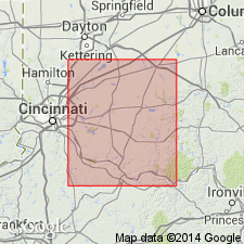
Bellevue beds of Nickles (1902), basically a fossil defined unit, redefined as a lithologic unit and called Bellevue Limestone. Bellevue Limestone is defined here as a sequence of medium- to thin-bedded limestone and shale in which thin-bedded, massive, coquinite limestone predominates. [At the type section] unit is 25 feet thick. Base at lower surface of coquinite limestone is widely exposed and can be recognized with ease. Upper boundary is gradational and commonly concealed. Type section is in cliff at intersection of Rice and Gage Streets in Cincinnati, OH. This appears to be different location from type section designated by Nickles (1902). Underlain by Miamitown Shale; overlain by unnamed strata. Age is Late Ordovician.
Source: GNU records (USGS DDS-6; Reston GNULEX).
- Usage in publication:
-
- Bellevue Tongue*
- Modifications:
-
- Revised
- AAPG geologic province:
-
- Cincinnati arch
Summary:
Reassigned as Bellevue Tongue of the Grant Lake Limestone. Consists of rubbly weathering, medium-gray limestone; beds thin, very irregular, and discontinuous; consists almost entirely of whole and broken brachiopods and bryozoans in an argillaceous calcareous matrix; weathers readily to yellowish-gray rubble that includes many whole fossils; rarely contains a few beds of even to irregularly bedded fine-grained limestone; locally includes small amounts of medium-gray shale as partings between limestone beds. Abundant fossils include Platystrophia, Hebertella, and Monticulapora. Thickness 8 to 23 ft. Underlain by Fairview Formation; overlain by Bull Fork Formation.
Source: GNU records (USGS DDS-6; Reston GNULEX).
- Usage in publication:
-
- Bellevue Member
- Modifications:
-
- Revised
- AAPG geologic province:
-
- Cincinnati arch
Summary:
Grant Lake Limestone and Grant Lake Formation (of the informal Cincinnati group) are adopted by the Ohio Geological Survey for southwestern OH. The shale content of the Grant Lake Limestone progressively increases between Maysville, KY, and Cincinnati, OH. The term Grant Lake Formation is used where the unit becomes predominantly shale. The Grant Lake Formation is divided into (ascending) Bellevue, Corryville, and Mount Auburn Members. Name is applied in Butler , Hamilton, and Warren Cos. and in portions of Brown, Clermont, and Clinton Cos. The Grant Lake Limestone is divided into the Bellevue, Corryville, and Straight Creek (new name) Members. Name is applied in Adams and Highland Cos. and in portions of Brown, Clermont, and Clinton Cos. The Bellevue consists primarily of interbedded, wavy- to irregularly-bedded limestone and irregularly-bedded, fissile-parted, fossiliferous shale. Shale percentage ranges from 17 to 47 percent. Differentiated from the overlying Corryville by mean shale percentage, limestone bedding style, shale partings characteristics and shale fossil content. Thickness of the Bellevue ranges from <6 m to >21 m. Contact with the underlying Miamitown Shale or Fairview Formation ranges from sharp to gradational.
Source: GNU records (USGS DDS-6; Reston GNULEX).

- Usage in publication:
-
- Bellevue Limestone*
- Modifications:
-
- Overview
- AAPG geologic province:
-
- Cincinnati arch
Summary:
The Bellevue Limestone in southwestern OH and north-central KY is present in the Cincinnati area. Consists of a sequence of medium- to thick-bedded, coquinoid limestone, with minor interbedded shales. Thickness is 25 feet or less. Overlies the Kope Formation, intertongues with the Fairview or Dillsboro Formations, and may be a tongue of the Grant Lake Limestone. The Bellevue is of Late Ordovician (Maysvillian) age.
Source: GNU records (USGS DDS-6; Reston GNULEX).
- Usage in publication:
-
- Bellevue Tongue
- Modifications:
-
- Overview
- AAPG geologic province:
-
- Cincinnati arch
Summary:
The Bellevue Tongue is a northern extension of the Grant Lake Limestone in northern KY, IN, and OH. The Kope-Fairview-Bellevue succession is the first of three major progradational units that compose the Cincinnatian Series in the Cincinnati, OH, area. Each succession is interpreted as a mixed siliciclastic-carbonate ramp. The Kope Formation is the most distal facies of the ramp complex, the Fairview is the intermediate-depth lithofacies, and the Bellevue is the shallow, inner-ramp to carbonate sand-shoal facies. Coarse-grained limestones make up the bulk of the Bellevue and are evidence of constant reworking and agitation. The shales that make up the rest of the unit are fossiliferous, poorly indurated, and better described as bioclastic silt. The trend toward larger, more robust fossils seen in the underlying Fairview reaches a maximum in the Bellevue. Large forms of RAFINESQUINA, HEBERTELLA, and PLATYSTROPHIA dominate the brachiopod species. Age of the Bellevue is Late Ordovician (Maysvillian).
Source: GNU records (USGS DDS-6; Reston GNULEX).

- Usage in publication:
-
- Bellevue Limestone*
- Modifications:
-
- Age modified
- AAPG geologic province:
-
- Cincinnati arch
Summary:
Age of Bellevue Limestone in southwestern OH refined to Cincinnatian (Maysvillian).
Source: GNU records (USGS DDS-6; Reston GNULEX).
For more information, please contact Nancy Stamm, Geologic Names Committee Secretary.
Asterisk (*) indicates published by U.S. Geological Survey authors.
"No current usage" (†) implies that a name has been abandoned or has fallen into disuse. Former usage and, if known, replacement name given in parentheses ( ).
Slash (/) indicates name conflicts with nomenclatural guidelines (CSN, 1933; ACSN, 1961, 1970; NACSN, 1983, 2005, 2021). May be explained within brackets ([ ]).