

- Usage in publication:
-
- Belkofski tuff*
- Modifications:
-
- Original reference
- Biostratigraphic dating
- Dominant lithology:
-
- Volcaniclastics
- Volcanics
- Tuff
- AAPG geologic province:
-
- Alaska Peninsula province
- Alaska Southwestern region
Summary:
Pg. 12, pl. 2; 1955, USGS Bull. 1028-A, p. 6-7, pl. 3. Belkofski tuff. Thick series of well-bedded tuff composed largely of fine to coarse lithic tuff, ranging in color from green to purple to gray. Beds have been intensely silicified and sericitized in vicinity of diorite stocks that intrude them. Beds are gently undulating with average dips of 5 to 10 degrees. Plant fossils, principally silicified and carbonized trunks of trees and impressions of conifer needles, present in lower part of formation beds 1 to 5 centimeters thick of silicified and carbonized plant remains present. Thickness more than 3,000 feet. Unit cut by stocks of quartz diorite, by basaltic plugs and necks, by thick sills of andesite, and by smaller sills and dikes of basalt and andesite. Conformably overlies nonfossiliferous beds of green arkose; lava flow units --Black Point basalt. Arch Point basalt, and Dushkin basalt (all new)-- fill canyons and gullies carved in tuff and intrusive diorite stocks; probably comparable in age to Cathedral Valley agglomerate (new). Evidence indicates a post-Eocene, pre-Pleistocene age; tentatively assigned to late Tertiary.
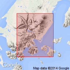
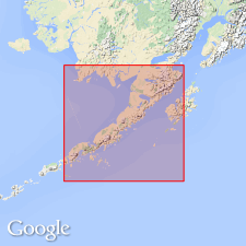
[Type locality not designated.] Beds crop out principally around Belkofski Bay and on Belkofski Point, vicinity of Pavlof Volcano, [in southeast part of Cold Bay quadrangle (scale 1:250,000)], Alaska Peninsula, southwestern AK; [also crops out from Dushkin Lagoon (east of Volcano Bay) southwesterly to King Cove].
Source: US geologic names lexicon (USGS Bull. 1200, p. 284); supplemental information from GNU records (USGS DDS-6; Menlo GNULEX).
- Usage in publication:
-
- Belkofski tuff*
- Modifications:
-
- Age modified
- AAPG geologic province:
-
- Alaska Peninsula province
- Alaska Southwestern region
Summary:
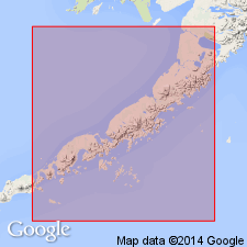
Geographically extended into report area; crops out east of Cold Bay (from King Cove to Kaslokan Point) with one small outcrop west of Cold Bay near Thinpoint Lagoon. Consists of several thousand ft of well-bedded basaltic tuffs, agglomerates and volcanic sedimentary rocks; also some interbedded basalt flows and sills, dikes and plugs of basalt and andesite. Unfossiliferous in report area. Intruded by quartz diorite stock near King Cove. Base not exposed; unconformably overlain by unnamed glacial and alluvial deposits. [Most of unit's lower and upper contacts are shown on map as juxtaposed against ocean and unmapped areas.] Age believed to be middle Tertiary (everywhere mapped on Alaska Peninsula) but evidence (based on analogies with nearby area) is inconclusive.
Source: GNU records (USGS DDS-6; Menlo GNULEX).
- Usage in publication:
-
- Belkofski Formation
- Modifications:
-
- Principal reference
- Revised
- Redescribed
- Age modified
- AAPG geologic province:
-
- Alaska Peninsula province
- Alaska Southwestern region
Summary:
Named changed to Belkofski Formation [to better reflect its lithic diversity]. Probably represents some part of Beaver Bay Group. Is here stratigraphically extended to include green arkose at its base (exposed at Indian Head and on part of northwest shore of Belkofski Bay). Geographically restricted from parts of Frosty Peak and only questionably recognized elsewhere in the Frosty Peak area (see prior mapping by Waldron, 1961). Geographically extended into Dolgoi Island, and questionably recognized in areas on Goloi and Inner Iliasik Islands (Pavlof Islands) and in areas on Deer Island. Along east shore of Cold Bay, thought to be overlain by younger volcanic sediments, including Bear Lake(?) Formation, and by probable Pliocene to Pleistocene lavas and breccias. Age is Eocene and Oligocene based on regional stratigraphic correlations.
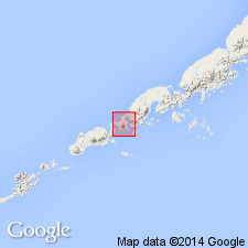
Type locality: exposures in Cold Bay area, in southeast corner of Cold Bay quadrangle (scale 1:250,000).
Source: Modified from GNU records (USGS DDS-6; Menlo GNULEX).
- Usage in publication:
-
- Belkofski Formation*
- Modifications:
-
- Biostratigraphic dating
- Age modified
- AAPG geologic province:
-
- Alaska Peninsula province
- Alaska Southwestern region
Summary:
Geographically extended to area southwest of Pavlof Volcano at expense of Bear Lake(?) Formation of Burk (1965) and questionably extended to part of west shore of Otter Cove in the False Pass 1:250,000 quad. Consists of about 6,000 ft of tuffaceous volcaniclastic sandstone, siltstone, and pebble conglomerate; along northwest shore of Belkofski Bay is composed of 1,150-ft section of greenish marine sandstone (at base) grading up into nonmarine tuffaceous sandstone and minor carbonaceous mudstone and andesitic ash-flow tuff. Pelecypod fossils from basal sandstone "indicate a probable Oligocene age"; plant fossils in upper part include evergreen needles and deciduous leaves that are Oligocene age. Intruded by quartz diorite; conformably overlain by Bear Lake Formation on southeast part of Ukolnoi Island; elsewhere unconformably overlain by Pliocene to Holocene volcanic and sedimentary materials. Age is Oligocene based on fossils [and stratigraphic relations]
Source: GNU records (USGS DDS-6; Menlo GNULEX).
- Usage in publication:
-
- Belkofski Formation*
- Modifications:
-
- Principal reference
- Age modified
- Geochronologic dating
- AAPG geologic province:
-
- Alaska Peninsula province
- Alaska Southwestern region
Summary:
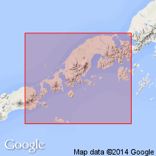
Belkofski Formation. Type section designated along northwest shore of Belkofski Bay, about 5 km north of Indian Head [Cold Bay 1:250,000 quadrangle]. Age is late Oligocene(?) to middle Miocene(?) based on stratigraphic relations and radiometric ages.
Source: GNU records (USGS DDS-6; Menlo GNULEX).
For more information, please contact Nancy Stamm, Geologic Names Committee Secretary.
Asterisk (*) indicates published by U.S. Geological Survey authors.
"No current usage" (†) implies that a name has been abandoned or has fallen into disuse. Former usage and, if known, replacement name given in parentheses ( ).
Slash (/) indicates name conflicts with nomenclatural guidelines (CSN, 1933; ACSN, 1961, 1970; NACSN, 1983, 2005, 2021). May be explained within brackets ([ ]).