

- Usage in publication:
-
- Bedrock Spring Formation*
- Modifications:
-
- Named
- Dominant lithology:
-
- Conglomerate
- Sandstone
- Siltstone
- Claystone
- AAPG geologic province:
-
- Mojave basin
Summary:
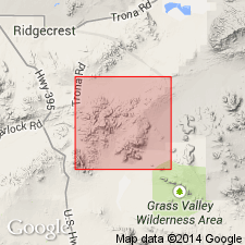
Named for Bedrock Spring, 2 mi north of Dome Mountain and about 1 mi west of type section which is in Lava Mountains [SE/4 NE/4 sec.5 T29S R42E, Cuddleback Lake 15' quad and Klinker Mountain 7.5' quad, San Bernardino Co, CA] Shown on geologic map of Lava Mountains. Rocks of unit previously included in Rosamond Formation of Hulin (1925) which also included part of Almond Mountain Volcanics (new). Bedrock Spring Formation consists of coarse arkosic conglomerate, sandstone, siltstone, and claystone with smaller amounts of limestone, evaporites, tuff, tuff breccia, rubble breccia, and lapilli breccia. Thickness is more than 5000 ft at type. In some areas unconformably underlies conglomerate facies of Christmas Canyon Formation (new). Unconformably underlies Almond Mountain Volcanics. Unconformably overlies pre-middle Pliocene rocks. Vertebrate fossils indicate middle Pliocene or possibly late early Pliocene age.
Source: GNU records (USGS DDS-6; Menlo GNULEX).
- Usage in publication:
-
- Bedrock Spring Formation*
- Modifications:
-
- Areal extent
- Age modified
- AAPG geologic province:
-
- Mojave basin
Summary:
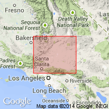
Exposed on slopes of Red Mountain and near Summit Diggings, San Bernardino Co, CA. Shown on geologic map of western Mojave Desert. Author cites G.E. Lewis (in Smith, 1964, p.21) for reason for age to be probably middle(?) Pliocene based on mammalian time scale.
Source: GNU records (USGS DDS-6; Menlo GNULEX).
- Usage in publication:
-
- Bedrock Spring Formation*
- Modifications:
-
- Age modified
- Biostratigraphic dating
- AAPG geologic province:
-
- Mojave basin
Summary:
Age revised from middle(?) Pliocene to: late Miocene based on reassignment of formerly middle or possibly late early Pliocene mammalian fauna to "Hemphillian or possibly late Clarendonian" age.
Source: GNU records (USGS DDS-6; Menlo GNULEX).
For more information, please contact Nancy Stamm, Geologic Names Committee Secretary.
Asterisk (*) indicates published by U.S. Geological Survey authors.
"No current usage" (†) implies that a name has been abandoned or has fallen into disuse. Former usage and, if known, replacement name given in parentheses ( ).
Slash (/) indicates name conflicts with nomenclatural guidelines (CSN, 1933; ACSN, 1961, 1970; NACSN, 1983, 2005, 2021). May be explained within brackets ([ ]).