

- Usage in publication:
-
- Bayfield sandstone group
- Modifications:
-
- Original reference
- Dominant lithology:
-
- Sandstone
- AAPG geologic province:
-
- Lake Superior region
- Wisconsin arch
Summary:
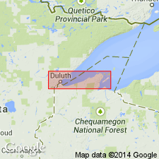
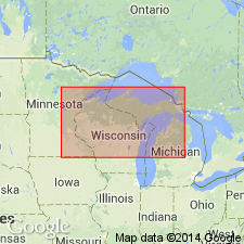
Pg. 25. Bayfield sandstone group. Chiefly quartz sandstones. Formerly called Western Lake Superior sandstone, but correlation with Lake Superior sandstone of Michigan is doubtful. No fossils. Largely or wholly nonmarine. Thickness 4,300 feet. Included in upper Keweenawan. Divided into (descending) Chequamegon sandstone, Devils Island sandstone, and Orienta sandstone. Rests conformably on Oronto group. [Age is pre-Cambrian (late Keweenawan). As mapped covers a large part of Bayfield Co., northwestern WI. Extends into Douglas Co., northwestern WI.]
Source: US geologic names lexicon (USGS Bull. 896, p. 128).
- Usage in publication:
-
- Bayfield group*
- Modifications:
-
- Revised
- AAPG geologic province:
-
- Lake Superior region
- Wisconsin arch
Summary:
Bayfield group. Recent work by G.I. Atwater and G.M. Clement in northwestern Wisconsin and northeastern Minnesota has established presence of a great structural discordance and erosional unconformity between lowest Upper Cambrian sandstone and uppermost Keweenawan Bayfield group.
Source: US geologic names lexicon (USGS Bull. 896, p. 128).
- Usage in publication:
-
- Bayfield group
- Modifications:
-
- Areal extent
- AAPG geologic province:
-
- Lake Superior region
- Wisconsin arch
Summary:
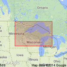
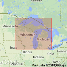
Pg. 1480-1483. Bayfield group. Group divided by Thwaites (1912) into (ascending) Orienta, Devils Island, and Chequamegon sandstones. Overlies Oronto group. Jacobsville sandstone in Michigan is believed to be eastern equivalent of Bayfield group. Age is Precambrian.
Source: US geologic names lexicon (USGS Bull. 1200, p. 242-243).
- Usage in publication:
-
- Bayfield group
- Modifications:
-
- Revised
- Age modified
- Areal extent
- AAPG geologic province:
-
- Lake Superior region
- Sioux uplift
- Wisconsin arch
Summary:
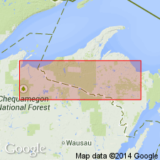
Pg. 137-150. Bayfield group. Discussion of Cambrian-Keweenawan boundary. Suggested that Bayfield sediments are continental deposits of Middle and quite possibly also of Early Cambrian age laid down in structural basins at or after close of the Algonkian. Term Chequamegon dropped; unit is Port Wing brownstone member (new) or Orienta formation repeated by faulting. In this report, term Bayfield embraces the following: Red Clastics, Fond du Lac, or Hinckley in Minnesota and in Michigan the Jacobsville sandstone [not adopted by the USGS, Michigan Geol. Survey, or Minnesota Geol. Survey].
Source: Publication; US geologic names lexicon (USGS Bull. 1200, p. 242-243).
- Usage in publication:
-
- Bayfield Group
- Modifications:
-
- Age modified
- AAPG geologic province:
-
- Lake Superior region
- Wisconsin arch
Summary:
Pg. 6-8, 15, fig. 3, 8. Bayfield Group. Age changed to Cambrian or Precambrian(?).
Source: GNC index card files (USGS-Reston).
- Usage in publication:
-
- Bayfield Group
- Modifications:
-
- Age modified
- AAPG geologic province:
-
- Lake Superior region
- Wisconsin arch
Summary:
Pg. 951-953. Bayfield Group. Age changed to Cambrian.
Source: GNC index card files (USGS-Reston).
- Usage in publication:
-
- Bayfield Group*
- Modifications:
-
- Paleomagnetics
- AAPG geologic province:
-
- Lake Superior region
- Wisconsin arch
Summary:
Pg. D118 (fig. 1), D121 (table 2). Bayfield Group. Includes (descending) Chequamegon Sandstone, Devils Island Sandstone, and Orienta Sandstone. Upper Keweenawan.
See also P.M. DuBois, 1962, Canada Geol. Survey Bull. 71, 75 p.
Source: Publication; GNC index card files (USGS-Reston).
- Usage in publication:
-
- Bayfield Group
- Modifications:
-
- Revised
- Age modified
- Areal extent
- AAPG geologic province:
-
- Lake Superior region
- Wisconsin arch
Summary:
Bayfield Group assigned to Keweenawan Supergroup. Includes Orienta, Devils Island, and Chequamegon Formations. Correlates with Jacobsville Sandstone of MI and Hinckley Sandstone of MN [this implies restriction of Bayfield from either MI or MN]. May correlate with all of Mount Simon Sandstone. Age is Middle Proterozoic.
Source: GNU records (USGS DDS-6; Reston GNULEX).

- Usage in publication:
-
- Bayfield Group*
- Modifications:
-
- Areal extent
- AAPG geologic province:
-
- Lake Superior region
- Wisconsin arch
Summary:
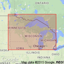
Bayfield Group. Considered youngest sedimentary Precambrian rocks in the Lake Superior region. In northwestern Wisconsin, consists of: Orienta (base), Devil's Island, and Chequamegon Sandstones. Correlative units in Minnesota include Fond du Lac Formation and Hinckley Sandstone. Is of fluvial and lacustrine origin and is compositionally distinct from underlying Oronto Group. Has normal magnetic polarity. Age is considered Middle Proterozoic on basis of relative stratigraphic position; however, has previously been assigned a Late Proterozoic (King, 1976) or Cambrian (Ostrum, 1967) age.
Source: Modified from GNU records (USGS DDS-6; Denver GNULEX).
- Usage in publication:
-
- Bayfield Group*
- Modifications:
-
- Areal extent
- AAPG geologic province:
-
- Lake Superior region
- Wisconsin arch
Summary:
On the correlation chart for Precambrian rocks of the conterminous United States, the Bayfield Group in the Lake Superior region is shown as Middle Proterozoic (approximately 1100 Ma).
Source: GNU records (USGS DDS-6; Reston GNULEX).
For more information, please contact Nancy Stamm, Geologic Names Committee Secretary.
Asterisk (*) indicates published by U.S. Geological Survey authors.
"No current usage" (†) implies that a name has been abandoned or has fallen into disuse. Former usage and, if known, replacement name given in parentheses ( ).
Slash (/) indicates name conflicts with nomenclatural guidelines (CSN, 1933; ACSN, 1961, 1970; NACSN, 1983, 2005, 2021). May be explained within brackets ([ ]).