

- Usage in publication:
-
- Bastille Limestone Member
- Modifications:
-
- Named
- Dominant lithology:
-
- Limestone
- Dolomite
- AAPG geologic province:
-
- Great Basin province
Summary:
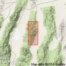
Named as basal member of Masket Shale in August Canyon sequence. [Map shows Bastille south of August Canyon between August and North Mill Canyons]. Type section designated as slope above Gatecliff, Toquima Range [Nye Co, NV]. Consists of bedded, somewhat shaly dolomite (lowest 30 ft), heavy-ledged calcarenite with echinoderm fragments, corals, and few brachiopods (next 30 ft repeated twice because of faulting) and calcisiltite with interbedded shaly beds (remaining 160 ft). Total thickness is about 220 ft. Underlies remaining Masket Shale (undivided). Overlies Gatecliff Formation. Assigned Silurian age.
Source: GNU records (USGS DDS-6; Menlo GNULEX).

- Usage in publication:
-
- Bastille Limestone
- Modifications:
-
- Revised
- AAPG geologic province:
-
- Great Basin province
Summary:
Bastille Limestone Member of Masket Shale (Kay and Crawford, 1964) probably should be considered as unit of formational rank preceding Masket Shale Formation. Biostratigraphic evidence suggests age correlation with lower unit of Roberts Mountains Formation. Age is shown as Silurian (Wenlockian).
Source: GNU records (USGS DDS-6; Menlo GNULEX).
- Usage in publication:
-
- Bastille Limestone Member*
- Modifications:
-
- Age modified
- Biostratigraphic dating
- AAPG geologic province:
-
- Great Basin province
Summary:
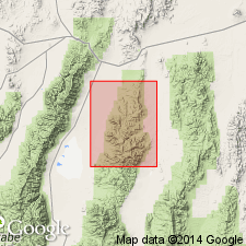
Outcrops near mouth of Mill Canyon shown on map. Consists of about 100 ft of light gray medium- to thick-bedded dolomite overlain by about 25 ft of medium- to thick-bedded limestone that contains abundant crinoids, corals, and brachiopods. Diagnostic fossils (which occur about 115 ft above base) indicate Silurian and Early Devonian age.
Source: GNU records (USGS DDS-6; Menlo GNULEX).
For more information, please contact Nancy Stamm, Geologic Names Committee Secretary.
Asterisk (*) indicates published by U.S. Geological Survey authors.
"No current usage" (†) implies that a name has been abandoned or has fallen into disuse. Former usage and, if known, replacement name given in parentheses ( ).
Slash (/) indicates name conflicts with nomenclatural guidelines (CSN, 1933; ACSN, 1961, 1970; NACSN, 1983, 2005, 2021). May be explained within brackets ([ ]).