

- Usage in publication:
-
- Bashi deposits
- Wood's Bluff deposits
- Modifications:
-
- Original reference
- Dominant lithology:
-
- Clay
- Sand
- Lignite
- AAPG geologic province:
-
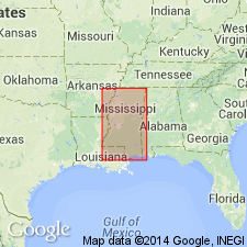
- Mid-Gulf Coast basin
Summary:
Pg. 158-159. Alabama Eocene deposits comprise (ascending): (1) Wood's Bluff and Bashia (with Cave and Knight's Branches) deposits (Eo-lignitic) [Wilcox and Midway], consisting of alternating dark clays, greenish and buff sands, and numerous seams of lignite, partly very rich in fossils, and as far as is yet positively known, the oldest Tertiary deposits of the State, 50 to -?- feet; (2) "Buhrstone" (siliceous Claiborne of Hilgard), comprising siliceous claystones (buhrstone proper) densely charged with fossils or their impressions, laminated clays, sands and calcareous deposits, about 250(?) feet; (3) fossiliferous arenaceous deposit (Claibornian), 17 feet; and (4) "White Limestone" (Jacksonian), not very abundant in fossils, 50 to -?- feet.
Source: Publication; US geologic names lexicon (USGS Bull. 896, p. 122, Eo-lignitic entry p. 693).
- Usage in publication:
-
- Bashi series*
- Wood's Bluff series
- Modifications:
-
- Revised
- Dominant lithology:
-
- Marl
- Sand
- Clay
- Lignite
- AAPG geologic province:
-
- Mid-Gulf Coast basin
Summary:
Pg. 43-47. Wood's Bluff or Bashi series. Consists of (descending): (1) Wood's Bluff or Bashi marl, 15 to 30 feet thick; (2) 25 feet of gray sandy clays containing toward base 4 or 5 thin seams of lignite; (3) 35 to 40 feet of yellowish cross-bedded sands; and (4) lignite bed 2 feet thick. Underlies Hatchetigbee series and overlies Bell's Landing series [Tuscahoma sand of modern nomenclature]. [Age is early Eocene.]
Source: US geologic names lexicon (USGS Bull. 896, p. 122).

- Usage in publication:
-
- Bashi formation*
- Modifications:
-
- Overview
- AAPG geologic province:
-
- Mid-Gulf Coast basin
Summary:
Bashi formation of Wilcox group. Is next youngest formation of Wilcox group in southern Alabama, and contains deposits of both marine and nonmarine origin. Extends a short distance into southeastern Mississippi. Is believed to occupy a position between Grenada formation and Holly Springs sand, but occurs 80 miles southeast of the outcrops of those formations. Age is Early Eocene.
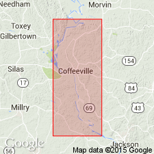
Named from exposures on Bashi Creek, [Woods Bluff 7.5-min quadrangle], Clarke Co., southwestern AL, especially at Wood's Bluff, Tombigbee River, just below mouth of Bashi Creek.
Source: US geologic names lexicon (USGS Bull. 896, p. 122).
- Usage in publication:
-
- Bashi formation
- Modifications:
-
- Revised
- AAPG geologic province:
-
- Mid-Gulf Coast basin
Summary:
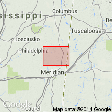
Pg. 53-61. Bashi formation as described by Smith and Johnson, 1887 (USGS Bull. 43) is marked by 2 feet of lignitic and lignite clay at base overlain by 35 to 40 feet of yellowish cross-bedded sand which grades upward into 25 feet or more of gray lignitic sandy clays and associated beds of lignite; top of formation is marked by 15 to 30 feet of glauconitic marl; passes up without apparent break into overlaying lignitic sands and clays of Hatchetigbee formation. Essentially same section, with exception of the basal lignite, is present in Mississippi, extending from southeastern corner of Lauderdale County to Meridian, near center of the County. In this area, typical Bashi marl is overlain by bed of sandy clay and silt which reaches thickness of 30 feet in some areas, and grades upward into lignitic sand and silt. This unit is here placed in Bashi formation although it has been considered to be basal Hatchetigbee by some earlier workers. Overlies Holly Springs formation. [Age is early Eocene.]
Source: US geologic names lexicon (USGS Bull. 1200, p. 229).
- Usage in publication:
-
- Bashi marl member*
- Modifications:
-
- Revised
- AAPG geologic province:
-
- Mid-Gulf Coast basin
Summary:
Pg. 27-28; 1946, USGS Strategic Min. Inv. Prelim. Rpt. 3-195, p. 22. Bashi marl member of Hatchetigbee formation. Proposed that Bashi marl be allocated to member status in Hatchetigbee formation. Thickness 2 to 25 feet; in some places splits into two or three distinct beds and there thickness is greater. [Age is early Eocene.]
Source: US geologic names lexicon (USGS Bull. 1200, p. 229).

- Usage in publication:
-
- Bashi formation
- Modifications:
-
- Revised
- AAPG geologic province:
-
- Mid-Gulf Coast basin
Summary:
Pg. 9. Bashi formation is here considered to be restricted to fossiliferous marine greensand marl, 6 to 20 feet thick in central and western Alabama, and to equivalent sand, clay, and fossiliferous marl beds, 40 feet thick or more, in eastern Alabama. Overlies Tuscahoma formation which includes about 70 feet of strata formerly included in the Bashi; underlies Hatchetigbee formation. Formation extends across state. [Age is early Eocene.]
Source: US geologic names lexicon (USGS Bull. 1200, p. 229).
- Usage in publication:
-
- Bashi marl member
- Modifications:
-
- Revised
- AAPG geologic province:
-
- Mid-Gulf Coast basin
Summary:
Mapped as Bashi marl member of Wilcox formation. [Age is early Eocene.]
Source: US geologic names lexicon (USGS Bull. 1200, p. 229).
- Usage in publication:
-
- Bashi marl member*
- Modifications:
-
- Areal extent
- AAPG geologic province:
-
- South Georgia sedimentary province
Summary:
Bashi marl member of Hatchetigbee formation. Correlation chart of outcropping- Tertiary formations of Eastern Gulf region shows Bashi marl member of Hatchetigbee extending into Georgia. [Age is early Eocene.]
Source: US geologic names lexicon (USGS Bull. 1200, p. 229).
- Usage in publication:
-
- Bashi marl member
- Modifications:
-
- Areal extent
- AAPG geologic province:
-
- Black Warrior basin
Summary:
Pg. 182-188, pls. 1, 5. Bashi marl member of Hatchetigbee formation. Basal member of Hatchetigbee. Thickness about 40 feet in Kemper County, Mississippi. Overlies Tuscahoma sand. [Age is early Eocene.]
Source: US geologic names lexicon (USGS Bull. 1200, p. 229).
- Usage in publication:
-
- Bashi Marl Member
- Modifications:
-
- Areal extent
- AAPG geologic province:
-
- Mid-Gulf Coast basin
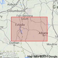
Summary:
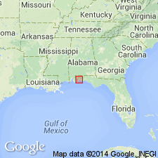
Pg. 18-22. Bashi Marl Member of Hatchetigbee Formation. Is a very thin, regionally extensive marker bed at base of Hatchetigbee in subsurface of Escambia and Santa Rosa Counties, western Florida Panhandle. Maximum thickness 10 feet. Identified by electric log at depths between 2,800 and 1,600 feet below surface. Easily recognized because its resistivity is several times greater than that of units above and below. Rests conformably on Tuscahoma Sand. Age is early Eocene.
Source: Publication.
- Usage in publication:
-
- Bashi Marl Member*
- Modifications:
-
- Biostratigraphic dating
- AAPG geologic province:
-
- Mid-Gulf Coast basin
- South Georgia sedimentary province
Summary:
In eastern Alabama and western Georgia Gulf Coastal Plain, the Bashi Marl Member of the Hatchetigbee Formation and its "unnamed upper member" are time equivalents, and all facies of the Hatchetigbee were deposited during earliest early Eocene (lower half of calcareous nannofossil Zone NP10, radiometric age of 53.0-53.5 MA).
Source: GNU records (USGS DDS-6; Reston GNULEX).
- Usage in publication:
-
- Bashi Formation*
- Modifications:
-
- Revised
- AAPG geologic province:
-
- Mid-Gulf Coast basin
- South Georgia sedimentary province
Summary:
The Bashi Formation, raised in rank, consists of lithologies previously called Bashi Marl Member of the Hatchetigbee Formation. Overlies the Tuscahoma Formation and conformably underlies Hatchetigbee or Tallahatta Formation.
Source: GNU records (USGS DDS-6; Reston GNULEX).

- Usage in publication:
-
- Bashi Marl Member*
- Modifications:
-
- Overview
- AAPG geologic province:
-
- Mid-Gulf Coast basin
Summary:
Pg. 19, 24, 47. Bashi Marl Member of Hatchetigbee Formation. Pale-olive to greenish-gray, fine-grained, abundantly glauconitic fossiliferous ("OSTREA THIRSAE beds") sand and marl containing boulder-size calcareous sandstone concretions. Occurs in basal 6 to 35 feet of Hatchetigbee. Age is early Eocene (early Ypresian).
See also L.D. Toulmin, 1977, Alabama Geol. Survey Mon., no. 13, p. 106-107.
Source: Publication.
- Usage in publication:
-
- Bashi Formation
- Modifications:
-
- Biostratigraphic dating
- AAPG geologic province:
-
- Mid-Gulf Coast basin
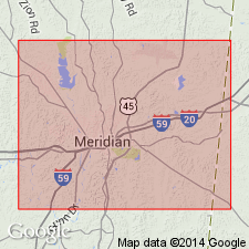
Summary:
The fish fauna of the Bashi Formation discovered at Meridian is early Eocene and represents an embayment or near-shore environment. The age of the Bashi may be equivalent to the Paniselian Stage of Europe, and lies above the Ypresian. Species types and sizes collected from the Bashi are very similar to those recovered in Flanders, Belgium. Report includes discussion of historical geology of the Bashi.
Source: GNU records (USGS DDS-6; Reston GNULEX).
- Usage in publication:
-
- Bashi Formation*
- Modifications:
-
- Biostratigraphic dating
- AAPG geologic province:
-
- Mid-Gulf Coast basin
Summary:
The Bashi and Hatchetigbee Formations of Eocene age intertongue throughout the Mid-Gulf Coast basin. Authors follow use of Bashi Formation of Gibson (1982) and compare biostratigraphic relationships with the Bashi Marl of Toulmin (1977). The Bashi Formation unconformably overlies the Tuscahoma Formation of Paleocene age and underlies the Hatchetigbee Formation. Therefore the Paleocene-Eocene boundary is within the hiatus between the Tuscahoma and Bashi Formations. The Bashi and Hatchetigbee Formations include calcareous nannofossil zones NP10 and NP11 and are of early Eocene age.
Source: GNU records (USGS DDS-6; Reston GNULEX).
- Usage in publication:
-
- Bashi Formation*
- Modifications:
-
- Overview
- AAPG geologic province:
-
- Mid-Gulf Coast basin
Summary:
Bashi Formation of Wilcox Group. Recognized in updip (north) area. Conformably underlies Hatchetigbee Formation and unconformably overlies Tuscahoma Formation (both of Wilcox Group). Age is earliest Eocene (earliest Ypresian); nannofossil zone NP10, planktic foram zone P6 (M. SUBBOTINAE zone).
Source: Publication.
For more information, please contact Nancy Stamm, Geologic Names Committee Secretary.
Asterisk (*) indicates published by U.S. Geological Survey authors.
"No current usage" (†) implies that a name has been abandoned or has fallen into disuse. Former usage and, if known, replacement name given in parentheses ( ).
Slash (/) indicates name conflicts with nomenclatural guidelines (CSN, 1933; ACSN, 1961, 1970; NACSN, 1983, 2005, 2021). May be explained within brackets ([ ]).