

- Usage in publication:
-
- Baldwin conglomerate
- Modifications:
-
- First used
- Dominant lithology:
-
- Conglomerate
- AAPG geologic province:
-
- Wisconsin arch
Summary:
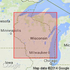
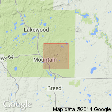
First published use as map unit in vicinity of McCaslin syncline, eight mi southwest of Thunder Mountain, northern Oconto Co., WI (Lake Superior region), where "a thin band of conglomerate (the "Baldwin" conglomerate) can be traced for several miles in a roughly east-west direction." Type locality not designated. Derivation of name not stated. Name attributed to Mancuso (unpublished). Exposed at field trip Stop 1, just northeast of the town of Mountain where pebbles are noted to include: "various Waupee volcanics, Macauley granite, and others not so easy to identify...Red granite pebbles apparently are absent--although locally irregular patches of the matrix take on a reddish color, presumably due to emanations from the nearby rhyolite." An exposure of the conglomerate-rhyolite contact shows a "peculiar 8-inch band of laminated greyish material that separates recognizable conglomerate from the rhyolite." Age is not stated.
Source: GNU records (USGS DDS-6; Reston GNULEX).
- Usage in publication:
-
- Baldwin Conglomerate*
- Modifications:
-
- Principal reference
- Dominant lithology:
-
- Conglomerate
- Metavolcanics
- AAPG geologic province:
-
- Wisconsin arch
Summary:
First described in thesis by Mancuso (1957); here adopted for use in northeast WI in Lake Superior region. Type area designated near Baldwin Creek, east of town of Mountain, Oconto Co., in northern part of sec. 6, T31N, R16E. Is metamorphosed sedimentary rock containing subangular to subrounded clasts of metavolcanic rocks, quartzite, gneiss, and schist in a matrix of quartz, feldspar, biotite, amphibole, and muscovite. Possibly younger than quartzite exposed at McCaslen Mountain and Thunder Mountain (Olson, 1984). Geologic map. Stratigraphically overlies rocks of Waupee Volcanics and is intruded by apophyses from Hagar Quartz Porphyry of Van Schmus and others (1975). Is Early Proterozoic in age.
Source: GNU records (USGS DDS-6; Reston GNULEX).
For more information, please contact Nancy Stamm, Geologic Names Committee Secretary.
Asterisk (*) indicates published by U.S. Geological Survey authors.
"No current usage" (†) implies that a name has been abandoned or has fallen into disuse. Former usage and, if known, replacement name given in parentheses ( ).
Slash (/) indicates name conflicts with nomenclatural guidelines (CSN, 1933; ACSN, 1961, 1970; NACSN, 1983, 2005, 2021). May be explained within brackets ([ ]).