

- Usage in publication:
-
- Bagley andesite*
- Modifications:
-
- Original reference
- Dominant lithology:
-
- Andesite
- AAPG geologic province:
-
- Klamath Mountains province
Summary:
Bagley andesite. Includes the lavas and pyroclastics of a succession of volcanic eruptions of similar general character. Commonly filled with an abundance of small phenocrysts of plagioclase, and rarely also with dark grains in a greenish groundmass. Composed chiefly of andesitic tuff, sometimes coarse, almost agglomeratic, but generally fine and stratified, with occasional traces of marine fossils. More than three-fourths of Bagley Mountain area is occupied by tuff. The lavas are most abundant near summit and whole mass has thickness of about 1,000 feet. Both areas [Bagley Mountain and along Pit River] of Bagley andesite lie practically on border between Potem and Modin formations, but do not necessarily indicate an unconformity. These areas represent centers of greater accumulation of volcanic material near points of eruption during beginning of Potem epoch. Between the two points the contemporaneous sediments contain some detritus from both centers, but apparently the greater portion comes from a different source. For this reason the intermediate sediments were included in the Potem. Age is Early(?) Jurassic.
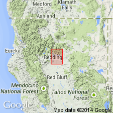
Named from Bagley Mountain in northeast corner of Redding quadrangle, Shasta Co., northern CA.
Source: US geologic names lexicon (USGS Bull. 896, p. 101); supplemental information from GNU records (USGS DDS-6; Menlo GNULEX).
- Usage in publication:
-
- Bagley andesite*
- Modifications:
-
- Age modified
- Dominant lithology:
-
- Andesite
- AAPG geologic province:
-
- Klamath Mountains province
Summary:
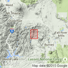
Type area is specified as Bagley Mountain, located in the northeast corner of the Redding quadrangle, about 1 mile from the southwest corner of the Big Bend area. Estimated thickness in Big Bend area is 700 feet. Appears to be volcanic facies of the Potem Formation. Age and correlation in this area are considered to be the same as the Potem -Early and Middle Jurassic.
Source: GNU records (USGS DDS-6; Menlo GNULEX).
For more information, please contact Nancy Stamm, Geologic Names Committee Secretary.
Asterisk (*) indicates published by U.S. Geological Survey authors.
"No current usage" (†) implies that a name has been abandoned or has fallen into disuse. Former usage and, if known, replacement name given in parentheses ( ).
Slash (/) indicates name conflicts with nomenclatural guidelines (CSN, 1933; ACSN, 1961, 1970; NACSN, 1983, 2005, 2021). May be explained within brackets ([ ]).