

- Usage in publication:
-
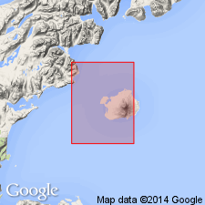
- Augustine Volcanics*
- Modifications:
-
- Named
- Dominant lithology:
-
- Pumice
- AAPG geologic province:
-
- Alaska Southwestern region
Summary:
[Probably named for Augustine Island] Type locality designated as exposures on Augustine Island, Iliamna B-2 quad, south central AK. Composed of light gray to light tan and white to dark gray pumice, minor lava flows, vent plugs and domes, volcanic mud and rubble flows, and small amounts of scoria and cinders. Thickness ranges from 1 to >100 m. Overlies Tertiary age sedimentary rocks. Assigned Pleistocene and Holocene ages. [no basis given]
Source: GNU records (USGS DDS-6; Menlo GNULEX).
For more information, please contact Nancy Stamm, Geologic Names Committee Secretary.
Asterisk (*) indicates published by U.S. Geological Survey authors.
"No current usage" (†) implies that a name has been abandoned or has fallen into disuse. Former usage and, if known, replacement name given in parentheses ( ).
Slash (/) indicates name conflicts with nomenclatural guidelines (CSN, 1933; ACSN, 1961, 1970; NACSN, 1983, 2005, 2021). May be explained within brackets ([ ]).