- Usage in publication:
-
- Augusta Member
- Modifications:
-
- Original reference
- Dominant lithology:
-
- Dolomite
- Limestone
- AAPG geologic province:
-
- Ozark uplift
Summary:
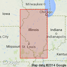
Pg. 59-60, 227-228. Augusta Member of Joachim Dolomite of Ancell Group (new). Name proposed for member of Joachim Dolomite [also called Joachim Formation in text]. Consists principally of pure to silty, thick-bedded dolomite and limestone. Thickness 29 feet at type section; 26 feet in well in Calhoun County, Illinois; 106 feet in Pulaski County, Illinois. Overlies Abernathy Member (new); underlies Boles Member (new). North of Perry County, Missouri, rests directly on Tonti Member (new) of St. Peter Sandstone. Grades westward into Starved Rock Sandstone along Apple Creek in Cape Girardeau and Perry Counties, Missouri. Age is Middle Ordovician (Champlainian).
Type section: in cut on Chicago, Rock Island. and Pacific RR, at foot of bluffs along southeast side of Missouri River, 1 mi southwest of hamlet of St. Albans, in SW/4 NE/4 SW/4 sec. 10, T. 44 N., R. 2 E., [Labadie 7.5-min quadrangle], Franklin Co., eastern MO. Named from village of Augusta, which is 5 mi west of type section. Also well exposed in Ancell type section in Cape Girardeau Co., MO.
[Typographical error (US geologic names lexicon, USGS Bull. 1350, p. 36, GNU records, USGS DDS-6; Reston GNULEX): type section is 1 mi southwest of St. Albans, not southeast.]
Source: US geologic names lexicon (USGS Bull. 1350, p. 35-36); Hdbk Illinois stratigraphy (Illinois Geol. Survey Bull. 95, p. 65); supplemental information from GNU records (USGS DDS-6; Reston GNULEX).

- Usage in publication:
-
- Augusta Member
- Modifications:
-
- Overview
- AAPG geologic province:
-
- Illinois basin
Summary:
Pg. 53 (fig. O-4), 61 (fig. O-15), 65. Augusta Member of Joachim Dolomite of Ancell Group. Recognized in southern Illinois. Consists of relatively pure to very silty, light-gray, white-weathering dolomite in thick beds. Contains layers of pure, algal dolomite or limestone. Locally, basal part is siltstone or contains layers of green shale, indicative of its facies relation to upper part of St. Peter Sandstone. Thickness 29 feet at type section; thins northward to 16 feet in subsurface of Calhoun County, Illinois; thickens southward, is 50 to 75 feet thick in outcrops in Missouri and is 106 feet thick in a well in Pulaski County, Illinois. Is less sandy and sand is finer grained than that in Abernathy Member below; it is thicker bedded and less shaly than Boles Member above. Age is Middle Ordovician (Champlainian; Blackriveran).
Source: Publication.

- Usage in publication:
-
- Augusta Member
- Modifications:
-
- Overview
- AAPG geologic province:
-
- Ozark uplift
Summary:
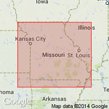
Pg. 17. Augusta Member of Joachim Dolomite. Is the only member of the "lower Joachim Dolomite" north of the Cape Girardeau County area. Characterized by interbedded sandstone, sandy dolomite, and dolomite, reflecting the transitional nature of the Joachim-St. Peter boundary. Overlies St. Peter Sandstone in most of its extent, and is overlain by shaly dolomite of the Boles Member of the "middle Joachim Dolomite." Age is [Late] Ordovician (Mohawkian).
See also T.L. Thompson, Missouri Div. Geol. Land Survey, Rpt. Inv., no. 70, pt. 3, 1991, and Missouri Div. Geol. Land Survey, v. 40 (revised), 2nd ser., 1995.
Source: Publication.
For more information, please contact Nancy Stamm, Geologic Names Committee Secretary.
Asterisk (*) indicates published by U.S. Geological Survey authors.
"No current usage" (†) implies that a name has been abandoned or has fallen into disuse. Former usage and, if known, replacement name given in parentheses ( ).
Slash (/) indicates name conflicts with nomenclatural guidelines (CSN, 1933; ACSN, 1961, 1970; NACSN, 1983, 2005, 2021). May be explained within brackets ([ ]).

