

- Usage in publication:
-
- Asotin Member*
- Modifications:
-
- Original reference
- Dominant lithology:
-
- Basalt
- AAPG geologic province:
-
- Eastern Columbia basin
Summary:
Pg. G2 (fig. 1), G4 (table 1), G6 (fig. 2), G10-11 (table 2), G43-G44, pl. 1. Asotin Member of Saddle Mountains Basalt of Yakima basalt subgroup [informal] of Columbia River Basalt Group. A single thick hackly jointed basalt flow lying between the Wilbur Creek (new) and Weissenfels Ridge (new) Members of the Saddle Mountains Basalt in the Lewiston basin of eastern Washington and western Idaho (credits V.E. Camp, 1976, Washington State Univ., Pullman, PhD dissert., 201 p.). Is an invasive flow; at type and in many other places in Lewiston basin, has an invasive sill-like relation to the enclosing sedimentary rocks; these sedimentary deposits are easily erodible, leading to development of a prominent cliff 40 to 50 m high that characterizes the member. Top of flow is peperitic and chilled against the siltstone (predominantly subarkosic) which at time of eruption was nonindurated and quite thin. Asotin is sparsely olivine and plagioclase phyric; contains more olivine than underlying Wilber Creek and less olivine than many flows of overlying Weissenfels Ridge. May be confused with Pomona Member (new) of Saddle Mountains Basalt; differs in that it contains more magnesium and aluminum and less iron. Has normal magnetic polarity. Overlies Wilbur Creek Member; separated by an erosional unconformity. Conformably underlies Weissenfels Ridge Member. Possibly same as Huntzinger flow (informal) of Mackin (1961, Washington Div. Mines and Geol., Rpt. Inv., no. 19, 45 p.). Areal extent map shows inferred original distribution in southeast Washington and western Idaho (see pl. 1, fig. J). Source for Asotin has not been found; distribution pattern suggests a vent southeast of the Uniontown Plateau near the Snake River. Age is middle Miocene, based on stratigraphic position and paleomagnetics.
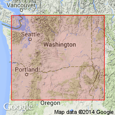
Type locality (see fig. 1, loc. 14 and pl. 1, fig. J): roadcuts along Cloverland Grade in NE/4 SE/4 sec. 26, NW/4 SW/4 sec. 25, and SW/4 SW/4 sec. 25, T. 10 N., R. 45 E., 5 km southwest of Asotin, Asotin quadrangle, Asotin Co., extreme southeast WA. At type, the base of the member is at about 543 m (1,780 feet), the top at about 585 m (1,920 feet) (citing V.E. Camp, 1976, Washington State Univ., Pullman, PhD dissert., fig. 14). Good exposures also near Asotin (see fig. 1, loc. 7).
[Yakima basalt subgroup considered informal and should not be capitalized. "Subgroup" not recognized as a formal stratigraphic rank term (CSN, 1933; ACSN, 1961, 1970; NACSN, 1983, 2005, 2021).]
Source: Publication; GNU records (USGS DDS-6; Menlo GNULEX); Changes in stratigraphic nomenclature, 1979 (USGS Bull. 1502-A, p. A6).
For more information, please contact Nancy Stamm, Geologic Names Committee Secretary.
Asterisk (*) indicates published by U.S. Geological Survey authors.
"No current usage" (†) implies that a name has been abandoned or has fallen into disuse. Former usage and, if known, replacement name given in parentheses ( ).
Slash (/) indicates name conflicts with nomenclatural guidelines (CSN, 1933; ACSN, 1961, 1970; NACSN, 1983, 2005, 2021). May be explained within brackets ([ ]).