

- Usage in publication:
-
- Artillery formation*
- Modifications:
-
- Original reference
- Dominant lithology:
-
- Conglomerate
- Arkose
- Sandstone
- Shale
- Limestone
- Basalt
- AAPG geologic province:
-
- Plateau sedimentary province
Summary:
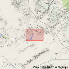
Pg. 14 (table 2), 16-22, pls. 1, 2. Artillery formation. Consists of conglomerate, arkose, sandstone, shale, limestone, a little clay, some tuff, and a widespread basalt member. About 2,500 feet thick. Rests with angular unconformity upon rocks of Precambrian complex and Paleozoic(?) sediments. In some areas, unconformably underlies Miocene(?) volcanics; in other places, overlain by Chapin Wash formation, Cobwebb basalt, or Sandtrap conglomerate (all new); on east side of Bill Williams River, overlain by extensive gravel blanket, and in Santa Maria district by Quaternary(?) basalt. In central spur of Artillery Mountains, has been overthrust by Precambrian complex and Paleozoic(?) rocks. Silicified palm roots were collected from some of the limestone beds. Tentatively assigned to lower Eocene (p. 21). Plates 1 and 2 (geol. maps) show age as early Eocene(?).
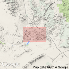
Named from the Artillery Mountains, Mohave Co., west-central AZ. Formation occupies broad tracts within mapped area and extends far beyond its borders, particularly northward along Big Sandy River and westward into Rawhide Mountains.
Source: US geologic names lexicon (USGS Bull. 1200, p. 145).
- Usage in publication:
-
- Artillery Formation*
- Modifications:
-
- Geochronologic dating
- AAPG geologic province:
-
- Basin-and-Range province
Summary:
Age of 43.3 Ma has been obtained on basalt in upper part of formation near Artillery Peak (J.S. Gassaway, written commun., 1976).
Source: GNU records (USGS DDS-6; Menlo GNULEX).
- Usage in publication:
-
- Artillery Formation*
- Modifications:
-
- Age modified
- Biostratigraphic dating
- AAPG geologic province:
-
- Basin-and-Range province
Summary:
Recent age determination and new vertebrate fossil evidence show Artillery Formation is Miocene in age, only slightly older than Chapin Wash of probable early Miocene age.
Source: GNU records (USGS DDS-6; Menlo GNULEX).
- Usage in publication:
-
- Artillery Formation*
- Modifications:
-
- Geochronologic dating
- AAPG geologic province:
-
- Basin-and-Range province
Summary:
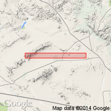
Artillery Formation shown on geologic map of Copper Penny prospect, Santa Maria mining district, Yuma Co, AZ as Oligocene(?) to Miocene in age. K-Ar ages on fresh biotite from rhyolite tuff unit and on hornblende, from capping trachybasalt yielded 27.3 +/-1.1 Ma and 18.6 +/-1.5 Ma.
Source: GNU records (USGS DDS-6; Menlo GNULEX).
- Usage in publication:
-
- Artillery Formation*
- Modifications:
-
- Age modified
- Geochronologic dating
- AAPG geologic province:
-
- Basin-and-Range province
Summary:
Age is Oligocene and(or) Miocene based on K-Ar age of 23.0 +/-0.7 Ma from sample in upper part of unit (and also based on stratigraphic relations).
Source: GNU records (USGS DDS-6; Menlo GNULEX).
- Usage in publication:
-
- Artillery Formation
- Modifications:
-
- Overview
- AAPG geologic province:
-
- Plateau sedimentary province
Summary:
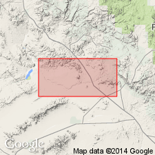
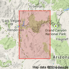
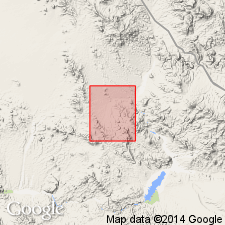
Exposures confined to northern part of map area, Rawhide Mountains, Mohave Co, AZ in Plateau sedimentary province. Geologic map. Rests unconformably on Precambrian? granite and is unconformably overlain by the Chapin Wash Formation in the Rawhide Mountains. The most complete section is in secs 33 and 34, T11N, R14W. Has a maximum thickness of 1,400 m. Divided into (ascending): member 1--a brown to green coarse-grained arkosic sandstone 160 m thick; member 2--gray and brown, thin- to thick-bedded, commonly sandy limestone with chert? nodules and red jasper pebbles interbedded with brown, red, green siltstone and sandstone, and green tuffaceous shales about 120 m thick; member 3--red-brown and green arkosic sandstone with conglomerate layers of rounded to subangular clasts of granite, gneiss, metavolcanics, schist, quartzite, red arkosic sandstone and basalt 185 to 280 m thick; member 4--varicolored calcareous siltstone, sandstone, and limestone with small stromatolitic structure 200 to 400 m thick; member 5--massive red fanglomerate 200 to 600 m thick of debris (includes boulders up to 60 cm in diameter) from metavolcanic rocks. Members 2 and 4 intruded by basalt; a basalt below the Artillery plate has a 15.9 +/-0.3 m.y. K-Ar whole rock age. Member 2 has poorly preserved palm roots. Upper part may be Miocene. Assigned an Eocene? age.
Source: GNU records (USGS DDS-6; Denver GNULEX).
- Usage in publication:
-
- Artillery Formation
- Modifications:
-
- Not used
Summary:
Many of the units given informal designations under the heading "Rocks deposited in basins not related to present topography" were assigned to the Artillery and Chapin Wash Formations by Lasky and Webber (1949). Their nomenclature is not followed because: 1) the lithologic descriptions of the formations are similar and not useful for mapping; 2) this report recognized many lithologically distinctive and mappable units in each of the original formations; 3) the regional unconformities Lasky and Webber used to distinguish Artillery from Chapin Wash are local; and 4) the base of the Tertiary sequence is late Oligocene, not Eocene, the proposed age of the Artillery. The authors' work in this and in the four adjoining quads indicates the rocks are late Oligocene and Miocene because: 1) the K-Ar age determinations on the older basalt sequence range from 16.5 to 18.7 m.y.; 2) the basalts are interbedded with 18.5 Ma Peach Springs Tuff; 3) K-R determinations on silicic volcanic rocks are mostly 12 to 13 m.y.; and 4) rocks from the lower part of the sequence yielded 39Ar/40Ar ages of about 26.5 Ma on sanidine and biotite.
Source: GNU records (USGS DDS-6; Denver GNULEX).
For more information, please contact Nancy Stamm, Geologic Names Committee Secretary.
Asterisk (*) indicates published by U.S. Geological Survey authors.
"No current usage" (†) implies that a name has been abandoned or has fallen into disuse. Former usage and, if known, replacement name given in parentheses ( ).
Slash (/) indicates name conflicts with nomenclatural guidelines (CSN, 1933; ACSN, 1961, 1970; NACSN, 1983, 2005, 2021). May be explained within brackets ([ ]).