

- Usage in publication:
-
- Arco Hills Formation*
- Modifications:
-
- Named
- Reference
- Dominant lithology:
-
- Limestone
- Mudstone
- Sandstone
- AAPG geologic province:
-
- Snake River basin
- Idaho Mountains province
Summary:
Pg. 2, 4, 11-18, figs. 1, 2. Arco Hills Formation. Present in southern Lost River Range-Arco Hills, southern Lemhi Range, and southern Beaverhead Mountains, south-central Idaho. Consists of interbedded medium-gray, olive-gray, yellowish-brown, and grayish-red thin-bedded, argillaceous, and silty or sandy limestone, calcareous mudstone or shale, siltstone and minor sandstone, and medium- to thick-bedded pure limestone. Limestones are locally phosphatic and in western sections, variably cherty. Thickness at type 249 feet (76 m); ranges from 170 to 307 feet (52 to 93 m). Gradationally or unconformably underlies Bluebird Mountain Formation; contact placed at base of lowest thick (4 m+) sandstone or siltstone. Gradationally overlies Surrett Canyon Formation. Intertongues with Big Snowy Formation in southern Beaverhead Mountains. Is Shannon's (GSA Bull., v. 72, no. 12, 1961) lower unit C or upper unit B of southern Lost River and Lemhi Ranges; unnamed units of Mapel and others (Doublespring quadrangle, 1965), Mapel and Shropshire (Hawley Mountain quadrangle, 1973), and Mamet and others (Hawley Mountain area, 1971). Age is Late Mississippian (latest Chesterian), based on fossils (brachiopods, bryozoans, crinoids, foraminifers, and sparse corals and trilobites) and stratigraphic position; Mamet microfossil zone 19 (Mamet and Skipp, 1970). Authors propose an arbitrary northern limit for the Arco Hills, Bluebird Mountain, and Snaky Canyon Formations at about Lat. 44 deg. 30 min. N.; volcanic rocks along northeast margin of Snake River Plain provide natural southern limit. Report includes correlation chart, measured sections, fossil list, geologic sketch map.
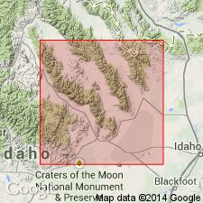
Type section (=reference section of Bluebird Mountain Formation): about 1 km east of town of Arco, Arco Hills, in N/2 NE/4 sec. 31, T. 4 N., R. 27 E., [in vicinity of Lat 43 deg. 38 min. 06 sec. N., Long. 113 deg. 17 min. 12 sec. W., Arco North 7.5-min quadrangle], Butte Co., south-central ID. Named from Arco Hills, [Arco Hills 7.5-min quadrangle], Butte Co., south-central ID. [Lat./Long. coords. from USGS GNIS database and ACME Mapper 2.0, accessed on Darwin's 200th birthday, 2009.]
Reference sections (=reference sections of Bluebird Mountain Formation) --all in south-central ID: (1) southern Lemhi Range, in SE/4 sec. 6, T. 6 N., R. 30 E., Butte Co.; (2) ridge east of East Canyon, southern Lemhi Range, in SE/4 sec. 36 (unsurveyed), T. 7 N., R. 29 E., Butte Co.; (3) north side of Skull Canyon, Blue Dome area, southern Beaverhead Mountains, in NW/4 NW/4 sec. 28 and NE/4 NE/4 sec. 29, T. 10 N., R. 30 E., Clark Co.
Source: Publication; supplemental information from US geologic names lexicon (USGS Bull. 1564, p. 4-5); Changes in stratigraphic nomenclature, 1979 (USGS Bull. 1502-A, p. A5).
For more information, please contact Nancy Stamm, Geologic Names Committee Secretary.
Asterisk (*) indicates published by U.S. Geological Survey authors.
"No current usage" (†) implies that a name has been abandoned or has fallen into disuse. Former usage and, if known, replacement name given in parentheses ( ).
Slash (/) indicates name conflicts with nomenclatural guidelines (CSN, 1933; ACSN, 1961, 1970; NACSN, 1983, 2005, 2021). May be explained within brackets ([ ]).