- Usage in publication:
-
- Archer Creek formation
- Modifications:
-
- Original reference
- Dominant lithology:
-
- Schist
- Marble
- AAPG geologic province:
-
- Piedmont-Blue Ridge province
Summary:
Pg. 15 (table 1), 16-17. Archer Creek formation of Evington group. Green to blue-gray siliceous graphitic schist member, as much as 500 feet thick, forms lower part of formation; bluish fine- to medium-grained marble member, as much as 400 feet thick, lies in upper part of formation and is interbedded with graphitic schist member. Marble commonly forms valleys. Includes Joshua schist and Arch marble and of Brown (1951, 1953). Underlies Mount Athos formation; overlies Candler formation. Age is Paleozoic(?).
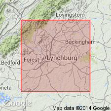
Named from exposures along Archer Creek about 1.5 mi above its confluence with James River. Exposed extensively along James River valley to southwest of Allen Creek, in neighborhood of Jack Mountain and Chestnut Mountain, and southeast of Evington, [Campbell Co.], south-central VA.
Source: US geologic names lexicon (USGS Bull. 1200, p. 126-127).

- Usage in publication:
-
- Archer Creek Formation
- Modifications:
-
- Not used
- AAPG geologic province:
-
- Piedmont-Blue Ridge province
Summary:
Arch Marble and Joshua Schist of Brown (1953; 1958) and Archer Creek Formation of Espenshade (1954) are included within the banded marble unit of Alligator Back Formation on the State map. Alligator Back is assigned to Lynchburg Group. Evington Group is not used.
Source: GNU records (USGS DDS-6; Reston GNULEX).
For more information, please contact Nancy Stamm, Geologic Names Committee Secretary.
Asterisk (*) indicates published by U.S. Geological Survey authors.
"No current usage" (†) implies that a name has been abandoned or has fallen into disuse. Former usage and, if known, replacement name given in parentheses ( ).
Slash (/) indicates name conflicts with nomenclatural guidelines (CSN, 1933; ACSN, 1961, 1970; NACSN, 1983, 2005, 2021). May be explained within brackets ([ ]).

