The National Geologic Map Database is migrating to a new infrastructure. We apologize for any service disruptions during this process.
|
|---|


- Usage in publication:
-
- Arapahoe formation
- Modifications:
-
- Original reference
- Dominant lithology:
-
- Conglomerate
- Shale
- Sandstone
- AAPG geologic province:
-
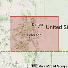
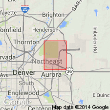
- Denver basin
Summary:
[In footnote on p. 97 Eldridge withdrew "Willow Creek beds," because of preoccupation in Canada, and substituted Arapahoe (named from development in Arapahoe Co., Denver basin, eastern CO).]
Pg. 86-112. †Willow Creek beds. Consist of 600 to 1,200 feet of gray argillaceous or arenaceous shales with lenticular masses of hard quartzose sandstone and an occasional ironstone, underlain by 200 feet of conglomerate or gritty sandstone, which may become bulk of formation, as in type locality, or may thin to merest edge, as in northern limit along Platte River near Brighton. This formation contains pebbles from every formation that lies beneath it in Denver field, as well as from others far beyond, especially the Carboniferous. Unconformably overlies Laramie formation and unconformably underlies Denver beds, described by Cross. Contains dinosaur remains. Named for Willow Creek, in southern part ot field, 1 to 3 miles southeast of mouth of Platte Canyon [Denver basin, eastern Colorado], where it has its greatest and most typical development. [Age is Late Cretaceous.]
Source: US geologic names lexicon (USGS Bull. 896, p. 65-66, Willow Creek entry p. 2343).
- Usage in publication:
-
- Arapahoe conglomerate member*
- Modifications:
-
- Revised
- AAPG geologic province:
-
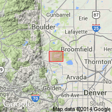
- Denver basin
Summary:
Pg. 65-86. Discussion of Cretaceous-Tertiary boundary in Denver basin, Colorado. Stratigraphic and paleontologic evidence shows that Laramie formation, Arapahoe formation, and Cretaceous parts of Denver formation and Dawson arkose comprise a unit correlative with Lance formation and its equivalents. Proposed that Laramie be redefined to include all Upper Cretaceous sequence between top of Fox Hills and base of Paleocene and that term Arapahoe as Arapahoe conglomerate member of Laramie be retained for conglomerate immediately overlying present Laramie formation. Not considered to be a mappable unit. Its upper limits placed at the first appearance of andesitic debris, a criteria that has little value as a distinguishing feature because andesite also occurs in the Dawson arkose.
Source: US geologic names lexicon (USGS Bull. 1200, p. 123); supplemental information from GNU records (USGS DDS-6; Denver GNULEX).
- Usage in publication:
-
- Arapahoe formation
- Modifications:
-
- Areal extent
- AAPG geologic province:
-
- Denver basin
Summary:
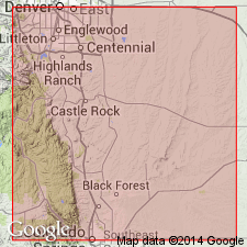
The Laramie-Arapahoe contact placed at same horizon as the one selected by its definers (Emmons, Cross, and Eldridge, 1896). The contact is an erosional disconformity; this contact separates clay of the Laramie from arkosic conglomerate of the Arapahoe. The Arapahoe throughout the Denver basin includes all Cretaceous light-colored arkosic conglomerate, sandstone and shale above the Laramie and below an unconformity at the base of Denver formation. This unconformity accounts for the variable thickness of the Arapahoe. Is thickest in the Golden-Green Mountain area; it becomes finer grained and thins to the east and south. Only the basal conglomerate or coarse arkosic sandstone found east and southeast from Castle Rock where it ranges from 0 to 35 ft thick. Is 50 to 100 ft thick in the Matheson-Bland-Byers area at northeast side of Denver basin area. The basal sandstone or conglomerate is characterized by small pebbles of black, red, yellow chert, white limestone, and granite in a coarse, arkosic yellow sandstone. Geologic map; mapped as a thin band at southwest edge of basin, as a continuous exposure around the northeast and north side of the basin, and locally at west side of basin. The source area was the Front Range. Of Late Cretaceous age. Arapahoe of this paper is the lithologic and time equivalent of the basal Dawson of Dane and Pierce (1936).
Source: GNU records (USGS DDS-6; Denver GNULEX).
- Usage in publication:
-
- Arapahoe formation*
- Modifications:
-
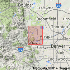
- Mapped 1:24k (Golden quad, Jefferson Co, CO)
- Dominant lithology:
-
- Sandstone
- Claystone
- Conglomerate
- AAPG geologic province:
-
- Denver basin
Summary:
Is Upper Cretaceous formation mapped in northern Jefferson Co, CO (Denver basin). Unconformably? overlies Laramie formation (Upper Cretaceous); unconformably? underlies Denver formation (Upper Cretaceous and Paleocene). Near Golden, formation outcrops in narrow belt of steeply dipping, north-striking rocks; north of Golden strike swings to east and dip flattens rapidly, causing outcrop area to become wide in central eastern parts of quad. Basal conglomerate is separately mapped; conglomerate is very prominent at Golden but is not present between Van Bibber Creek and Lower Twin Lake. Described as conglomerate, sandstone, and claystone. Basal conglomerate is composed mainly of pebbles of chert but includes some granite, gneiss, and schist. Sandstone beds are light gray to light brown, quartzose, fine to medium grained, and cross-bedded. Claystone makes up greater part of unit; is medium gray to brown, and generally very silty. Contact with overlying Denver not found due to poor exposure of upper part of Arapahoe. Thickness is 250-300 ft.
Source: GNU records (USGS DDS-6; Denver GNULEX).

- Usage in publication:
-
- Arapahoe Formation*
- Modifications:
-
- Mapped 1:24k (Morrison quad, Jefferson Co, CO)
- Dominant lithology:
-
- Conglomerate
- Sandstone
- Siltstone
- Claystone
- AAPG geologic province:
-
- Denver basin
Summary:
Is Upper Cretaceous formation mapped in Jefferson Co, CO (Denver basin). Outcrops occur as narrow band along east side of Hogback. Map unit described as coarse- and fine-grained sandstone, siltstone, claystone, and thin pebble beds in upper part; white, yellowish-gray, and yellowish-orange, coarse-grained sandstone and poorly sorted pebble- and-cobble conglomerate in lower part. Stones from sedimentary rocks make up about 60 percent and igneous and metamorphic rocks about 40 percent of basal conglomerate, but proportions reverse upward. Sandstone composed of quartz, feldspar, and mica. Conglomerate contains shale blocks 4 by 2 ft, sandstone blocks 1 by 1 ft, chert, and petrified wood. Cut-and-fill structure in conglomerate. Contains concretions and layered concentrations of ironstone and dinosaur bones. Thickness 400 ft. Unconformably overlies Laramie Formation (Upper Cretaceous) with local major uplift noted. Underlies Denver Formation (Upper Cretaceous and Paleocene).
Source: GNU records (USGS DDS-6; Denver GNULEX).
- Usage in publication:
-
- Arapahoe Formation*
- Modifications:
-
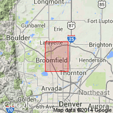
- Mapped 1:24k (Lafayette quad, Adams Boulder, and Jefferson Cos, CO)
- Dominant lithology:
-
- Claystone
- Siltstone
- Sandstone
- Conglomerate
- AAPG geologic province:
-
- Denver basin
Summary:
Is Upper Cretaceous formation mapped in northwestern Adams, southeastern Boulder, and northeastern Jefferson Cos, CO (Denver basin). Unconformably overlies Laramie Formation (Upper Cretaceous); conformably underlies Denver Formation (Upper Cretaceous and Paleocene) though contact not exposed. Unit is fairly widespread throughout mapped area especially in southwestern part of quad. Unit described as olive-gray to bluish-gray claystone and siltstone, and light-gray to light-orange-brown (weathered) fine-grained sandstone and sparse granule conglomerate. Festoon cross-bedding and lenticular cut-and-fill channels are shown in manmade exposures. Channels filled with conglomerate; commonly contain large blocks of shale derived from Laramie. Driller's logs note well-indurated layered sandstone in subsurface. Contains calcite-cemented concretions along Big Dry Creek. Dinosaur bones have been found north of Broomfield (K.B. Ketner, oral Commun., 1972). Dips gently to southeast. Thickness about 120 m.
Source: GNU records (USGS DDS-6; Denver GNULEX).
- Usage in publication:
-
- Arapahoe Formation*
- Modifications:
-
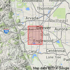
- Mapped 1:24k (Fort Logan quad, Arapahoe, Denver, and Jefferson Cos, CO)
- Dominant lithology:
-
- Sandstone
- Siltstone
- Claystone
- Shale
- Conglomerate
- AAPG geologic province:
-
- Denver basin
Summary:
Is Upper Cretaceous formation mapped undivided with Denver Formation (Upper Cretaceous and Paleocene) in western Arapahoe, western Denver, and eastern Jefferson Cos, CO (Denver basin). Unconformably overlies Laramie Formation (Upper Cretaceous); underlies Denver Formation. Combined unit described as brown, yellowish-brown, gray, and blue-gray interbedded sandstone, claystone, siltstone, shale, and conglomerate. Cross-bedded and lenticular units are common throughout map unit. Shale and claystone generally exhibit marked swelling properties when wetted. Lower conglomerate member of Arapahoe is generally water bearing. Most extensive outcrops are in western part of quad; scattered smaller outcrops over much of quad. Engineering properties discussed. Thickness of combined units is 810 ft reported in well log from location in downtown Denver.
Source: GNU records (USGS DDS-6; Denver GNULEX).
- Usage in publication:
-
- Arapahoe Formation*
- Modifications:
-
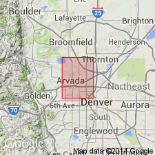
- Mapped 1:24k (Arvada quad, Adams, Denver, and Jefferson Cos, CO)
- Dominant lithology:
-
- Sandstone
- Claystone
- Siltstone
- Shale
- Conglomerate
- AAPG geologic province:
-
- Denver basin
Summary:
Is Upper Cretaceous formation mapped undivided with Denver Formation (Upper Cretaceous and Paleocene) in southwestern Adams, northwestern Denver, and northeastern Jefferson Cos, CO (Denver basin). Is oldest unit in quad; underlies Denver. Map unit is described as brown, yellowish-brown, gray, and blue-gray interbedded sandstone, claystone, siltstone, shale, and conglomerate; cross-bedded and lenticular units common throughout map unit. Shale and claystone generally swell markedly when wetted. Lower conglomerate member of Arapahoe is generally water bearing. Outcrops are scattered over quad though are most extensive in northeastern part. Engineering properties discussed. A thickness of 781 ft is reported in well log from Westminster area.
Source: GNU records (USGS DDS-6; Denver GNULEX).
- Usage in publication:
-
- Arapahoe Formation*
- Modifications:
-
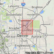
- Mapped 1:24k (Commerce City quad, Adams and Denver Cos, CO)
- Dominant lithology:
-
- Sandstone
- Claystone
- Siltstone
- Shale
- Conglomerate
- AAPG geologic province:
-
- Denver basin
Summary:
Is Upper Cretaceous formation mapped undivided with Denver Formation (Upper Cretaceous and Paleocene) in western Adams and northern Denver Cos, CO (Denver basin). Is oldest map unit in quad; underlies Denver Formation. Map unit is described as brown, yellowish-brown, gray, and bluish-gray interbedded sandstone, claystone, siltstone, shale, and conglomerate. Lower conglomerate member of Arapahoe is generally water bearing. Cross-bedded and lenticular units are common throughout map unit. Outcrops mainly on western side of South Platte River valley and in northwestern part of quad. Engineering properties discussed. Thickness of map unit of 785 ft reported in well log from northeastern Commerce City (NE/4 sec 5, T3S, R67W).
Source: GNU records (USGS DDS-6; Denver GNULEX).
- Usage in publication:
-
- Arapahoe Formation*
- Modifications:
-
- Mapped 1:24k (Sable quad, Adams and Denver Cos, CO)
- Dominant lithology:
-
- Sandstone
- Claystone
- Siltstone
- Shale
- Conglomerate
- AAPG geologic province:
-
- Denver basin
Summary:
Is Upper Cretaceous formation mapped undivided with Denver Formation (Upper Cretaceous and Paleocene) in southwestern Adams Co, CO (Denver basin). Is oldest map unit in quad; map unit unconformably underlies Verdos Alluvium (Pleistocene); Arapahoe underlies Denver Formation. Map unit described as brown, yellowish-brown, gray, and bluish-gray, interbedded sandstone, claystone, siltstone, shale, and conglomerate. Cross-bedded and lenticular units common throughout map unit. Lower conglomerate member of Arapahoe is generally water bearing. Outcrops mainly in northeastern part of quad; two small outcrops in northwestern part of quad. Engineering properties discussed. Thickness of map unit of 994 ft reported in well log from sec 24, T3S, R67W in southwestern part of quad.
Source: GNU records (USGS DDS-6; Denver GNULEX).
- Usage in publication:
-
- Arapahoe Formation*
- Modifications:
-
- Mapped 1:12k (Jefferson Co, CO)
- Dominant lithology:
-
- Claystone
- Sandstone
- AAPG geologic province:
-
- Denver basin
Summary:
Is Upper Cretaceous formation mapped in northern Jefferson Co, CO (Denver basin). Arapahoe unconformably overlies Laramie Formation (Upper Cretaceous) and was mapped as part of Laramie by earlier workers; unconformably underlies Rocky Flats Alluvium (lower Pleistocene). Outcrops as a few small isolated exposures along roads forming eastern and northern boundary of map area and in secs 2 and 11. Unit described as commonly consisting of light-olive-gray to black, massive to laminated claystone and silty claystone; light-gray to light-orange-brown, thin discontinuous, silty, fine-grained sandstone; and minor light-gray to olive-gray, lenticular, channel-fill deposits consisting of medium- to coarse-grained sandstone and very poorly sorted, massive to trough cross-bedded, conglomeratic sandstone. Lower half of unit contains more sandstone than upper half. Medium- to coarse-grained and conglomeratic sandstone is common at and near base. Composition of sandstone is distinctive consisting of well rounded, frosted quartz grains and minor chert, ironstone, and volcanic-rock fragments. Imprints of leaves and woody and carbonaceous material are locally common. Thickness is about 80 m.
Source: GNU records (USGS DDS-6; Denver GNULEX).
For more information, please contact Nancy Stamm, Geologic Names Committee Secretary.
Asterisk (*) indicates published by U.S. Geological Survey authors.
"No current usage" (†) implies that a name has been abandoned or has fallen into disuse. Former usage and, if known, replacement name given in parentheses ( ).
Slash (/) indicates name conflicts with nomenclatural guidelines (CSN, 1933; ACSN, 1961, 1970; NACSN, 1983, 2005, 2021). May be explained within brackets ([ ]).