

- Usage in publication:
-
- Apsey Conglomerate Member*
- Modifications:
-
- Original reference
- Dominant lithology:
-
- Conglomerate
- Tuff
- AAPG geologic province:
-
- Basin-and-Range province
Summary:
Apsey Conglomerate Member of Galiluro Volcanics. Thin-bedded, yellowish- to light-gray conglomerate and some conglomeratic tuff. Cliff-forming, erodes to conical shapes, and cavernous. Thickness 0 to 122 m. Overlies Hells Half Acre Member of Galiluro Volcanics; disconformably underlies Gila Conglomerate. Age is Miocene.
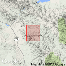
Type locality: Apsey Camp on Ash Creek, in sec. 25, T. 5 S., R. 17 E., Brandenburg Mountain 7.5-min quadrangle, Pinal Co., southeastern AZ.
Reference sections: (1) north of Aravaipa Canyon, in secs. 5, 6, 7, and 8, T. 6 S., R. 18 E.; and (2) along Ash Creek, in secs. 19, 20, 29, and 30, T. 5 S., R. 18 E., Pinal Co., AZ.
Source: US geologic names lexicon (USGS Bull. 1520, p. 11-12); GNU records (USGS DDS-6; Denver GNULEX).
For more information, please contact Nancy Stamm, Geologic Names Committee Secretary.
Asterisk (*) indicates published by U.S. Geological Survey authors.
"No current usage" (†) implies that a name has been abandoned or has fallen into disuse. Former usage and, if known, replacement name given in parentheses ( ).
Slash (/) indicates name conflicts with nomenclatural guidelines (CSN, 1933; ACSN, 1961, 1970; NACSN, 1983, 2005, 2021). May be explained within brackets ([ ]).