

- Usage in publication:
-
- "Apache" formation
- Modifications:
-
- Original reference
- Dominant lithology:
-
- Sand
- Clay
- AAPG geologic province:
-
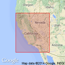
- Ventura basin
Summary:
(T.W. Dibblee, Jr., p. 84.) Tentatively named "Apache" formation. Buff-red sand, pebbly sand, and gypsiferous clays. Continental. Equivalent to Santa Margarita formation to west. [Age is late Miocene.]
Notable exposures in Apache Canyon, in sec. 2, T. 8 N., R. 28 W., Mt. Pinos quadrangle, Ventura Co., southern CA.
Source: Publication; US geologic names lexicon (USGS Bull. 1200, p. 114).
- Usage in publication:
-
- Apache formation†
- Modifications:
-
- Abandoned
- AAPG geologic province:
-
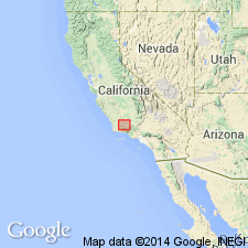
- Ventura basin
Summary:
Pg. 2999. †Apache formation abandoned. Preoccupied name Apache replaced with Quatal formation.
Source: US geologic names lexicon (USGS Bull. 1200, p. 114).
For more information, please contact Nancy Stamm, Geologic Names Committee Secretary.
Asterisk (*) indicates published by U.S. Geological Survey authors.
"No current usage" (†) implies that a name has been abandoned or has fallen into disuse. Former usage and, if known, replacement name given in parentheses ( ).
Slash (/) indicates name conflicts with nomenclatural guidelines (CSN, 1933; ACSN, 1961, 1970; NACSN, 1983, 2005, 2021). May be explained within brackets ([ ]).