

- Usage in publication:
-
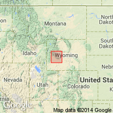
- Amsden formation*
- Modifications:
-
- Original reference
- Dominant lithology:
-
- Shale
- Limestone
- Sandstone
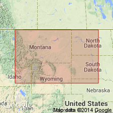
- AAPG geologic province:
-
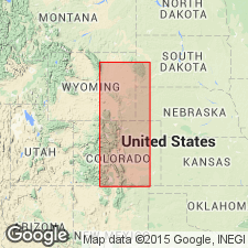
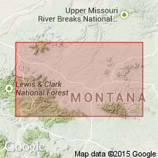
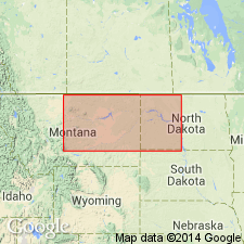
- Powder River basin
Summary:
Pg. 394-401. Amsden formation. Red shales, white limestones, and cherty and sandy limestones. Thickness 150 to 350 feet. Underlies Tensleep sandstone and overlies (without apparent unconformity) Little Horn limestone [now replaced with Madison limestone].
Named from Amsden Branch of Tongue River, west of Dayton, Sheridan, WY.
Source: US geologic names lexicon (USGS Bull. 896, p. 48).
- Usage in publication:
-
- Amsden formation
- Modifications:
-
- Areal extent
- AAPG geologic province:
-
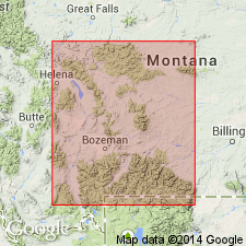
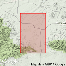
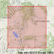
- Central Montana uplift
Summary:
Pg. 1017 (table 3), 1020-1023. Amsden formation. In its type locality, consists of those beds that occur between top of Madison limestone and base of Tensleep formation. Originally considered Pennsylvanian in age; Branson and Greger (1918, GSA Bull., v. 29, no. 2) have shown Amsden of Wind River Mountains to be Mississippian. In south-central Montana, Amsden rests upon erosional surface developed on Madison limestone. In area between Three Forks and Townsend, Amsden is separated from Madison by series of fossiliferous sandstones, shales, and limestones that attain thickness as great as 1,200 feet in central Montana. Group of strata between Amsden and Madison in central Montana has been designated Big Snowy group (new). In central Montana, Amsden underlies Ellis formation (Upper Jurassic). Section measured on southeast corner of Quadrant Mountain (type section of Quadrant) shows Amsden formation (beds 1-7) 109 feet thick; underlies Quadrant formation (beds 8-21); overlies Madison limestone.
Source: US geologic names lexicon (USGS Bull. 1200, p. 85-88).

- Usage in publication:
-
- Amsden formation*
- Modifications:
-
- Overview
- AAPG geologic province:
-
- Powder River basin
Summary:
Amsden formation. Recognized in Wyoming and Montana. Age is considered Mississippian (local) and Pennsylvanian. In some areas fossils of Mississippian age have been found in basal part of what is considered to be Amsden formation. C.C. Branson (1936) proposed to call Mississippian part of Amsden the Sacajawea formation. H.W. Scott (1935) states underlies Amsden formation in central Montana.
Source: US geologic names lexicon (USGS Bull. 896, p. 48).
- Usage in publication:
-
- Amsden formation
- Modifications:
-
- Revised
- AAPG geologic province:
-
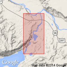
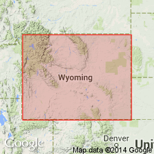
- Wind River basin
Summary:
Pg. 650-660. Amsden formation. Restricted at base to exclude unit herein named Sacajawea formation. At measured section of Bull Lake Creek, Wyoming, Lower Amsden consists of 21 feet of unfossiliferous laminated limestone possibly of Chester age; Upper Amsden consists of 80 feet of sandstone overlain by 96 feet of limestone, sandstone, and shale. Underlies Tensleep sandstone.
Source: US geologic names lexicon (USGS Bull. 1200, p. 85-88).
- Usage in publication:
-
- Amsden formation
- Modifications:
-
- Not used
- AAPG geologic province:
-
- Wind River basin
Summary:
Pg. 1201, 1223. Amsden formation. Discussion of Pennsylvanian of central Wyoming. Tensleep sandstone of Darton is only locally recognizable as lithologic unit and is not a true stratigraphic unit. No boundary can be drawn to separate it from Amsden formation, and fauna of upper part of Amsden is indistinguishable from that of Tensleep sandstone. Name Tensleep is herein retained as name of a formation which includes entire Pennsylvanian sequence in central Wyoming; that is, Tensleep sandstone of Darton, upper part of Amsden, and some unnamed beds above Tensleep. Measured sections show that the Tensleep overlies Sacajawea formation, or Sacajawea(?), or unnamed beds of Chester(?) age.
Source: US geologic names lexicon (USGS Bull. 1200, p. 85-88).
- Usage in publication:
-
- Amsden formation
- Modifications:
-
- Not used
- AAPG geologic province:
-
- Wind River basin
Summary:
Pg. 132. Amsden formation. Discussion of Wind River Mountains area. Tensleep as herein defined includes upper part of Amsden of Darton and name Amsden is dropped.
Source: US geologic names lexicon (USGS Bull. 1200, p. 85-88).
- Usage in publication:
-
- Amsden formation
- Modifications:
-
- Not used
- AAPG geologic province:
-
- Bighorn basin
Summary:
Pg. 350. Scott's (1935) section on Quadrant Mountain [Park County, northern Wyoming] revised. Beds 3-21 are Pennsylvanian and are included in Quadrant formation; beds 1-2 are Mississippian and are referred to Sacajawea(?) formation. Name Amsden deleted from section.
Source: US geologic names lexicon (USGS Bull. 1200, p. 85-88).
- Usage in publication:
-
- Amsden formation
- Modifications:
-
- Areal extent
- AAPG geologic province:
-
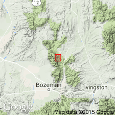
- Montana folded belt
Summary:
Pg. 18-19, 21 (fig. 5). Amsden formation. In Three Forks area, overlies Madison formation and underlies Quadrant formation. Lower part, which is probably equivalent to Sacajawea, contains an upper Mississippian fauna comparable to that of Brazer limestone; beds in upper 100 feet contain fossils generally considered Pennsylvanian.
Source: US geologic names lexicon (USGS Bull. 1200, p. 85-88).
- Usage in publication:
-
- Amsden formation
- Modifications:
-
- Areal extent
- AAPG geologic province:
-
- Williston basin
- Central Montana uplift
Summary:
Pg. 1293-1295. Amsden formation. Branson (1937, 1939) and Thompson and Scott (1941) recognized that the Amsden, as defined by Darton, included strata of both Pennsylvanian and Mississippian age. They placed all Pennsylvanian strata in the Tensleep (Quadrant) and established Sacajawea formation to include lower beds bearing a Ste. Genevieve fauna. Between redefined Tensleep and Sacajawea are unnamed strata bearing a Chester fauna. These latter beds may be traced throughout central Montana and much of Williston basin, overlapping truncated edges of Big Snowy and Sacajawea sediments along Montana-Wyoming border. Name Amsden should be retained for these strata in Montana and Williston basin; if name Amsden is not retained, then new term must be coined for these strata.
Source: US geologic names lexicon (USGS Bull. 1200, p. 85-88).

- Usage in publication:
-
- Amsden formation
- Modifications:
-
- Biostratigraphic dating
Summary:
[Fusulinid] MILLERELLA zone occurs about middle of Amsden formation.
Source: US geologic names lexicon (USGS Bull. 1200, p. 85-88).
- Usage in publication:
-
- Amsden formation
- Modifications:
-
- Areal extent
- AAPG geologic province:
-
- Central Montana uplift
- Sweetgrass arch
Summary:
Pg. 1296, 1301-1302. Amsden formation. In Judith basin area, [Stanford-Lewiston area, Judith Basin and Fergus Counties, central Montana], consists of two members: lower sequence of red and pink shales and mudstone, red coarse poorly sorted ferruginous sandstones, and locally thin beds of grayish-green and buff fine-grained limestone; upper sequence of marine fossilferous limestone containing interbedded red, maroon, and purple shale. In places where pre-Ellis erosion has not cut too deep, a thin sequence of yellow, pink, and purple clay shale lies above the marine limestone section. Overlies erosional surface truncating Heath and Otter shales; underlies Ellis formation. Age is Mississippian and Early Pennsylvanian (Morrow).
Source: US geologic names lexicon (USGS Bull. 1200, p. 85-88).
- Usage in publication:
-
- Amsden formation*
- Modifications:
-
- Mapped
- AAPG geologic province:
-
- Central Montana uplift
- Sweetgrass arch
Summary:
Amsden formation. Where exposed along northern flank of Little Belt Mountains, the Amsden ranges in thickness from about 500 feet to more than 900 and rests with apparent conformity on Otter formation. Unconformably underlies Ellis group which in this area commonly consists of only Swift formation. In Hobson area, age is Mississippian (Sloss, Montana School Mines Geol. Mem., no. 24, p. 7, 1946); elsewhere in western Montana and Wyoming it is Mississippian and Pennsylvanian.
Source: Publication; US geologic names lexicon (USGS Bull. 1200, p. 85-88).
- Usage in publication:
-
- Amsden formation
- Modifications:
-
- Areal extent
- AAPG geologic province:
-
- Montana folded belt
Summary:
Pg. 512 (fig. 2d). Amsden formation. Discussion of crinoid fauna from Mississippian Lodgepole formation (Fairy Lake area, east of Three Forks, Bridger Mountains, Gallatin County, [Sacagawea Peak 7.5-min quadrangle], southwestern Montana). Columnar section shows Amsden formation overlying Mission Canyon formation. Age is Pennsylvanian.
Source: Publication; US geologic names lexicon (USGS Bull. 1200, p. 85-88).
- Usage in publication:
-
- Amsden formation
- Modifications:
-
- Revised
Summary:
Sacajawea formation restricted vertically to include only red-bed sequence at base of Amsden and extended laterally throughout area where red beds are recognizable. Term Amsden should be retained for limestones and dolomites between Sacajawea (restricted) and typical sandstone of Tensleep or its equivalents.
Source: US geologic names lexicon (USGS Bull. 1200, p. 85-88).
- Usage in publication:
-
- Amsden formation
- Modifications:
-
- Biostratigraphic dating
- AAPG geologic province:
-
- Wind River basin
Summary:
Review of fossils identified from Amsden formation indicates a Pennsylvanian rather than Mississippian age for the Amsden in Wyoming. [Faunal collections examined in this paper are from Fremont Co., west-central WY.]
Source: US geologic names lexicon (USGS Bull. 1200, p. 85-88).
- Usage in publication:
-
- Amsden formation
- Modifications:
-
- Revised
- AAPG geologic province:
-
- Wind River basin
Summary:
Chart shows that Darwin sandstone member of Amsden formation overlies type Sacajawea formation at Bull Lake [Freemont County, east-central Wyoming].
Source: US geologic names lexicon (USGS Bull. 1200, p. 85-88).
- Usage in publication:
-
- Amsden formation*
- Modifications:
-
- Mapped 1:48k
- AAPG geologic province:
-
- Powder River basin
Summary:
Pg. B49, pl. 6. Amsden formation. In Crazy Creek area, Johnson County, Wyoming, overlies Madison limestone and underlies Tensleep sandstone. Thickness about 250 feet. Corals in lower part of formation range from Late Mississippian to Early Pennsylvanian.
Source: US geologic names lexicon (USGS Bull. 1200, p. 85-88).
- Usage in publication:
-
- Amsden formation
- Modifications:
-
- Revised
- AAPG geologic province:
-
- Wind River basin
Summary:
Pg. 333-337. Discussion of age of Amsden formation at Cherry Creek, Wind River Mountains. Six new collections of fossils from lower part of Amsden place Mississippian-Pennsylvanian boundary more than 48 feet and less than 63 feet above Madison limestone. Lower faunas are Chesterian in age, and upper faunas are tentatively dated Atokan. Name Sacajawea formation is rejected for Mississippian beds at Cherry Creek. Presence of two sandstones in Amsden, both of which have been called "Darwin sandstone" is inferred. Amsden at Cherry Creek contains beds that are specifically excluded farther north in Wind River Mountains. Thus, there is dual usage of name Amsden. Solution of problem lies in type area of formation. If typical Amsden contains both Mississippian and Pennsylvanian faunas, Cherry Creek section is also typical Amsden, and Love's (1954) restricted Amsden should be renamed. Conversely, if type Amsden lacks Sacajawea fauna, restricted Amsden is proper, and Cherry Creek section should be renamed.
Source: US geologic names lexicon (USGS Bull. 1200, p. 85-88).
- Usage in publication:
-
- Amsden formation*
- Modifications:
-
- Areal extent
- AAPG geologic province:
-
- Central Montana uplift
Summary:
Pg. 1918-1919, 1928-1929. In central Montana, so-called "Amsden" formation consists of three lithologic divisions: an upper dolomite unit, a middle brownish limestone unit, and a lower sequence of red shale and sandstone beds. Dolomite unit is lithologically, stratigraphically, and paleontologically equivalent to carbonate part of Amsden at its type locality in Wyoming. Amsden dolomite overlaps toward the south the underlying brown limestone and red shale beds and also formations of Big Snowy group. Unconformably(?) underlying Amsden dolomite of Atokan age is brown ostracodal limestone unit which is probably of Chester age but may be all or in part Early Pennsylvanian. This brown limestone was named Alaska Bench formation by Freeman (1922), and his terminology is recommended herein. Thickness 33 feet along Durfee Creek, Fergus County, central Montana; top of section eroded.
Source: US geologic names lexicon (USGS Bull. 1200, p. 85-88).
- Usage in publication:
-
- Amsden formation*
- Modifications:
-
- Areal extent
- AAPG geologic province:
-
- Montana folded belt
Summary:
Pg. 498-499, 550, pl. 42. Amsden formation. In Townsend Valley, Broadwater and Jefferson Counties, central Montana, Amsden formation, which is probably separated from Mission Canyon limestone by erosional unconformity, includes rocks of both Mississippian and Pennsylvanian age. Consists of red calcareous siltstone with medial unit of gray carbonate rock and grades into Quadrant formation. Thickness 259 feet in Limestone Hills.
Source: US geologic names lexicon (USGS Bull. 1200, p. 85-88).
- Usage in publication:
-
- Amsden formation*
- Modifications:
-
- Not used
- AAPG geologic province:
-
- Central Montana uplift
Summary:
Pg. 344-346. Amsden formation not used. Big Snowy group revised to include (ascending) Kibbey sandstone, Otter, Heath, Cameron Creek, and Devils Pocket formations. Various parts of Big Snowy group (revised) have been correlated with Amsden formation of northern Wyoming and southern Montana. The two sequences represent same general interval of geologic time, from end of Madison to beginning of Tensleep. They occupy distinct basins separated by a divide, toward which Amsden rocks thin and vanish from the south and Big Snowy rocks thin and vanish from the north. Scott (1935) used Amsden formation in central Montana for rocks (Cameron Creek formation and Alaska Bench limestone) lying above Heath formation. Very few dependable correlative ties have been found between Big Snowy rocks of central Montana and Amsden rocks less than 50 miles away in osuthern Montana. Mundt (1956) shifted name Amsden from rocks to which it was assigned by Scott and applied it to entirely different rocks of Atokan age. In present report, it is preferred to give these rocks separate formational names and discontinue term Amsden in central Montana.
Source: US geologic names lexicon (USGS Bull. 1200, p. 85-88); supplemental information from GNU records (USGS DDS-6; Denver GNULEX).
- Usage in publication:
-
- Amsden formation
- Modifications:
-
- Revised
- AAPG geologic province:
-
- Bighorn basin
Summary:
Amsden formation of Montchauve group. Sacajawea formation, Amsden formation, and Tensleep sandstone are products of marine transgressive-regressive cycle that took place on Wyoming cratonic shelf during Pennsylvanian Period as one phase in development of eastern Cordilleran geosyncline. Name Montchauve group is suggested for these formations.
Source: US geologic names lexicon (USGS Bull. 1200, p. 85-88).
- Usage in publication:
-
- Amsden formation
- Modifications:
-
- Revised
- AAPG geologic province:
-
- Central Montana uplift
- Sweetgrass arch
- Williston basin
Summary:
Pg. 1942 (fig. 2), 1962-1963. Amsden formation. This paper concurs with Scott and Wilson's (1953) proposals of applying name Sacajawea to persistent predominantly red shale unit (including Darwin sand) formerly referred to as "lower Amsden." Term Amsden then is restricted to the overlying predominantly cherty carbonate sequence. Term Amsden (restricted) is used in central Montana area to refer to carbonate sequence underlain by Tyler formation, or older rocks where Tyler is absent. Unit is overlain by either Tensleep sandstone, Minnelusa formation of Williston basin, or strata of Ellis group. Maximum thickness 400 feet (south end of Judith basin). Divisible into two units: lower, predominantly Alaska Bench limestone member, and unnamed upper part referred to as dolomite member. [Age is Early to Middle Pennsylvanian (Morrowan to Atokan).] Name Amsden (restricted) could possible be extended into Williston basin region.
Source: US geologic names lexicon (USGS Bull. 1200, p. 85-88).
- Usage in publication:
-
- Amsden formation
- Modifications:
-
- Areal extent
Summary:
Discussion of stratigraphy of Pennsylvanian in northern Utah, western Wyoming, northwestern Colorado, and southeastern Idaho. Suggested that Quadrant and Casper formational names be abandoned and Tensleep-Amsden-Sacajawea terminology extended to include strata formerly referred to by these names and that term Sacajawea be accepted as formational name applicable to red clastic sequence between Madison limestone, or equivalent, and Amsden carbonates.
Source: US geologic names lexicon (USGS Bull. 1200, p. 85-88).
- Usage in publication:
-
- Amsden Formation*
- Modifications:
-
- Areal extent
- AAPG geologic province:
-
- Montana folded belt
Summary:
Pg. 47-49, measured sections (p. 126, 130, 132, 133), pls. Amsden Formation. Thin-bedded clastic and carbonate rocks having a distinctive red color. Thickness 250 to 600 feet. Underlies Quadrant Formation; contact is gradational. Overlies Big Snowy Formation. Age is Late Mississippian or Early Pennsylvanian based on fossils.
Mapped with Big Snowy Formation in Broadwater, Jefferson, and Gallatin Cos., MT.
Source: Publication.
- Usage in publication:
-
- Amsden Formation*
- Modifications:
-
- Revised
- Reference
- Dominant lithology:
-
- Sandstone
- Siltstone
- Shale
- Limestone
- AAPG geologic province:
-
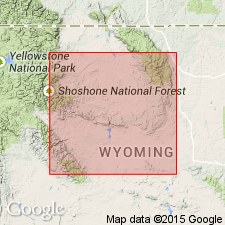
- Bighorn basin
Summary:
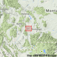
Pg. G5 (fig. 3), G8. Amsden Formation. Recognized in Bighorn, Wind River, and Great Divide basins, Wyoming. Includes (ascending) Darwin Sandstone Member, 123 feet; Horsehoe Shale Member (new), 100+ feet; and Ranchester Limestone Member (new), 73 to 177 feet. Unconformably overlies Mississippian Madison Limestone; underlies Tensleep Sandstone and in places Quadrant Quartzite. Correlates in part with Morgan Formation of Washakie basin, lower Casper Formation and Fountain Formation of Laramie basin, Hartville Formation of Hartville area, and Minnelusa Formation of Powder River basin. Age is Late Mississippian to Middle Pennsylvanian (Chester to Atoka) based on fossils.
Type section: on Amsden Creek, in SE/4 sec. 33, T. 57 N., R. 87 W., 4 mi west of Dayton, [Dayton South 7.5-min quadrangle], Sheridan Co., WY.
Reference section: west flank of Bighorn Mountains, near lower end of Tensleep Canyon, near Tensleep [Ten Sleep], about 0.5 mi upstream from Wigwam Trout Rearing Station on north side of U.S. Highway 16, [border of Ten Sleep and Old Maid Gulch 7.5-min quadrangles], Washakie Co., WY.
Source: Publication.
- Usage in publication:
-
- Amsden Group*
- Amsden Formation*
- Modifications:
-
- Revised
- AAPG geologic province:
-
- Central Montana uplift
- Powder River basin
- Sweetgrass arch
- Williston basin
Summary:
Amsden Group. Amsden raised to group rank in central Montana where it includes (ascending): Tyler Formation, Alaska Bench Limestone, and Devils Pocket Formation. Amsden Formation remains in good usage elsewhere. Age is Early and Middle Pennsylvanian [Morrowan to Desmoinesian].
Source: Changes in stratigraphic nomenclature, 1967 (USGS Bull. 1274-A, p. A2); supplemental information from GNU records (USGS DDS-6; Denver GNULEX).
- Usage in publication:
-
- Amsden Group*
- Amsden Formation*
- Modifications:
-
- Not used
- AAPG geologic province:
-
- Montana folded belt
Summary:
B1, B2 (fig. 1), B5 (fig. 3). Amsden Group or Amsden Formation restricted to central Montana. In southwestern Montana, rocks are assigned to the Quadrant Sandstone and Snowcrest Range Group (new). However, at Arasta Creek, in the Gravelly Range of southwest Montana, a thin finger of Ranchester Limestone Member of Amsden Formation occurs between Quadrant Sandstone and Snowcrest Range Group. In east-central Idaho, rocks are assigned to (descending) Snaky Canyon Formation and Bluebird Mountain Formation of Skipp and others (1979).
Source: Publication.
- Usage in publication:
-
- Amsden Formation*
- Modifications:
-
- Age modified
- AAPG geologic province:
-
- Wind River basin
- Bighorn basin
Summary:
Upper Mississippian Darwin Sandstone Member, basal member of the Amsden Formation [only part of Amsden discussed in report] in parts of the Wind River and Bighorn basins of WY is extended into Fremont Canyon and at Casper Mountain, Natrona Co in the Wind River basin and eastward to Boxelder Canyon in the northern Laramie Range, Converse Co in the Powder River basin where it is assigned as the basal member of the Casper Formation. The Darwin is also assigned as the basal member of Hartville Formation in the Hartville area, Platte Co. in the Denver basin. Darwin is a time transgressive unit of Meramecian and Chesterian age in western and central WY and of possibly Morrowan to Desmoinesian age in eastern WY. Correlation chart.
Source: GNU records (USGS DDS-6; Denver GNULEX).
- Usage in publication:
-
- Amsden Formation*
- Modifications:
-
- Areal extent
- AAPG geologic province:
-
- Montana folded belt
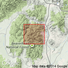
Summary:
Amsden Formation (as used by Myers, 1952, USGS OFR-52-147, scale 1:31,680; Theodosis, 1956, Indiana Univ. PhD thesis; Fraser and Waldrop, 1972, USGS Geol. Quad. Map GQ-988, scale 1:24,000). Notable exposures in Vipond Park area, Pioneer Mountains, Beaverhead County, Montana. Consists of marl, carbonate, and sandstone. Thickness about 100 m. Overlies Madison Group; underlies Quadrant Quartzite. Age is considered latest Mississippian, and may be in part Early Pennsylvanian, based on conodonts (B.R. Wardlaw, USGS, written commun., 1983).
Source: Publication.
- Usage in publication:
-
- Amsden Formation*
- Modifications:
-
- Not used
- AAPG geologic province:
-
- Montana folded belt
Summary:
Amsden Formation. In Badger Pass area of Badger Ridge, Beaverhead County, Montana, rocks previously assigned to Amsden are included in Conover Ranch Formation.
Source: Modified from GNU records (USGS DDS-6; Denver GNULEX).
For more information, please contact Nancy Stamm, Geologic Names Committee Secretary.
Asterisk (*) indicates published by U.S. Geological Survey authors.
"No current usage" (†) implies that a name has been abandoned or has fallen into disuse. Former usage and, if known, replacement name given in parentheses ( ).
Slash (/) indicates name conflicts with nomenclatural guidelines (CSN, 1933; ACSN, 1961, 1970; NACSN, 1983, 2005, 2021). May be explained within brackets ([ ]).