

- Usage in publication:
-
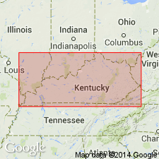
- Alger formation
- Modifications:
-
- Overview
- AAPG geologic province:
-
- Appalachian basin
Summary:
Pg. 145. See entry under Foerste (1906).
Source: NA
- Usage in publication:
-
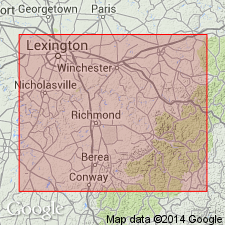
- Alger formation
- Modifications:
-
- Principal reference
- Dominant lithology:
-
- Clay
- Shale
- Limestone
- AAPG geologic province:
-
- Appalachian basin
- Cincinnati arch
Summary:
Pg. 27, 61; also 1905, Kentucky Geol. Survey Bull., no. 6, p. 145. Alger formation. Upper formation of Crab Orchard division (lower part of Niagaran division) of east-central Kentucky. Essentially clay. Includes the following members: Estill clay at top, Waco limestone in middle, and Lulbegrud clay at base; also Flades clay, the equivalent of Estill clay and Waco limestone. Overlain unconformably by Devonian limestone and underlain by Indian Fields formation of Crab Orchard division.
Named from Alger Station on the Louisville and Atlantic RR, between Panola and Irvine, about 1 mi east of Estill-Madison Co. line, KY.
Source: US geologic names lexicon (USGS Bull. 896, p. 30-31).
- Usage in publication:
-
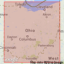
- Alger formation
- Modifications:
-
- Revised
- Areal extent
- AAPG geologic province:
-
- Cincinnati arch
Summary:
Alger formation extended into southwestern Ohio and subdivided into (ascending) Osgood, Laurel, and Missie members. Average thickness about 55 feet.
Source: Modified from GNU records (USGS DDS-6; Reston GNULEX).
- Usage in publication:
-
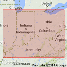
- Alger Formation
- Modifications:
-
- Not used
- AAPG geologic province:
-
- Cincinnati arch
Summary:
Foerste included Lulbegrud Clay, Waco Limestone, and Estill Clay in Alger Formation. Foerste (1906) in discussing Crab Orchard division, stated that purpose of his grouping was to indicate stratigraphic equivalency of Silurian strata of Kentucky with corresponding strata in Ohio and that lithologically the grouping was not a natural one. Present report places the Lulbegrud and Waco units in Noland Formation (new) and considers Estill Shale of formation rank in Crab Orchard Group. Name Estill Shale should replace name Alger in Ohio. Name Alger serves no useful purpose in Kentucky.
Source: Modified from GNU records (USGS DDS-6; Reston GNULEX).
- Usage in publication:
-
- Alger Shale*
- Modifications:
-
- Revised
- AAPG geologic province:
-
- Cincinnati arch
Summary:
Designated Alger Shale of Crab Orchard Group. Divided into (ascending) Lulbegrud Shale Member, Waco Member, and Estill Shale Member. Lulbegrud primarily clay shale; Waco is dolomite and interbedded clay shale; Estill is primarily clay shale. Recognized in Bath County, Kentucky, and southward into east-central Kentucky. Overlies Drowning Creek Formation; unconformably underlies Devonian rocks.
Source: Modified from GNU records (USGS DDS-6; Reston GNULEX).
For more information, please contact Nancy Stamm, Geologic Names Committee Secretary.
Asterisk (*) indicates published by U.S. Geological Survey authors.
"No current usage" (†) implies that a name has been abandoned or has fallen into disuse. Former usage and, if known, replacement name given in parentheses ( ).
Slash (/) indicates name conflicts with nomenclatural guidelines (CSN, 1933; ACSN, 1961, 1970; NACSN, 1983, 2005, 2021). May be explained within brackets ([ ]).