

- Usage in publication:
-
- Alaska Bench limestone
- Modifications:
-
- Original reference
- Dominant lithology:
-
- Limestone
- AAPG geologic province:
-
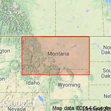
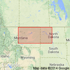
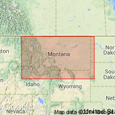
- Central Montana uplift
Summary:
Pg. 826-827. Alaska Bench limestone. Excessively hard, gray, fossiliferous limestone that weathers red. Forms a series of hogbacks and sloping benches around Big Snowy Mountains, central Montana. Well exposed on top of Alaska Bench, east of the Snowies, where it is 100 to 150 feet thick, and just below it are 300 feet of white to red sandstones, interbedded with varicolored shale, here named Tyler sandstone. Is overlain by 100 feet of nonfossiliferous black shale, usually classified as part of Quadrant but which may in part belong to Ellis formation. Age is Carboniferous (Pennsylvanian or Mississippian). [In his generalized section of Quadrant formation for central Montana, on p. 827, Freeman showed 100 feet of gray shale between Tyler sandstone and Alaska Bench limestone, and 100 feet of black shale above Alaska Bench limestone, all of which he included in the Quadrant.]
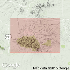
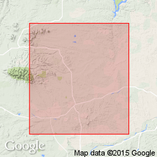
[Named from Alaska Bench, notably in T. 13 N., R. 20 E., Alaska Bench 7.5-min quadrangle, Fergus Co., central MT.]
Source: US geologic names lexicon (USGS Bull. 896, p. 23); GNC index card files (USGS-Menlo).
- Usage in publication:
-
- Alaska Bench limestone
- Modifications:
-
- Overview
- AAPG geologic province:
-
- Central Montana uplift
Summary:
Pg. 142, 143. Alaska Bench limestone. Overlies Cameron Creek formation and underlies Devils Pocket formation (both new) [see entries under Gardner (1959)]. Age is Mississippian or Pennsylvanian.
Source: US geologic names lexicon (USGS Bull. 1200, p. 37-38).
- Usage in publication:
-
- Alaska Bench limestone*
- Modifications:
-
- Areal extent
- AAPG geologic province:
-
- Central Montana uplift
Summary:
Pg. 1925-1929. Alaska Bench limestone. Limestone is light to dark brown and gray, with dull purplish red mottlings. Where exposed, commonly weathers to shades of pink, red, and gray; weathered Alaska Bench limestone superficially resembles unweathered carbonate rocks of Amsden formation. Many workers have assigned both limestone and overlying dolomite to Amsden, and this is common usage among Montana geologists. Thickness along Durfee Creek, Fergus County, central Montana, 201 feet. Underlies Amsden formation; overlies and is gradational with Tyler formation. Age is Mississippian or Pennsylvanian.
Source: US geologic names lexicon (USGS Bull. 1200, p. 37-38).
- Usage in publication:
-
- Alaska Bench limestone*
- Modifications:
-
- Revised
- AAPG geologic province:
-
- Central Montana uplift
Summary:
Pg. 332 (fig. 2), 334 (fig. 3), 338-339, 347. Alaska Bench limestone of Big Snowy group. Included in Big Snowy group. Alaska Bench limestone, as used in this report, includes not only massive limestone sequence recognized by Freeman but also similar and closely related overlying beds of limestone and dolomite that are missing from type area but that are exposed on south flank of Big Snowy Mountains, Freeman gave no specific measured section for formation but implied that Beacon Hill, in sec. 6, T. 12 N., R. 20 E., should be type locality. On Alaska Bench and throughout most of Fergus County, central Montana, all overlying strata and much of Alaska Bench limestone itself have been removed by erosion; only known complete surface sections are in vicinity of Stonehouse Ranch on south slope of Big Snowy Mountains and at Durfee Creek. Overlies Cameron Creek formation; underlies Devils Pocket formation. Age is Mississippian or Pennsylvanian.
Source: US geologic names lexicon (USGS Bull. 1200, p. 37-38).
- Usage in publication:
-
- Alaska Bench limestone member
- Modifications:
-
- Revised
- AAPG geologic province:
-
- Central Montana uplift
- Sweetgrass arch
- Williston basin
Summary:
Pg. 1942 (fig. 2), 1963. Alaska Bench limestone member of Amsden formation. Reallocated to member status in Amsden formation (restricted). Underlies unnamed dolomite member; overlies Cameron Creek member of Tyler formation. [Age is Early to Middle Pennsylvanian (Morrowan to Atokan).]
Source: US geologic names lexicon (USGS Bull. 1200, p. 37-38, Amsden entry p. 85-88).
- Usage in publication:
-
- Alaska Bench Limestone*
- Modifications:
-
- Revised
- Reference
- Dominant lithology:
-
- Limestone
- AAPG geologic province:
-
- Sweetgrass arch
- Williston basin
- Powder River basin
- Central Montana uplift
Summary:
Pg. B2-B3 (fig. 1), B14-B15, pls. 2, 4. Alaska Bench Limestone of Amsden Group. Removed from Big Snowy Group and reassigned as middle formation of Amsden Group in central Montana. Composed mostly of limestone and some dolomite in 1- to 2-foot-thick beds interstratified with red or gray mudstone. Thickness 0 to 290 feet. Overlies Cameron Creek Member of Tyler Formation of Amsden Group with gradational contact. Unconformably underlies Devils Pocket Formation of Amsden. Age changed from Mississippian or Pennsylvanian --to-- Early and Middle Pennsylvanian (Morrowan and Atokan), based on fossils.
Reference section (Amsden Group): Stonehouse Canyon, from center of west line sec. 25, T. 11 N., R. 20 E., eastward into SW/4 SW/4 sec. 29, T. 11 N., R. 21 E., thence down dry canyon southward across N/2 NW/4 sec. 31, T. 11 N., R. 21 E., [Sahara Hill and Patterson Canyon 7.5-min quadrangles], Golden Valley Co., central MT.
Source: Publication; Changes in stratigraphic nomenclature, 1969 (USGS Bull. 1324-A, p. A2).
For more information, please contact Nancy Stamm, Geologic Names Committee Secretary.
Asterisk (*) indicates published by U.S. Geological Survey authors.
"No current usage" (†) implies that a name has been abandoned or has fallen into disuse. Former usage and, if known, replacement name given in parentheses ( ).
Slash (/) indicates name conflicts with nomenclatural guidelines (CSN, 1933; ACSN, 1961, 1970; NACSN, 1983, 2005, 2021). May be explained within brackets ([ ]).