

- Usage in publication:
-
- Aguada limestone*
- Modifications:
-
- Original reference
- Dominant lithology:
-
- Limestone
- AAPG geologic province:
-
- Caribbean region
Summary:
Aguada limestone. Proposed for transitional beds, approximately 75 m thick, between underlying Rio Guatemala group (new) and overlying Aymamon limestone (new). Consists essentially of interbedded hard pure limestone and softer chalky to marly limestone; from 1 to 10 m of basal gravel, sand, and shale present where unit rests directly on Cretaceous rocks. Where basal gravel, sand, and shale not present, rests conformably on the Cibao formation. Age is early Miocene.
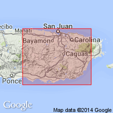
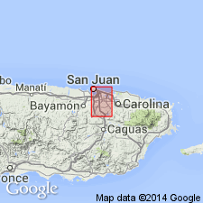
Named from exposures near the town of Aguada, near west coast of Island, Aguadilla quadrangle, Puerto Rico.
Source: US geologic names lexicon (USGS Bull. 1200, p. 26); GNU records (USGS DDS-6; Reston GNULEX).
- Usage in publication:
-
- Aguada Formation*
- Modifications:
-
- Revised
- AAPG geologic province:
-
- Caribbean region
Summary:
Pg. 7 (table), 33-34, pl. 2. Aguada Formation. In San Juan metropolitan district, consists predominantly of non-carbonate rocks; hence term formation to allow for lithologic variation. Estimated thickness 325 feet; 62.5 feet exposed in quarry near Bayamon hospital. There is some question whether formational name Aguada is correctly applied to these beds. From lithologic standpoint, they resemble noncarbonate clastic subdivisions of late Oligocene Rio Guatemala group which, according to Zapp and others (1948), does not occur in San Juan area. Because no paleontologic study was made of middle Tertiary section of San Juan area in preparation of this report, formational assignment cannot be examined in light of age criteria.
Source: US geologic names lexicon (USGS Bull. 1200, p. 26).
- Usage in publication:
-
- Aguada Limestone*
- Modifications:
-
- Overview
- AAPG geologic province:
-
- Caribbean region
Summary:
Pg. B356, B358 (fig. 164.2). Aguada Limestone. Oligocene and Miocene sequence in north-central Puerto Rico is (ascending) San Sebastian formation, Lares limestone, Cibao formation, Aguada limestone, and Aymamon limestone. Aguada, about 90 m thick, consists of somewhat earthy limestone interbedded with chalk and marl.
Source: US geologic names lexicon (USGS Bull. 1200, p. 26).
- Usage in publication:
-
- Aguada Limestone*
- Modifications:
-
- Revised
- Reference
- AAPG geologic province:
-
- Caribbean region
Summary:
Mapping in 1966 and 1967 shows that contacts mapped in 1948 for the top and bottom of the Aguada become too low toward the west and are at a higher stratigraphic position. The type area near Aguada is entirely in the Cibao Formation that underlies the Aguada. As the name is firmly entrenched in the literature for the limestone beds between the Cibao and the Aymamon Limestone above, the name Aguada is retained and a special reference section is designated.
Source: GNU records (USGS DDS-6; Reston GNULEX).

- Usage in publication:
-
- Aguada Limestone*
- Modifications:
-
- Overview
- AAPG geologic province:
-
- Caribbean region
Summary:
The Aguada Limestone occurs on the north coast of Puerto Rico and consists of hard granular calcarenite overlain by alternating beds of chalky marl and rubbly limestone. Maximum estimated thickness is 150 m. The Aguada is of early Miocene age.
Source: GNU records (USGS DDS-6; Reston GNULEX).
For more information, please contact Nancy Stamm, Geologic Names Committee Secretary.
Asterisk (*) indicates published by U.S. Geological Survey authors.
"No current usage" (†) implies that a name has been abandoned or has fallen into disuse. Former usage and, if known, replacement name given in parentheses ( ).
Slash (/) indicates name conflicts with nomenclatural guidelines (CSN, 1933; ACSN, 1961, 1970; NACSN, 1983, 2005, 2021). May be explained within brackets ([ ]).