

- Usage in publication:
-
- Admiralty till and clays
- Modifications:
-
- Original reference
- Dominant lithology:
-
- Clay
- AAPG geologic province:
-
- Puget Sound province
Summary:
Pg. 111+. Admiralty till and clays [Admiralty drift (GNC, ca. 1938)]. Thick deposit of stiff, blue clay, usually in evenly stratified beds but occasionally changing gradually to a well characterized till filled with subangular stone and gravel. In order to give them distinctive names it appears desirable the term "till" should be restricted to the unstratified deposits and the simple term "clays" should be applied to the stratified formations. Underlies Orting gravels also of Admiralty epoch, stage of retreat. Age is Pleistocene (pre-Wisconsin).
Principal exposures in bluffs along shores of Admiralty Inlet, Puget Sound region, western Washington. Notable exposure, 460 to 505 feet above sea level, on north bank of Carbon River. First recognized by I.C. Russell from Everett to Tacoma [no reference]. Also exposed in British Columbia, Canada.
Source: US geologic names lexicon (USGS Bull. 896, p. 15); GNU records (USGS DDS-6; Menlo GNULEX).
- Usage in publication:
-
- Admiralty clay*
- Modifications:
-
- Adopted
- AAPG geologic province:
-
- Puget Sound province
Summary:
Used in correlation table for units in west WA.
Source: GNU records (USGS DDS-6; Menlo GNULEX).
- Usage in publication:
-
- Admiralty glacial drift
- Modifications:
-
- Age modified
- AAPG geologic province:
-
- Puget Sound province
Summary:
Shown on map sheet 27 of northwestern WA along the western shore of Puget Sound [Admiralty Inlet] from Nisqually to Tacoma, WA. Age is pre-Wisconsin stage (Quaternary).
Source: GNU records (USGS DDS-6; Menlo GNULEX).
- Usage in publication:
-
- Admiralty clay*
- Modifications:
-
- Mapped
- AAPG geologic province:
-
- Puget Sound province
Summary:
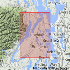
Described in Snohomish Co., WA as firm finely bedded gray, green, and blue silt and clay with carbonized wood and few sand and gravel beds. Exposed thickness 200 ft. Well logs show extends as much as 2000 ft below-sea level. Several measured sections described. In some areas underlies Pilchuck clay member (new) of Vashon drift; in other areas underlies Esperance sand member (new) of Vashon. In plateau blocks of county is overlain by several 100 ft of water-laid deposits. Mapped in western part of county, till pods shown separately. Also shown in cross sections. Is Pleistocene age.
Source: GNU records (USGS DDS-6; Menlo GNULEX).
- Usage in publication:
-
- Admiralty drift*
- Modifications:
-
- Mapped
- AAPG geologic province:
-
- Puget Sound province
Summary:
Mapped and described in Kitsap County, WA where it consists principally of massive blue clay and silt, deformed in most places. Contains till, volcanic ash, peat or lignite, sand, and some gravel. Top of formation commonly near or below sea level. Thickness as much as 400 ft. Underlies lower member of Orting gravel. Age is Pleistocene.
Source: GNU records (USGS DDS-6; Menlo GNULEX).
- Usage in publication:
-
- Admiralty clay*
- Modifications:
-
- Not used
- AAPG geologic province:
-
- Puget Sound province
Summary:
At locality south of Des Moines, Admiralty age deposits (Willis, 1898) probably include parts of Puyallup Formation and Salmon Springs drift. In east wall of Puyallup-Duwamish valley between Kent and Auburn (Willis, 1898), till is of Salmon Springs age. Although Bretz (1913) defined Admiralty as containing all pre-Vashon sediments, Pleistocene record is known to embrace at least three pre-Vashon glaciations and nonglacial intervals. Since Admiralty till and clays (Willis, 1898) cannot be assigned to single stratigraphic interval, name is not used in this paper. ["Name not be abandoned, however -in future it will probably be redefined and used in other parts of Puget Sound basin"]
Source: GNU records (USGS DDS-6; Menlo GNULEX).
- Usage in publication:
-
- Admiralty clay*
- Modifications:
-
- Overview
- AAPG geologic province:
-
- Puget Sound province
Summary:
Overview of Admiralty nomenclature and lithology traced. "The sum of all the work indicates that the Admiralty till and its offspring -Admiralty sediments, Admiralty clay and Admiralty drift -may each consist of more than one formation (assemblage of mappable lithologies)... For this reason Admiralty till and other Admiralty units have ceased to be used and probably ought to be formally redefined or abandoned." p.5
Source: GNU records (USGS DDS-6; Menlo GNULEX).
For more information, please contact Nancy Stamm, Geologic Names Committee Secretary.
Asterisk (*) indicates published by U.S. Geological Survey authors.
"No current usage" (†) implies that a name has been abandoned or has fallen into disuse. Former usage and, if known, replacement name given in parentheses ( ).
Slash (/) indicates name conflicts with nomenclatural guidelines (CSN, 1933; ACSN, 1961, 1970; NACSN, 1983, 2005, 2021). May be explained within brackets ([ ]).