

- Usage in publication:
-
- Abrams mica schist*
- Modifications:
-
- Original reference
- Dominant lithology:
-
- Schist
- AAPG geologic province:
-
- Klamath Mountains province
Summary:
Pg. 225-245. Abrams mica schist. Composed of thin folia of muscovite of dull colors (gray, light-brown, yellow and dull red) separated by irregular layers of white quartz, representing the original laminae. Very highly siliceous throughout. Is of sedimentary origin, being originally a series of argillaceous sandstone beds in part finely laminated. Thickness about 1,000 feet in upper Coffee Creek section, but may be much thicker at Bully Choop, to the south. Structurally underlies Salmon Hornblende Schist. Believed to be Algonkian rather than Cambrian or Silurian.
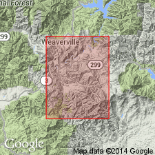
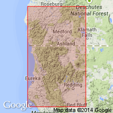
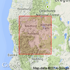
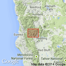
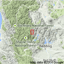
Named from Abrams Post Office, in upper Coffee Creek region, Coffee Creek quadrangle, Trinity Co., northern CA.
Source: US geologic names lexicon (USGS Bull. 896, p. 10); supplemental information from GNU records (USGS DDS-6; Menlo GNULEX).
- Usage in publication:
-
- Abrams formation*
- Modifications:
-
- Redescribed
- Dominant lithology:
-
- Schist
- Limestone
- AAPG geologic province:
-
- Klamath Mountains province
Summary:
Abrams mica schist of Hershey (1901) referred to as Abrams formation. Is described as grayish muscovite schist containing irregular bands of white quartzose material and locally some thin layers of blue and white crystalline limestone.
Source: GNU records (USGS DDS-6; Menlo GNULEX).

- Usage in publication:
-
- Abrams mica schist
- Modifications:
-
- Overview
- AAPG geologic province:
-
- Klamath Mountains province
Summary:
According to J.S. Diller (unpub. ms. on Weaverville quadrangle) the Abrams mica schist is 5,000 feet thick. Age is pre-Cambrian(?). Present in Trinity and Shasta Counties, northern California.
Source: US geologic names lexicon (USGS Bull. 896, p. 10).
- Usage in publication:
-
- Abrams formation*
- Modifications:
-
- Age modified
- AAPG geologic province:
-
- Klamath Mountains province
Summary:
Pg. 375-410. Abrams formation. Age modified from Algonkian age, as suggested by Hershey (1901), to pre-Middle Silurian and probably pre-Silurian [basis for age modification not given]. Introduced Siskiyou terrane to include Abrams and Salmon formations.
Source: GNU records (USGS DDS-6; Menlo GNULEX); supplemental information from US geologic names lexicon (USGS Bull. 896, p. 10).
- Usage in publication:
-
- Abrams mica schist*
- Modifications:
-
- Age modified
- AAPG geologic province:
-
- Klamath Mountains province
Summary:
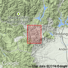
Pg. 16-18, pl. 1. Abrams mica schist. Thick series of metasedimentary rocks, dominantly quartz-mica schist, which is overlain unconformably by Salmon hornblende schist. Hinds (1932) introduced term Siskiyou terrane to include Abrams and Salmon schists. Exact stratigraphic position of rocks composing Siskiyou terrane is not known. Abrams and Salmon are oldest formations in area of this report [Scott Valley]. In northern and western parts of area, they are overlain unconformably by several thousand feet of greenstone and greenstone schist possibly correlative with Devonian(?) Copley greenstone of southern Klamath Mountains. In southern part of mountains surrounding Scott Valley, Chanchelulla(?) formation of probable Silurian age lies unconformably on Abrams and Salmon schists. Present evidence indicates only that Abrams and Salmon schists can be adjudged with certainty to be pre-Silurian age. Assignment to Precambrian or lower Paleozoic would be extremely tenuous.
Source: US geologic names lexicon (USGS Bull. 1200, p. 13).
- Usage in publication:
-
- Abrams mica schist*
- Modifications:
-
- Mapped
- AAPG geologic province:
-
- Klamath Mountains province
Summary:
Pg. B315-B316; California Div. Mines Bull., no. 179, p. 19-20, 1960. Abrams mica schist. Geologic mapping in Weaverville quadrangle indicates that (1) structure of metamorphic rocks in that quadrangle is synclinoral and Abrams mica schist overlies Salmon hornblende schist, (2) Abrams is probably younger, rather than older, than Salmon, and (3) marble lenses are of stratigraphic significance in that they are chiefly in lower part of Abrams.
Source: US geologic names lexicon (USGS Bull. 1200, p. 13).
- Usage in publication:
-
- Abrams formation*†
- Modifications:
-
- Abandoned
- AAPG geologic province:
-
- Klamath Mountains province
Summary:
Authors abandoned the name Abrams formation of Hershey (1901) because these rocks, as previously mapped, both underlie and overlie the unit they term the Salmon formation. They propose the name Grouse Ridge formation for the upper unit above the Salmon, and Stuart Fork formation for the lower unit below the Salmon to replace their abandoned Abrams formation.
Source: GNU records (USGS DDS-6; Menlo GNULEX).
- Usage in publication:
-
- Abrams Mica Schist*
- Modifications:
-
- Mapped
- AAPG geologic province:
-
- Klamath Mountains province
Summary:
Mapped in Weaverville 15-min quadrangle, Trinity County, California. ["Braced on map explanation as pre-Jurassic in age. No age revision implied."] Map explanation indicates unit may be equivalent to Grouse Ridge Formation of Davis and Lipman (1962).
Source: GNU records (USGS DDS-6; Menlo GNULEX).
- Usage in publication:
-
- Abrams Mica Schist*
- Modifications:
-
- Age modified
- Geochronologic dating
- AAPG geologic province:
-
- Klamath Mountains province
Summary:
K-Ar ages on muscovite from Abrams Mica Schist range from 329 +/-13 to 309 +/-12 Ma [Carboniferous], i.e., the apparent age of metamorphism. Shown on figure sketch map of southern Klamath Mountains area.
Source: GNU records (USGS DDS-6; Menlo GNULEX).
- Usage in publication:
-
- Abrams Mica Schist*
- Modifications:
-
- Areal extent
- Reinstated
- AAPG geologic province:
-
- Klamath Mountains province
Summary:
Abrams Mica Schist of Hershey (1901) restricted to exclude rocks structurally underlying the Salmon Hornblende Schist. As thus restricted Abrams structurally overlies the Salmon and is synonymous with the Grouse Ridge Formation of Davis and Lipman (1962). Rocks structurally underlying the Salmon are reassigned to the Stuart Fork Formation of Davis and Lipman (1962). "Rocks named the Stuart Fork may have been included by Hershey (1901) in his Abrams, but the exclusion of this small patch should not seriously redefine the Abrams; therefore, name, Abrams, should not have been abandoned by Davis and Lipman (1962) (oral commun., W.P. Irwin, 10/18/65). Davis and Lipman (1962, p. 1548) suggest abandoning name Abrams as a result of rejection of two possible redefinitions, one of which involves required exclusion of "Hershey's type locality, the Abrams post office.." Irwin states, verbally, that Hershey (1901, p. 227) applied name Abrams, derived from the then-existing Abrams post office in that area, to rocks in upper Coffee Creek region, the lithology of which Hershey then describes. No type locality was given by Hershey, a requirement not yet established for names in early reports. Certainly, says Irwin, Hershey never meant to apply stratigraphic name to Recent alluvium underlying post office site, given by Davis and Lipman as at Upper Nash Mine and shown on Coffee Creek quad, NE/4 NE/4 sec. 31, T. 38 N., R. 9 W. [See Lanphere and Irwin, 1987]
Source: GNU records (USGS DDS-6; Menlo GNULEX).
- Usage in publication:
-
- Abrams Mica Schist*
- Modifications:
-
- Age modified
- Geochronologic dating
- AAPG geologic province:
-
- Klamath Mountains province
Summary:
Age of primary metamorphism of Abrams Mica Schist is approximately 380 Ma (Devonian).
Source: GNU records (USGS DDS-6; Menlo GNULEX).
- Usage in publication:
-
- Abrams Mica Schist*
- Modifications:
-
- Age modified
- Geochronologic dating
Summary:
Sr-Rb ages from Abrams Mica Schist indicate age of first metamorphism is approximately 340 Ma (early Carboniferous) which is believed to be more reliable than previous K-Ar ages of 330 to 310 Ma.
Source: GNU records (USGS DDS-6; Menlo GNULEX).
- Usage in publication:
-
- Abrams Mica Schist*
- Modifications:
-
- Age modified
- AAPG geologic province:
-
- Klamath Mountains province
Summary:
[Age of metamorphism of Abrams Mica Schist changed from Carboniferous to Devonian]
Source: GNU records (USGS DDS-6; Menlo GNULEX).
- Usage in publication:
-
- Abrams Mica Schist*
- Modifications:
-
- Age modified
- AAPG geologic province:
-
- Klamath Mountains province
Summary:
Age of Abrams Mica Schist revised from Devonian to Devonian or older Paleozoic. [However paper cites age from Lanphere and others (1968) as Devonian.]
Source: GNU records (USGS DDS-6; Menlo GNULEX).
- Usage in publication:
-
- Abrams Schist
- Modifications:
-
- Areal extent
- AAPG geologic province:
-
- Klamath Mountains province
Summary:
Chap. 10, p. 139-152, 144 (table 10-1). Abrams Schist geographically extended into Klamath Mountains, Oregon. Age is Paleozoic(?).
Source: GNC index card files (USGS-Menlo).
- Usage in publication:
-
- Abrams Mica Schist*
- Modifications:
-
- Age modified
- AAPG geologic province:
-
- Klamath Mountains province
Summary:
Age of Abrams Mica and Salmon Hornblende Schists revised from Devonian or older Paleozoic, to Devonian.
Source: GNU records (USGS DDS-6; Menlo GNULEX).
- Usage in publication:
-
- Abrams Schist*
- Modifications:
-
- Redescribed
- Dominant lithology:
-
- Schist
- AAPG geologic province:
-
- Klamath Mountains province
Summary:
Unit renamed the Abrams Schist in accordance with art. 30b of the 1983 North American Stratigraphic Code.
Source: GNU records (USGS DDS-6; Menlo GNULEX).
For more information, please contact Nancy Stamm, Geologic Names Committee Secretary.
Asterisk (*) indicates published by U.S. Geological Survey authors.
"No current usage" (†) implies that a name has been abandoned or has fallen into disuse. Former usage and, if known, replacement name given in parentheses ( ).
Slash (/) indicates name conflicts with nomenclatural guidelines (CSN, 1933; ACSN, 1961, 1970; NACSN, 1983, 2005, 2021). May be explained within brackets ([ ]).