The National Geologic Map Database is migrating to a new infrastructure. We apologize for any service disruptions during this process.
|
|---|


- Usage in publication:
-
- Fizzle Flat lentil
- Modifications:
-
- Named
- Dominant lithology:
-
- Limestone
- Shale
- AAPG geologic province:
-
- Permian basin
Summary:
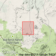
Pg. 151, 159 (fig. 2), 160, 164. Fizzle Flat lentil of Terilingua formation. Name applied to a 50-foot rock unit that occupies stratigraphic position close to Udden's (1907) intended Boquillas-Terlingua boundary in the quadrangle. Base of lentil is arbitrarily selected as boundary between "lower Boquillas-Terlingua unit" (approx. = Udden's Boquillas flags) and "upper Boquillas-Terlingua unit" (approx. = Udden's Terlingua beds). Is provisionally assigned to basal Terlingua (at base of lower chalky shale member of "upper Boquillas-Terlingua unit") based on fossil affinity with the Austin. The lentil, termed a transition zone, consists of indurated to hard, creamy yellow, platy, impure silty limestone and indurated to friable, gray to creamy yellow, laminated to platy, silty, and chalky shale with occasional thin (<0.25 in) bentonite seams. Unit is more silty and sandy in lower 10 feet, gets increasingly chalky upward; brown clastic dikes common; nearly barren of vegetation. Carries abundant peculiar INOCERAMUS (species with well-developed, straight, radiating ribs) in uppermost part; similar forms with less well-developed ribs occur throughout the lentil. INOCERAMUS cf. LABIATUS present at top. Contact between top of AUSTINICERAS? ledge and base of lentil is distinct over area. Age is Late Cretaceous.
Type not designated. Apparently named from Fizzle Flat, north of Alamo de Cesario Creek in west-central part of Agua Fria 15-minute quadrangle, southwestern Brewster Co., TX, Big Bend region (southern part of Permian basin), where it is mapped. A 50-foot thick section measured in Blue Hills area 1 mi south-southwest of Clanton Ranch.
Source: US geologic names lexicon (USGS Bull. 1200, p. 1360-1361); supplemental information from GNU records (USGS DDS-6; Denver GNULEX).
- Usage in publication:
-
- Fizzle Flat Member
- Modifications:
-
- Revised
- AAPG geologic province:
-
- Permian basin
Summary:
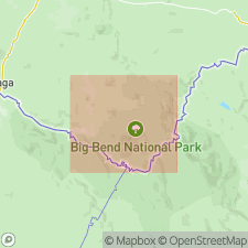
Pl. VIII (no text discussion). Revised to Fizzle Flat Member, upper member of Boquillas Formation (revised) in Agua Fria area, southwestern Brewster County, Texas (southern part of Permian basin). Was previously assigned (provisionally) to basal Terlingua Formation by Moon (1953). Upper contact is moved upward to include INOCERAMUS UNDULATOPLICATUS-bearing beds; unit thickness increased from original 50 feet to 160 feet. Overlies Sawmill Mountain Member (first used, undefined [not incl. in lexicon]) of Boquillas. Underlies Pen Formation (new). Is correlated with upper part of San Vicente Member (new) of Boquillas in Big Bend National Park.
Source: Modified from GNU records (USGS DDS-6; Denver GNULEX).
For more information, please contact Nancy Stamm, Geologic Names Committee Secretary.
Asterisk (*) indicates published by U.S. Geological Survey authors.
"No current usage" (†) implies that a name has been abandoned or has fallen into disuse. Former usage and, if known, replacement name given in parentheses ( ).
Slash (/) indicates name conflicts with nomenclatural guidelines (CSN, 1933; ACSN, 1961, 1970; NACSN, 1983, 2005, 2021). May be explained within brackets ([ ]).