

- Usage in publication:
-
- Beaverhead formation*
- Modifications:
-
- Principal reference
- Dominant lithology:
-
- Conglomerate
- Limestone
- Siltstone
- AAPG geologic province:
-
- Montana folded belt
Summary:
Pg. 235-243. Beaverhead formation proposed for sequence of conglomerate, sandstone, siltstone, autl limestone that crops out over area of at least 400 square miles in Beaverhead County, Montana, and extends across Montana-Idaho boundary. Divided into four mappable units at type section. Top and bottom members dominantly conglomerate; intermediate member consists of two mappable units: a lower thick massive limestone, locally concretionary, and an upper sequence of interbedded siltstone, sandstone, arkose, limestone. and subordinate conglomerate. Approximately 9,700 feet thick at incomplete section where neither top nor base is exposed. Rests unconformably upon rocks as young as Colorado group and as old as early Paleozoic, and it probably rests unconformably upon rocks as young as Montana gronp and as old as Precambrian. Unconformably overlies Kootenai, Dinwoody, Thaynes, Phosphoria, Quadrant, and Madison. At McKnight Canyon section, base of section is marked by high-angle normal faults which have dropped the Beaverhead against Triassic Thaynes formation and Mississippian Madison. Contact between Beaverhead and Pennsylvanian Quadrant obscured by talus. At top of section, a plate of Madison limestone has been thrust over Beaverhead formation. Unconformably overlain by fluviatile or lacustrine beds of Eocene or Oligocene age. Age designated as probably Late Cretaceous to early Eocene.
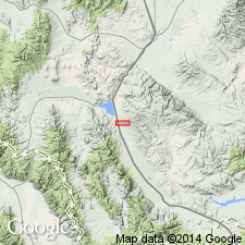
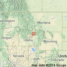
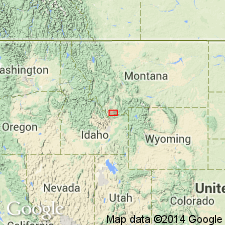
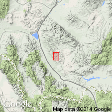
Type section: near mouth of McKnight Canyon, 6 mi west of Dell, [in T. 12 S., R. 10 W.], Beaverhead Co., southwestern MT. Named from Beaverhead Co., southwestern MT. Extends into east-central ID.
Source: US geologic names lexicon (USGS Bull. 1200, p. 260-261).

- Usage in publication:
-
- Beaverhead Formation
- Modifications:
-
- Revised
- AAPG geologic province:
-
- Montana folded belt
Summary:
Name Beaverhead Formation in the Montana folded belt province applied to conglomerate beds that are contiguous with sandstone assigned to newly named Monida Formation. The lithologic change from conglomerate (Beaverhead) to sandstone (Monida) takes place halfway between Snowline and Monida, MT. Beaverhead recognized on northern flanks of Tendoy Range and southern flanks of Snowcrest Range. Monida and Beaverhead lie unconformably on units that range in age from Mississippian Madison Group through Lower Cretaceous Aspen Formation that were deformed in early Laramide time; youngest strata of Monida and Beaverhead overlain unconformably by Eocene and Oligocene nonmarine sedimentary and volcanic rocks. Is an alluvial-fan deposit of Late Cretaceous to Paleocene (Campanian to Thanetian) age.
Source: GNU records (USGS DDS-6; Denver GNULEX).
- Usage in publication:
-
- Beaverhead Formation
- Modifications:
-
- Revised
- AAPG geologic province:
-
- Montana folded belt
Summary:
Lithologies (limestone conglomerate and siltstone) present at McKnight Canyon, in the Montana folded belt province--the type section of Beaverhead--represent only a small part of what has been called Beaverhead Formation. In this report, the Beaverhead in the Montana folded belt province is predominately quartzite and limestone conglomerate, but has some sandstone and limestone. Unconformably overlies Lower Cretaceous Aspen Formation at most localities. Divided into 11 informal units (no stratigraphic order implied) that were derived from different sources: Divide and Kidd quartzite conglomerate units (Belt source dominant); Divide limestone conglomerate unit (Triassic limestone dominant); Lima and McKnight limestone conglomerate units (Mississippian, limestone dominant); Chute, Clover Creek, Monida, and Snowline sandstone units; McKnight limestone unit; and exotic limestone blocks. Total thickness unknown due to poor exposures and truncated sections; appears to thicken westward. Estimated 10,000-15,000 ft thick. Assigned to Late Cretaceous, Paleocene, and perhaps early Eocene (palynomorphs in Divide, Monida, and Lima units). Deposited in rapidly subsiding basin; limestone conglomerate units probably deposited as alluvial fans; sandstone units probably deposited in braided-stream complexes; fresh-water limestone represents ponding; exotic blocks resulted from gravity sliding during periods of torrential rainfall.
Source: GNU records (USGS DDS-6; Denver GNULEX).
- Usage in publication:
-
- Beaverhead Formation*
- Modifications:
-
- Age modified
- AAPG geologic province:
-
- Montana folded belt
Summary:
Age changed from Late Cretaceous to Eocene, to Early? Cretaceous, to Eocene in the Beaverhead Mountains, MT in the Montana folded belt province on the basis of tricolporate and triporate pollen suggestive of Albian? age.
Source: GNU records (USGS DDS-6; Denver GNULEX).
- Usage in publication:
-
- Beaverhead Formation*
- Modifications:
-
- Age modified
- AAPG geologic province:
-
- Montana folded belt
Summary:
Palynomorphs in lowest beds of Beaverhead at Lima, MT in the Montana folded belt province suggest late Albian to Cenomanian age; those in middle part suggest mid-Turonian to late Coniacian age; those in upper one-third suggest latest Cretaceous to mid-Paleocene. 10,000 ft of conglomerate of Beaverhead is exposed. Is considered to be Early Cretaceous to middle Paleocene.
Source: GNU records (USGS DDS-6; Denver GNULEX).
- Usage in publication:
-
- Beaverhead Group*
- Modifications:
-
- Revised
- AAPG geologic province:
-
- Montana folded belt
Summary:
Name Beaverhead Formation has been applied to diverse rocks of syntectonic origin thought to be of Late Cretaceous to early Tertiary age. Raised in rank, and restricted in the Montana folded belt province in this report to the Divide limestone and conglomerate, Kidd quartzite, McKnight limestone conglomerate, and Chute Canyon sandstone and Lima limestone units of Ryder and Scholten (1973). These were derived from the west (probably the thrust belt), and they overlie and intertongue with Lima Conglomerate , a unit assigned as the basal formation of Beaverhead Group. Assigned a Campanian and Maestrichtian age. Other older units of Coniacian, Santonian, and early Maestrichtian age (Clover Creek, Monida, and Snowline sandstone units) assigned to Beaverhead by Ryder and Scholten removed from it. These older units are retained as informal.
Source: GNU records (USGS DDS-6; Denver GNULEX).

- Usage in publication:
-
- Beaverhead Group*
- Modifications:
-
- Revised
- Age modified
- AAPG geologic province:
-
- Montana folded belt
Summary:
Lower boundary revised in southwest MT, Montana folded belt province, to include Clover Creek sandstone unit, an informal unit beneath Lima Conglomerate of Beaverhead. The Snowline sandstone unit, an informal unit above Clover Creek intertongues with Lima and is added to Beaverhead. Nichols, Perry, and Haley (1985) had considered Lima to be basal unit of Beaverhead. A conglomerate younger than Lima previously assigned to Divide conglomerate unit in Little Sheep Creek area north of Alder Creek is named Little Sheep Creek conglomerate unit of Beaverhead because it contains different clast composition and age than Divide. Near Dell in Beaverhead Co the Red Butte conglomerate unit (first used) is distinguished in the upper part of the Beaverhead. Age of Beaverhead near Lima changed from Campanian and Maestrichtian to Coniacian, Santonian, Campanian, and Maestrichtian, or Late Cretaceous. Age of Beaverhead where Red Butte conglomerate unit present is also early Tertiary. Ranges from 89 m.y. to 69 m.y.
Source: GNU records (USGS DDS-6; Denver GNULEX).
- Usage in publication:
-
- Beaverhead Group*
- Modifications:
-
- Overview
- AAPG geologic province:
-
- Snake River basin
- Montana folded belt
Summary:
The Frontier Formation-Beaverhead Group contact is easily placed in west part of the study area from Knob Mountain, secs 27 and 28, T15S, R9W to Shineberger Creek, sec 29, T15S, T7W, Beaverhead Co, MT, Montana folded belt province, where the two units are separated by an angular unconformity. This same contact is difficult to locate in the east part of the study area near Humphrey, Clark Co, ID in Snake River basin where the contact is conformable. Occurrence of distinctive lithologies present in the Frontier but missing from the Beaverhead can be used to separate them in the east part of the area. The Frontier has 1) conglomerates and conglomeratic sandstone derived from Cretaceous and Jurassic formations and 2) green to olive-green porcellanites and tuffaceous and porcellanitic sandstone. The conglomerates of Jurassic and Cretaceous rocks lie below the unconformity separating Frontier from Beaverhead in the western exposures. The authors recommend using the unconformity for the contact where it can be recognized. Elsewhere the contact should be placed at the top of the green porcellanitic unit. This unit is an excellent time marker and is located near the top of the Frontier in the western exposures. Correlation charts.
Source: GNU records (USGS DDS-6; Denver GNULEX).
- Usage in publication:
-
- Beaverhead Group*
- Modifications:
-
- Revised
- AAPG geologic province:
-
- Montana folded belt
Summary:
A conglomerate 200 to 300 m thick mapped on both sides of the Red Rock valley between Ashbough Canyon and Red Butte near Dell, Beaverhead Co, MT in the Montana folded belt province, is named Red Butte Conglomerate, upper formation of the Beaverhead Group. Red Butte was designated informally as Red Butte conglomerate unit, McKnight conglomerate, Chute Canyon sandstone, or as an unnamed conglomerate in earlier reports. Red Butte unconformably overlies unnamed quartzite conglomerate and unconformably underlies the Eocene Sage Creek Formation. Geologic map. Age of group ranges from Santonian to early Eocene?. Age of Red Butte is Maastrichtian and early Tertiary? (Paleocene age likely; Eocene age possible).
Source: GNU records (USGS DDS-6; Denver GNULEX).
- Usage in publication:
-
- Beaverhead Group*
- Modifications:
-
- Mapped 1:250k
- AAPG geologic province:
-
- Montana folded belt
Summary:
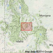
Mapped in south-central part of study area, Beaverhead Co, MT, Montana folded belt province. Consists of moderately indurated massive boulder, cobble, and pebble conglomerate with quartz-sand matrix, cemented with calcite; some interbedded sandstone and fresh-water limestone. In most places clasts consist of rounded to subangular fragments of Proterozoic quartzite and Paleozoic carbonate rocks; however, near Bannack sequence divided into an upper unit mainly of quartzite clasts separated from underlying carbonate-rich unit by volcanic rocks (not assigned to Beaverhead). Up to 350 m thick. Youngest thrust belt sedimentary rock; younger than Blackleaf Formation. Late Cretaceous and Tertiary? age.
Source: GNU records (USGS DDS-6; Denver GNULEX).
For more information, please contact Nancy Stamm, Geologic Names Committee Secretary.
Asterisk (*) indicates published by U.S. Geological Survey authors.
"No current usage" (†) implies that a name has been abandoned or has fallen into disuse. Former usage and, if known, replacement name given in parentheses ( ).
Slash (/) indicates name conflicts with nomenclatural guidelines (CSN, 1933; ACSN, 1961, 1970; NACSN, 1983, 2005, 2021). May be explained within brackets ([ ]).