The National Geologic Map Database is migrating to a new infrastructure. We apologize for any service disruptions during this process.
|
|---|


- Usage in publication:
-
- Jacobsville sandstone*
- Modifications:
-
- Named
- Dominant lithology:
-
- Sandstone
- AAPG geologic province:
-
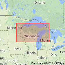
- Wisconsin arch
Summary:
Named for Jacobsville, Houghton Co., northwestern MI (Upper Peninsula). Replaces Lake Superior sandstones east of Copper Range and skirting coast at intervals to Grand Island. (Freda sandstone (new) used for Lake Superior sandstones west of Copper range; Munising sandstone (new) applies to upper 250 ft of Lake Superior sandstones that crosses the bluffs near Munising, dips southward, and is white or light in color). Consists of red and brown sandstone striped with streaks of red clay shale; conglomeratic where it laps on older formations. Thickness ranges from 0 to more than 1,500 ft. Relation to Freda sandstone is undetermined; they may be the same formation. Age is Late Cambrian.
Source: GNU records (USGS DDS-6; Reston GNULEX).

- Usage in publication:
-
- Jacobsville sandstone
- Modifications:
-
- Age modified
- AAPG geologic province:
-
- Wisconsin arch
Summary:
Age is not yet established, but is likely to be Upper Keweenawan [Precambrian, late Keweenawan].
Source: GNU records (USGS DDS-6; Reston GNULEX).
- Usage in publication:
-
- Jacobsville sandstone*
- Modifications:
-
- Areal extent
- Age modified
- AAPG geologic province:
-
- Michigan basin
Summary:
Age given is Cambrian. Is present in subsurface in one well in northwestern OH. Underlies Mount Simon sandstone; overlies Precambrian rocks.
Source: GNU records (USGS DDS-6; Reston GNULEX).
- Usage in publication:
-
- Jacobsville sandstone*
- Modifications:
-
- Age modified
- Overview
- AAPG geologic province:
-
- Wisconsin arch
Summary:
In Ahmeek quad, Jacobsville consists primarily of buff- or salmon-colored, fine- to coarse-grained sandstone, with subordinate amounts of reddish-brown pebble conglomerate. Sandstone contains a large proportion of well-rounded quartz grains. Outside quad area, more complete exposures show subordinate amounts of less resistant red shales and silty shales commonly interbedded with sandstone. Total thickness may be at least 1,800 ft based on drillhole a few miles south of Calumet; could be thicker. Although Lane (1911) suggested that Jacobsville could be a transitional unit linking Keweenawan with Cambrian sedimentation, later studies have shown it to represent probably the last phase of Keweenawan sedimentation and it may be of Precambrian age.
Source: GNU records (USGS DDS-6; Reston GNULEX).
- Usage in publication:
-
- Jacobsville formation
- Modifications:
-
- Revised
- Age modified
- AAPG geologic province:
-
- Wisconsin arch
Summary:
Revised as Jacobsville formation in this report. Four lithic units recognized within formation: conglomerate facies, lenticular sandstone facies, massive sandstone facies, and red siltstone facies. Thickness varies because of relief of Precambrian surface over which formation was deposited. Underlies Munising formation; in some areas, is covered by glacial drift. Along Lake Superior coast, from Munising to Beaver Lake, formation is under water. Age has been a matter of conjecture for many years; paper gives background and discusses factors favoring Keweenawan age and evidence opposing Keweenawan age. Unconformity between Jacobsville and Munising formations exposed at Grand Island proves that Jacobsville is older than Upper Cambrian, but it is impossible to estimate magnitude of unconformity and state whether Jacobsville is Lower and Middle Cambrian or Upper Keweenawan. Jacobsville represents continental sediments deposited in an enclosed basin during the same time as marine sediments of Lower and Middle Cambrian age were being deposited in other parts of the country.
Source: GNU records (USGS DDS-6; Reston GNULEX).
- Usage in publication:
-
- Jacobsville sandstone
- Modifications:
-
- Age modified
- AAPG geologic province:
-
- Wisconsin arch
Summary:
Age revised to Cambrian or Precambrian(?).
Source: GNU records (USGS DDS-6; Reston GNULEX).
- Usage in publication:
-
- Jacobsville Sandstone
- Modifications:
-
- Age modified
- AAPG geologic province:
-
- Wisconsin arch
Summary:
Age on chart shown as Early Cambrian.
Source: GNU records (USGS DDS-6; Reston GNULEX).
- Usage in publication:
-
- Jacobsville Sandstone*
- Modifications:
-
- Age modified
- AAPG geologic province:
-
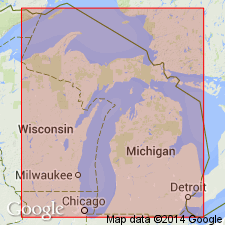
- Lake Superior region
- Wisconsin arch
Summary:
Geologic map (fig. 1) shows Jacobsville Sandstone as Upper Keweenawan.
Source: GNU records (USGS DDS-6; Reston GNULEX).
- Usage in publication:
-
- Jacobsville Sandstone*
- Modifications:
-
- Overview
- AAPG geologic province:
-
- Lake Superior region
- Wisconsin arch
Summary:
Pg. 59-60. Jacobsville Sandstone. Although earlier workers thought Jacobsville to be of Keweenawan age, authors of this report follow Hamblin (Michigan Geol. Survey Div. Pub., no. 51, 1958) who believed that Jacobsville represented continental deposition during Early and Middle Cambrian time.
Source: Modified from GNU records (USGS DDS-6; Reston GNULEX).
- Usage in publication:
-
- Jacobsville Sandstone*
- Modifications:
-
- Age modified
- AAPG geologic province:
-
- Wisconsin arch
Summary:
Jacobsville Sandstone shown as Upper Precambrian.
Source: GNU records (USGS DDS-6; Reston GNULEX).
- Usage in publication:
-
- Jacobsville Sandstone*
- Modifications:
-
- Age modified
- AAPG geologic province:
-
- Wisconsin arch
Summary:
Jacobsville Sandstone shown as Precambrian Y in age.
Source: GNU records (USGS DDS-6; Reston GNULEX).
- Usage in publication:
-
- Jacobsville Sandstone*
- Modifications:
-
- Age modified
- Revised
- AAPG geologic province:
-
- Wisconsin arch
Summary:
Age of Jacobsville Sandstone is Proterozoic Y, although correlation chart shows uncertainty as to how old or young the unit is. Assigned to Keweenawan Supergroup and is classified as Middle Keweenawan.
Source: GNU records (USGS DDS-6; Reston GNULEX).
- Usage in publication:
-
- Jacobsville Formation, Sandstone
- Modifications:
-
- Age modified
- AAPG geologic province:
-
- Wisconsin arch
Summary:
Shown as Middle Proterozoic age and is assigned to upper Keweenawan. Overlies middle Keweenawan volcanics. Correlated with Bayfield Group in WI (differs in its heavy mineral composition).
Source: GNU records (USGS DDS-6; Reston GNULEX).
- Usage in publication:
-
- Jacobsville Sandstone*
- Modifications:
-
- Areal extent
- AAPG geologic province:
-
- Wisconsin arch
Summary:
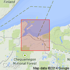
Jacobsville Sandstone extended from MI into WI in the area Iron Co.
Source: GNU records (USGS DDS-6; Reston GNULEX).
For more information, please contact Nancy Stamm, Geologic Names Committee Secretary.
Asterisk (*) indicates published by U.S. Geological Survey authors.
"No current usage" (†) implies that a name has been abandoned or has fallen into disuse. Former usage and, if known, replacement name given in parentheses ( ).
Slash (/) indicates name conflicts with nomenclatural guidelines (CSN, 1933; ACSN, 1961, 1970; NACSN, 1983, 2005, 2021). May be explained within brackets ([ ]).